A lot of extreme weather is occurring across the US today and over the weekend. Today some showers across the northeast and Florida while the central plains and south see the hot temperatures continue. In the southwest preparations are occurring for Hurricane Hilary to come late this weekend into next week. Let’s jump into all the action and see how long these patterns last!
[wpcode id=”41149″]
Heat in South and Plains
The south cannot get enough of the heat as the plains joins in on the extreme heat. A huge ridge extending from the Dakotas to Texas is causing these super hot temperatures in the central plains that are well above normal for this area and keeping the south hot. Highs will be in the 100s and upper 90s in much of the area. Lows won’t bring much cooling as lows will be in the low 80s and upper 70s. These hot temperatures will remain over the week as this ridging pattern remains and slowly shifts eastward. Temperatures will get hotter as highs across the plains become close to 110s. Record breaking highs are possible in this region so be cautious when outdoors.
[wpcode id=”41149″]
Showers in Northeast and Florida
Today the northeast and Florida is seeing some rainfall. The northeast will see a shower system come through today bringing rain all day today but leaving the area overnight. Much of the southern panhandle will see the tail end of a rain system today into early tomorrow morning. However showers will remain scattered Saturday as another system of showers moves in on Sunday bringing more rain to the region into Monday. Scattered showers may remain in the area for the rest of the week in Florida.
[wpcode id=”41149″]
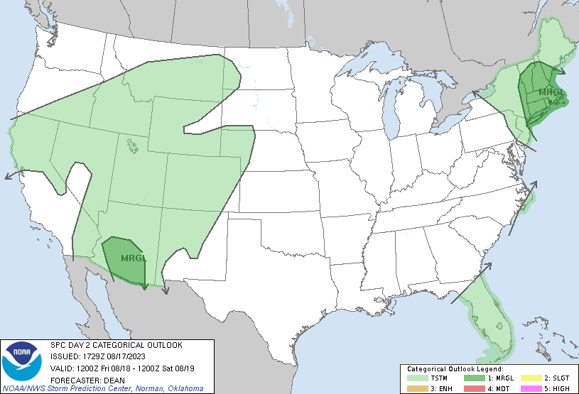
Hurricane Hilary in Southwest
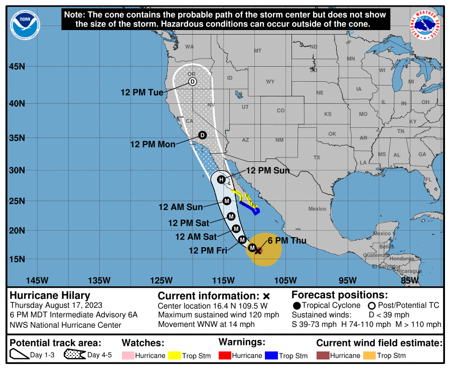
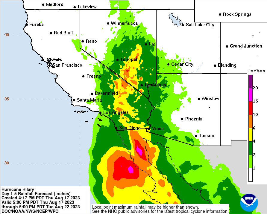
In the southwest Hurricane Hilary is coming doe the Baja California and southern California coast. Later this weekend into early next week Hilary will hit southern California at low Hurricane status and start to weaken as it travels north up the western coast. This will bring intense rain and wind to southern California and the Baja coast. Flash flooding and areas of heavy rainfall with rainfall in many areas. This rain will dissipate some as it travels north but bring lots of rain still to the area. This is something to watch out for and for more details check out the tropical forecasts daily!
[wpcode id=”41149″]
Travel Impacts
It could be a wet one in the northeast and Florida today which could cause some travel delays. Later this weekend the southern California region will be a place to avoid travel due to strong winds and rain from Hilary as well as the Baja coast. This area will be under many warnings so avoid travel there.
[wpcode id=”41149″]
Extended Outlook
Looking ahead for the week of the 24th of August to the 31st, we see a drier southeast with some above average moisture in the Rockies. The southern part of Texas will also be above average. Most if the US will be dry or normal. One area to be aware of is the above normal moisture in the Gulf of Mexico. This could mean some tropical action occurring at the end of the month which may something to watch out for.
As for temperature, the southeast and central plains will remain well above average as well as the northwest. On the flip side the northeast and midwest will be slightly below average. The heat will continue throughout the southeast especially which can be very dangerous. The extreme heat mixed with moisture from the gulf could potential mean some storms.
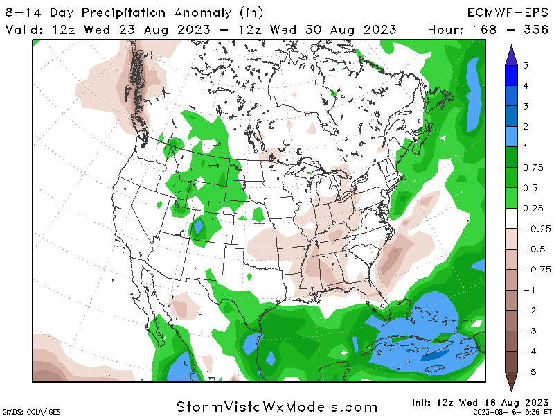
Precipitation Anomaly for 8-14 Days 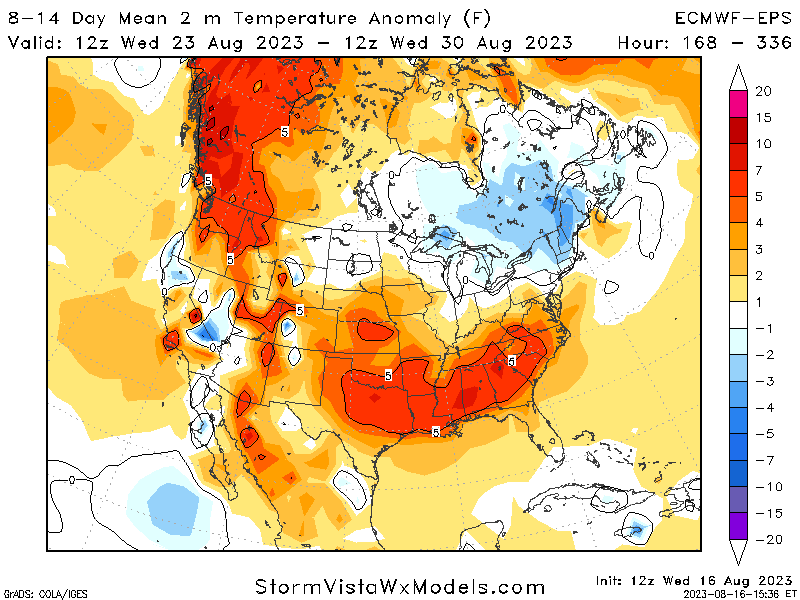
Temperature Mean for 8-14 Days
[wpcode id=”41149″]
Conclusion
We will see this pattern of extreme heat last for the next few weeks as we finish out August. As for precipitation showers will be scattered across CONUS but the main concern is Hurricane Hilary in the southwest. After the main impact the later impacts of Hilary will continue up the western coast and bring lots of rain to the area this coming week. Be aware of your local weather and stay up to date especially in the tropics about Hilary.


