The south stays super hot while we see some cooling happening in the northern half of the US. Some scattered thunderstorms and rain systems around the east and central US will leave some areas rather wet. Let’s dive into all the action!
[wpcode id=”41149″]
Heat Down South
Major ridging down south is causing an extreme rise in temperatures across the southeast especially. High temperatures will be in the upper 90s to low 100s with lows only cooling to the upper 70s. Heat indices will be really high so it will be dangerous to be outside for extended periods of time. Texas will also see a lot of these extreme temperatures. Many heat risk warnings are in effect especially in the mainland areas. Coastal areas will be slightly less hot but still hot.
After next week these extreme temperatures will come to a slow down and slightly cool down in the southeast. Meanwhile the southwest and Texas will see some ridging this week and stay hot for an extended period of time with a ridge building late next week. New Mexico, Arizona, Texas, and California will get the heat and temperatures in the 100s in many regions.
[wpcode id=”41149″]
Northeast and Central Plains Get Wet
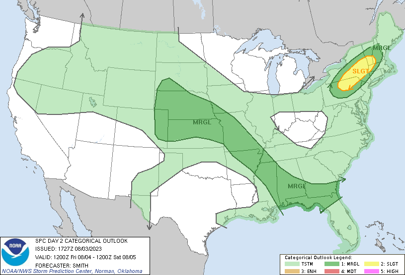
SPC Outlook for Friday 12Z to Saturday 12Z 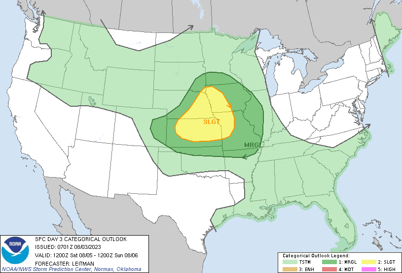
SPC Outlook for Saturday 12Z to Sunday 12Z
Today we will see some storms across the east and plains. The southeast will see some scattered storms and the northeast will see rain in the afternoon with small thunderstorms. In the north central region of the US some rain and scattered showers will hit the Dakotas with some isolated showers in Iowa. The central plains will see these showers Saturday morning and the system will build throughout the day as it moves towards the Midwest Saturday night into Sunday.
Rain will remain across the central US towards the east and Sunday night heavy rain will fall in the Ohio valley region. Said system will move across the northeast early next week. After these systems most of the US will stay pretty dry aside from some afternoon thunderstorms down south due to the extreme heat.
[wpcode id=”41149″]
Cooling in the North
Opposite the south the north will be cooler this week. In the northeast a trough will continue to bring in below average temperatures. Temperatures will reach the 70s and low 80s which is cool for August. The Great Lakes region will also see those cooler temperatures. Overnight lows will be in the 50s and 60s which will be a nice change compared to last week. This pattern will remain over the week but temperatures will slowly creep up as the week progresses.
The northwest will also be experiencing a trough covering much of Montana, Idaho, parts of Washington and Oregon. This will keep some cooler highs in the area which highs in the 70s and 80s and lows in the 50s and 60s. This pattern will continue over the weekend but temperatures will start to warm up heading into the next week.
[wpcode id=”41149″]
Travel Impacts
The northeast, central plains, and midwest could see some rain delays in airports due to rainfall. Traveling near the Dakotas be cautious because of heavy rainfall and flash flooding. Be mindful of hydroplaning on wet roadways and limited visibility. Always check local traffic reports to make sure you avoid unnecessary travel in rainy conditions. As for the south be sure to keep the AC running in the car!
[wpcode id=”41149″]
Extended Outlook
The heat will continue down south but cool down slightly in the southeast. However temperatures will still be above normal. For the southwest temperatures will be well above normal and those above normal temperatures will creep above the west coast. The Midwest and central US will stay more on average or slightly below average after this coming week. As for precipitation The western half of the US will be average for moisture while the northeast and central east will be slightly above normal for precipitation after next week.
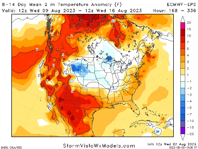
Temperature Anomaly for 8-14 Days 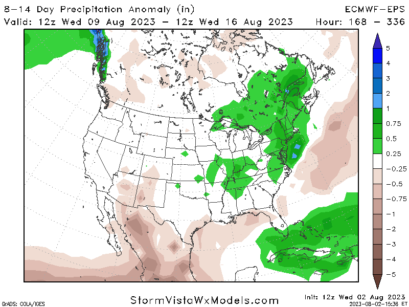
Precipitation Anomaly for 8-14 Days
[wpcode id=”41149″]
Conclusion
The south will remain hot as a new ridge enters the west late next week pushing in more hot air. The north will be cooler than normal and then heat up back to normal late next week. As for wet weather the east will have some showers today as well as the plains region over the weekend. This moisture will remain throughout the week with some scattered afternoon showers especially in the southeast. Be sure to check out your local weather forecast on our app is you stay up to date and can be prepared.


