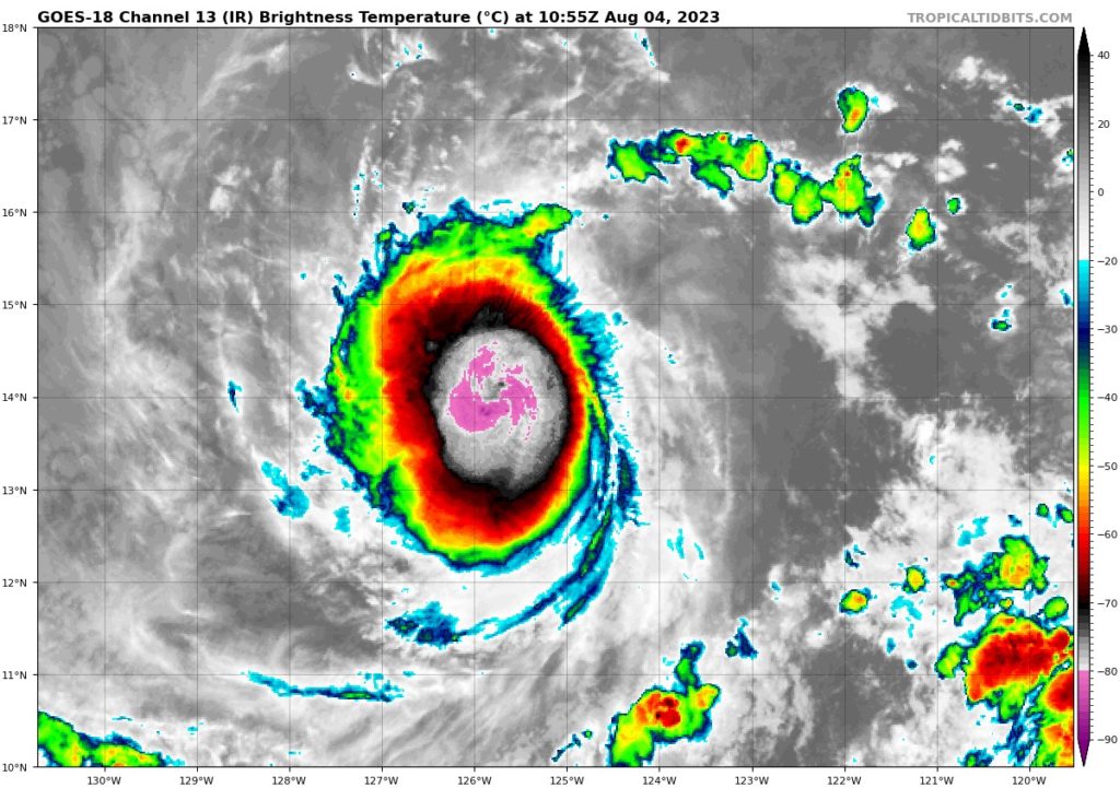
Hurricane Dora appears to have completed an eyewall replacement cycle and now has a new larger eye rather then its smaller pinhole eye. Dora remains a Category 2/3 storm and more details about its path and evolution are to be discussed below. Elsewhere in the Pacific we are monitoring another area of interest off the Mexican coastline that is expected to develop in the coming days. Finally, conditions in the Atlantic remain quiet for early August.

[wpcode id=”41149″]
Short Term
Hurricane Dora has just completed it’s eyewall replacement cycle allowing for a larger eye and a more expansive wind field to develop. The wind shear that was suppose to subtle weaken Dora has had a delayed onset and as result should have a reduced impact (if any) on weakening the Major Hurricane. Dora is not expected to impact any land masses, but rather will move from the Eastern Pacific Basin to the Central Pacific Basin far to the South of Hawaii. Dora, will take a path few hurricanes have taken and traverse both the Eastern and Central Pacific Basins with an outside chance of impacting the Western Pacific Basin as an organized Tropical System. Dora will maintain strength these next few days before it begins to weaken due to lower SSTs and higher windshear by midweek.
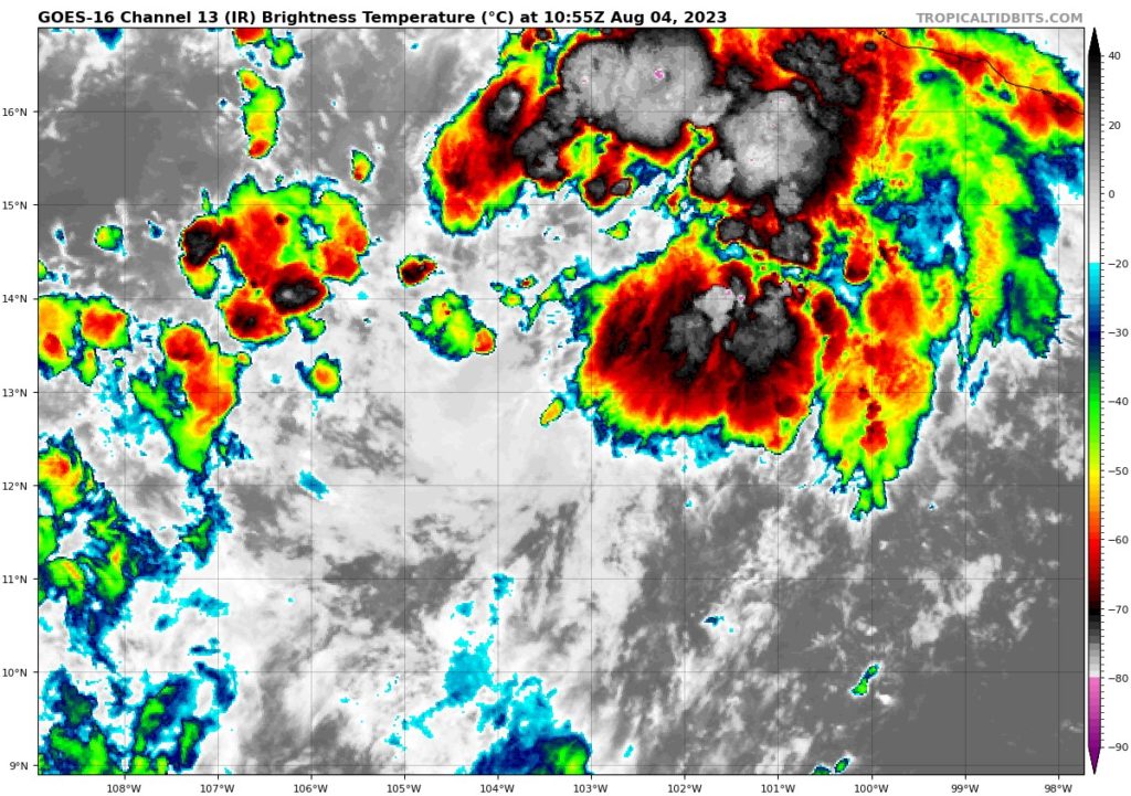
The other area of interest in the Eastern Pacific is off the Coast of Mexico. A broad area of low pressure has formed off the coast of Mexico and is beginning to organize into the next tropical system. In the short term, this organization could bring gusty winds and heavy rainfall to portions of the coastline. Any systems that forms is expected to remain a low end Tropical Storm and not impact the coastline, but the hazard should still be monitored for mariners and for changes in development.
Over in the Atlantic Basin, while the region remains warm, high wind shear and pockets of dry air continue to keep near term development chances low. Organized development of tropical systems is not expected at this time.
[wpcode id=”41149″]
Extended Outlook
While the East Pacific looks to remain active over the next week or two with one or more tropical systems expected to develop. The Atlantic looks to remain quiet due to a weak MJO, a strong El Nino pattern, and overall uncertainty in how certain atmospheric waves may develop. We do expected activity to begin to pick up in mid August as is typical for this time of year, but uncertainty regarding strength and evolution still exists especially during an El Nino year. As a forecast period gets closer however, we will have a greater deal of certainty which will allow us to craft a better forecast so as always check back here for updates!

[wpcode id=”41149″]
Conclusion
Hurricane Dora should maintain itself for at leas the next week as it traverses the Eastern and Central Pacific Basins. If it makes it to the West Pacific Basin that would be a rare treat to see, but thankfully no land impacts are expected across any of the basins. Tropical development off the Western Mexican coastline will need to be monitored as the systems moves parallel and near the coast. Any wobble East could result in higher impacts to populated coastal areas.
Finally, the Atlantic basin remains quiet and peaceful for the bulk of us at home this is a welcomed sight in August, but remember peak season is on the way and preparations to remain weather aware could be undertaken right now! Check those hurricane kits, make sure you have a plan, and check all important documentation! Better to be prepared then caught off guard!


