Happy Friday everyone! Today, the local area is expecting afternoon thunderstorms as well as heat indices surpassing 110 degrees. Let’s see how when and how this weather is gonna stick around.

Afternoon Storms Moving Through
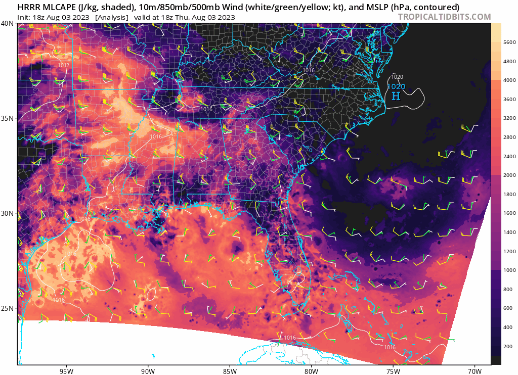
Eastern Mississippi and Western Alabama will be under marginal risks for thunderstorms and strong winds with Southern Louisiana also under a slight risk for today. The vast area of strong CAPE values shown above line up pretty nicely with where the Storm Prediction Center has outlined for this marginal risk of severe weather. Winds closer to the ground (as indicated by the white wind barbs) show mostly southernly winds along the coast and becoming westerly as the day progresses. This will pull up much of that moisture from the ocean while the enhanced flow in the mid-level will steepen lapse rates, giving these significant CAPE values for today for the chance of severe thunderstorms. With such a relatively unstable atmosphere, powerful thunderstorms will be able to develop.
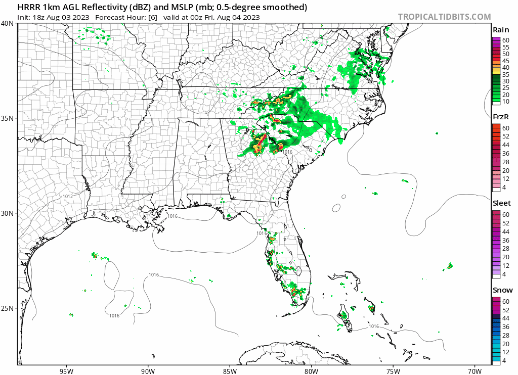

The main threat of severe weather will be this system moving through eastern Tennessee early in the morning and into Alabama by noon. From this storm will also be a strong outflow boundary from which many storms will develop along and continue delivering rain further south from the main system. Mississippi can mostly expect these storms east of Jackson in the afternoon while Northern Alabama will be facing the brunt of these rains with 2-3 inches of rain expected in some areas.
[wpcode id=”41149″]
August Heat in Full Effect
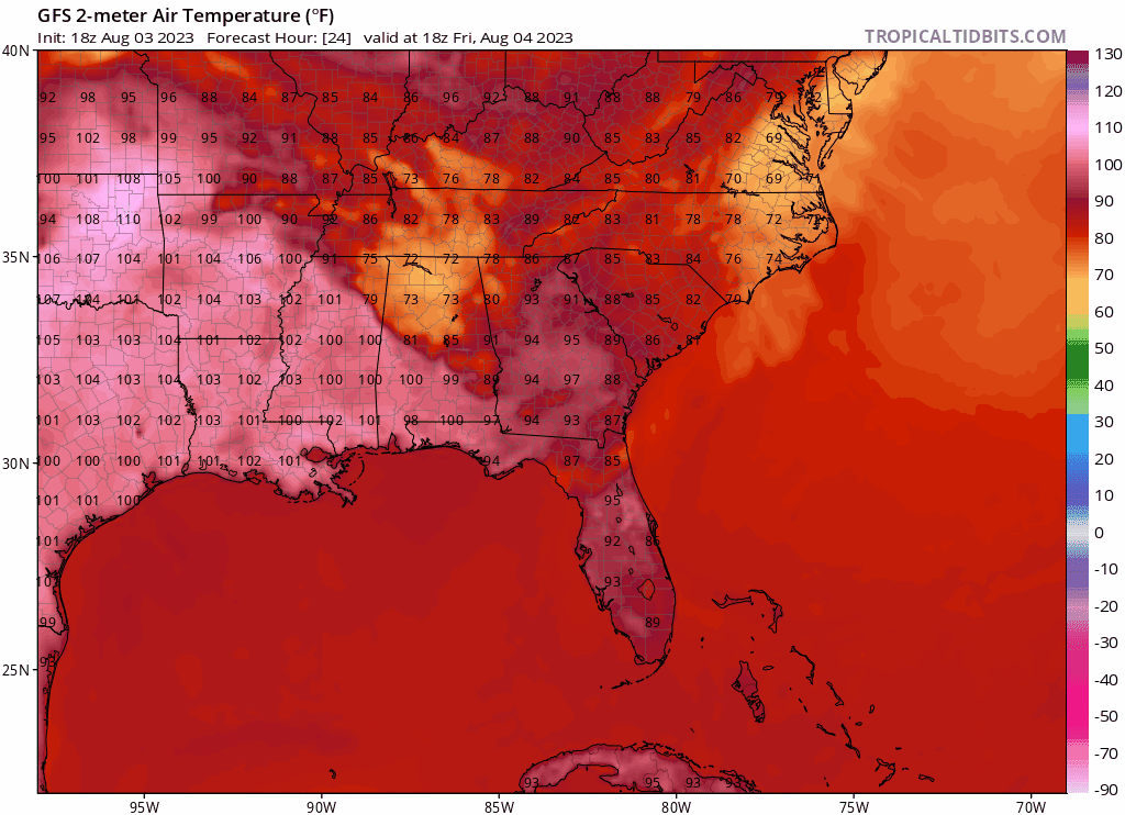
Extended heat advisories will be in full effect this weekend with high temperatures breaking 100 degrees across most of Louisiana and Mississippi with the rest of the Southeast coast seeing above average temperatures seeping in. Especially with the heavy humidity in most areas, heat indices will likely surpass 110 degrees in most areas, especially the further west you are located. The northern parts of Mississippi and Alabama will offer some slight lower temperatures in the low to mid 90s but the risk of heat related illness remains just as high so always take precautions out in this heat.
[wpcode id=”41149″]
Extended Outlook

Luckily by the end of next week, the heat will begin to return back west as the upper-level ridge makes its way back into the Southwest while the trough in the east begins to build up again. Temperatures around the local area will still likely be hovering around the 90s as is becoming typical for the summertime now but this general weak ridging will allow these hot temperatures to spread all throughout the Southeast Coast.
[wpcode id=”41149″]
Regional Day-To-Day Forecast
Today: Sunny and hot. Thunderstorms possible after around 1pm. High temperatures in the upper 90s to low 100s with heat indices into the 110s. West winds around 5-10 mph. Chance for rain around 40 percent east and 10 percent west.
Tonight: Partly cloudy. Low temperatures in the upper 70s. Southwest winds around 5 mph.
Saturday: Sunny. 30% Chance of showers and thunderstorms. High temperatures in the upper 90s to low 100s. West winds around 5 mph.
Saturday Night: Partly cloudy. 30% Chance of showers and thunderstorms. Low temperatures in the upper 70s. Southwest winds around 5 mph.
Sunday: Sunny and hot. 30% Chance of showers and thunderstorms. High temperatures in the upper 90s to low 100s. Southwest winds 5 mph.
Sunday Night: Partly cloudy. Chance of showers and thunderstorms. Low temperatures in the upper 70s. Southwest winds around 5 mph. Chance of rain 30%.
Monday: Sunny. 30% Chance of showers and thunderstorms. High temperatures in the upper 90s to low 100s. Winds southwest 5 to 10 mph.
Monday Night: Partly cloudy. 30% Chance of showers and thunderstorms. Low temperatures in the upper 70s. Southwest winds 5 to 10 mph.
Tuesday: Sunny. 50% Chance of showers and thunderstorms. High temperatures in the upper 90s to low 100s. West winds 5 to 10 mph.
Tuesday Night: Partly cloudy. 40% Chance of showers and thunderstorms. Low temperatures in the mid 70s. South winds 5 to 10 mph.
Wednesday: Mostly sunny. 40% Chance of showers and thunderstorms. High temperatures in the upper 90s to low 100s. Southwest winds 5 mph.


