The Setup
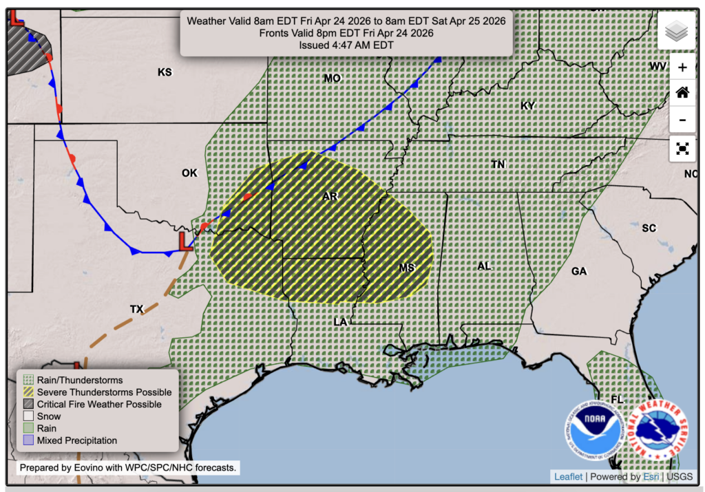
Hey everyone! We’re still looking at some on and off showers and storm activity for this weekend, primarily on Friday and Saturday. A low pressure system and associated front will sweep in from the Rockies and Plains. Out ahead of it, warm and moist air will feed in from the Gulf and supply storm energy, along with modest wind shear to support potential supercells. The main threats for tomorrow, Friday, are strong to severe winds and large hail, as well as a small tornado chance. As we know, tornadoes are always possible with these types of storms along outflow boundaries or in cells out ahead of the main line.
Areas in yellow in the Friday forecast chart are under a Level 2 Slight Risk of general severe weather, which is primarily north of our region, but I assume some of you are located in this region. For the rest of us, we’re currently under a Level 1 Marginal Risk, which means that severe weather is possible. I’ll walk you through the timing as best as I can below.

Tonight’s Forecast
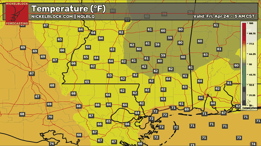
Tonight, we’ll see mostly clear skies with temperatures in the lower 60s. Humidity is on the rise with the persistent southerly flow off of the Gulf, so it will still feel sticky at night.

Tomorrow’s Forecast: Friday, April 24th
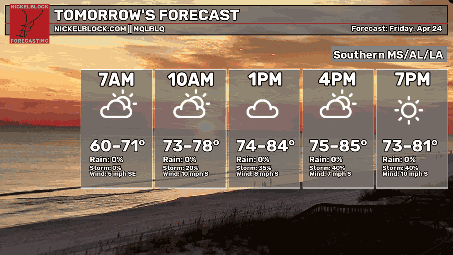
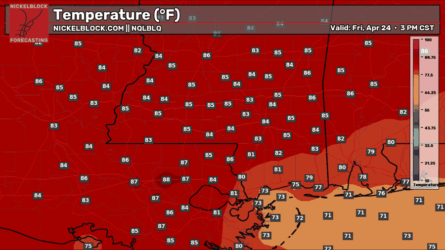
Another hot and humid day is in store for tomorrow, and we will start off the morning and afternoon off partly sunny with our rain and storm threat coming in later on in the evening into the overnight. The HRRR and the High-Res NAM show some scattered showers or thunderstorms before the main line, which will be hit-or-miss in the afternoon and evening, and then the main line coming through around midnight or so into Saturday. Along the line will feature gusty winds, as shown by the bow-looking structure from the HRRR. The line will continue south/southeast by Saturday morning.
Weekend Forecast
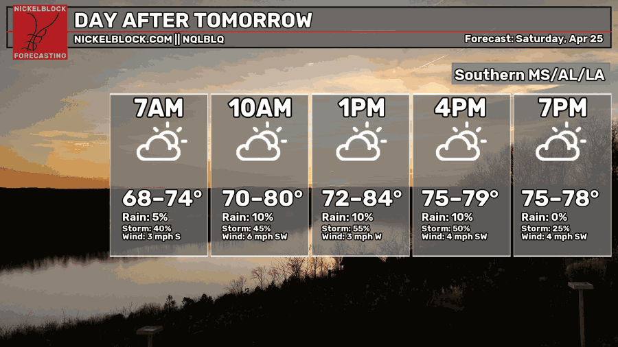
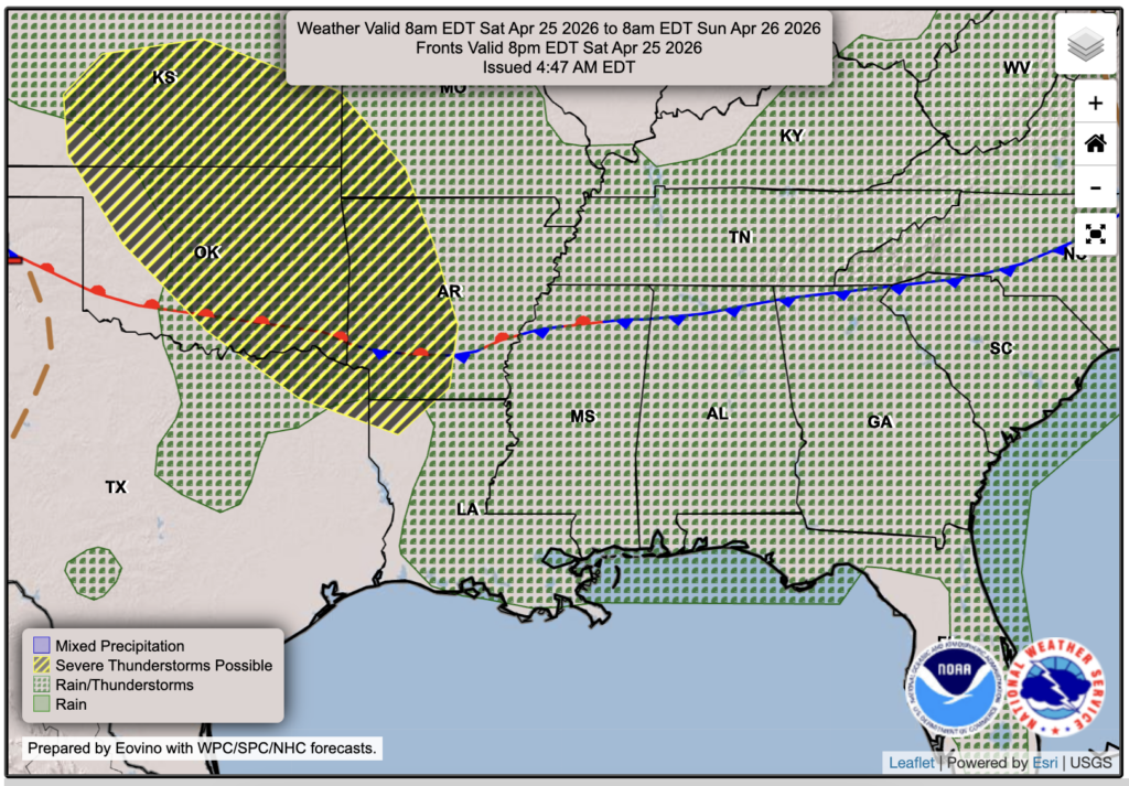
An even hotter and more humid day is in the forecast for Saturday, with temps in the mid 80s and dew points in the upper 60s, which is extremely humid! The main line will have exited by 6-9 AM or so, but the front will sort of stretch out and stall out over the deep south, which will allow for some leftover showers or storms for Saturday.
For Sunday, there will be a similar temperature in the mid-to-upper 80s with sticky humidity, since we won’t be receiving a true cold front passing through, which would typically lower humidity and temperatures along northerly flow. Not this time…

Extended Local Outlook
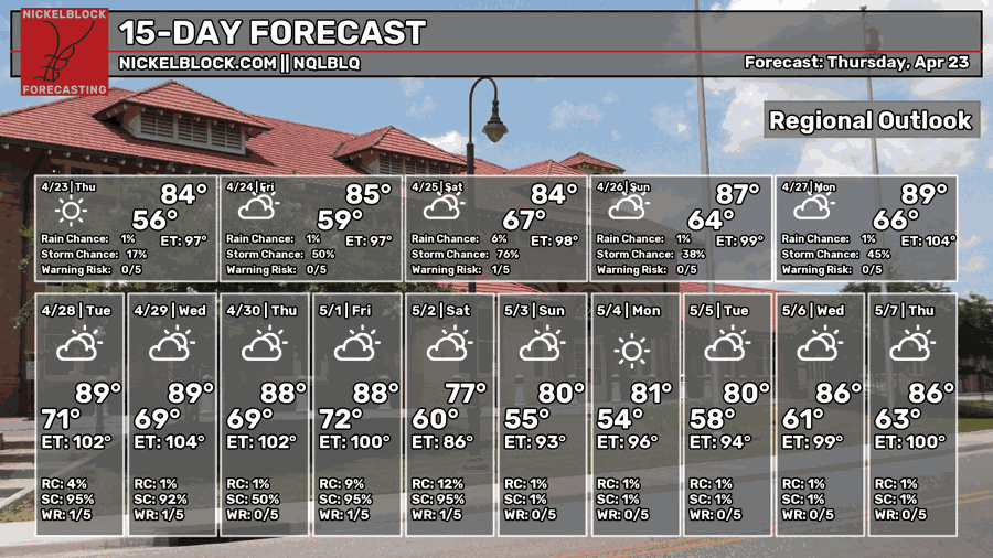
The stalled front won’t bring any relief from the heat or humidity, and we will see more of a progressive storm track, with a good chance at multiple shots of rain next week as well. No day’s currently look to be a washout, but plan for more shots of rain than recent weeks. We could use it! Keep an eye out on the app/website, as well as Nick’s update on Facebook for more details on this weekends storm threat.


