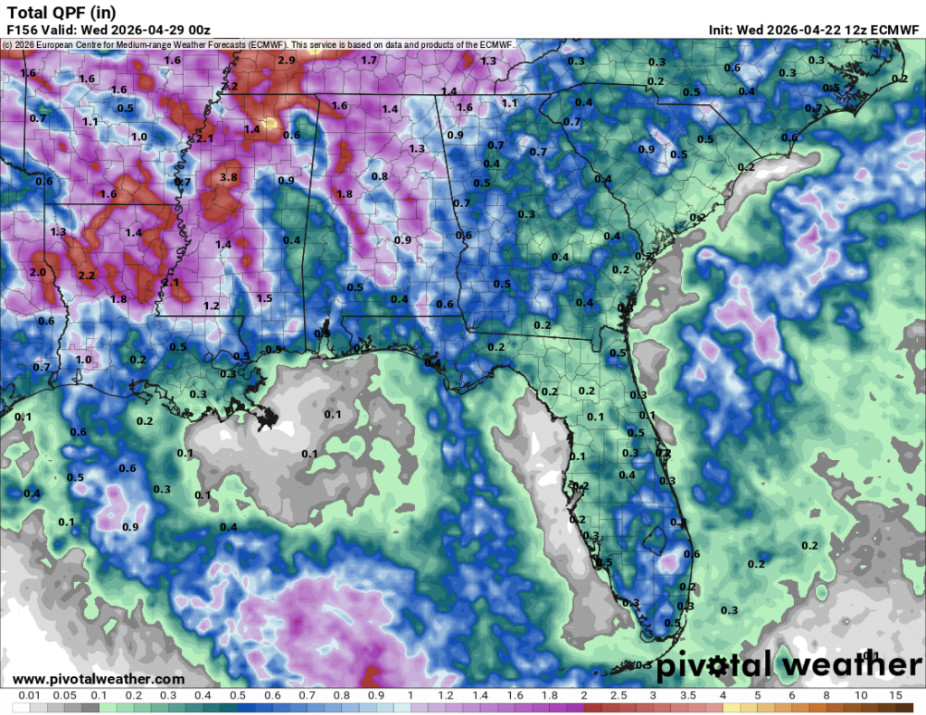
The humidity is increasing which means the rain is coming! The good news is that it’s a decent amount, too. The rain will come in waves as each low pressure system is basically chained to another one repeating the process. There will be a brief break on Sunday until another system moves in to start off the week.

Today
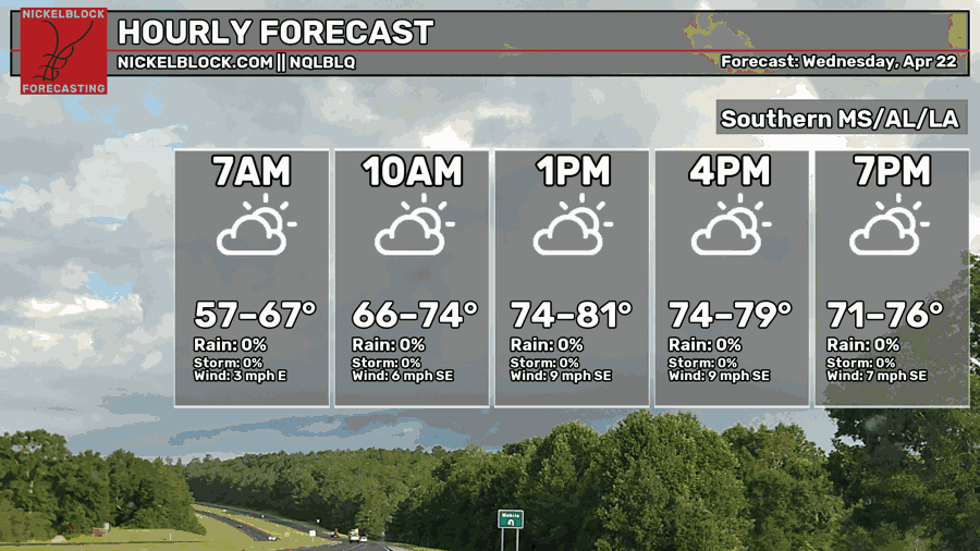
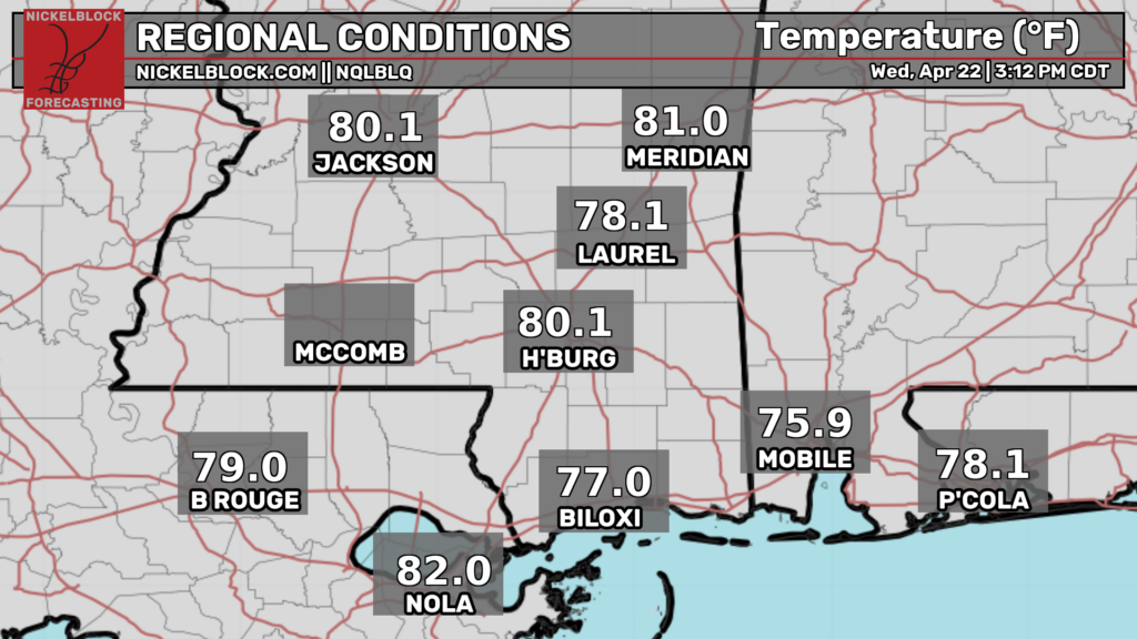
It’s been a mostly cloudy day with upper clouds cutting out a fair share of the sunlight. This hasn’t deterred the humidity though, and it’s been a warm day with temperatures in the upper 70s to low 80s across the Gulf South. Overnight, we’ll reach the upper 50s with mostly cloudy skies.

Tomorrow
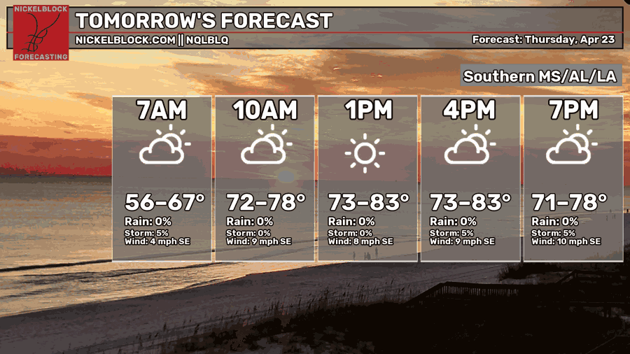
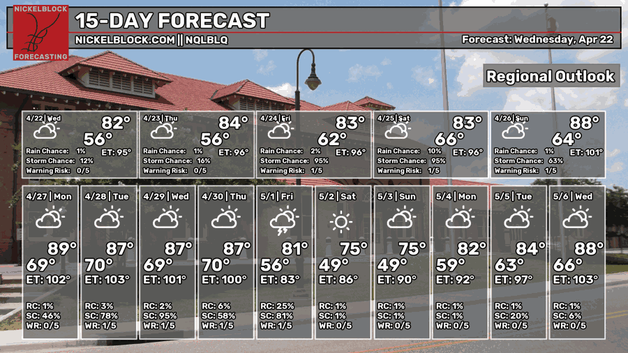
Another partly cloudy day is expected tomorrow with an ever-so-slight chance of an isolated shower across the Pine Belt. Most of the rain is relegated to the western part of Mississippi, but with the southeasterly flow from the Gulf, I don’t doubt we’ll see a shower or two in our area. Otherwise it’s going to be a warm Spring day. Overnight, we’ll fall into the low 60s.
Friday
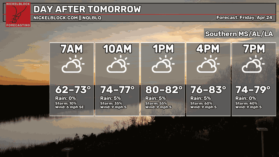

We’ll start off humid Friday morning before our first wave of rain comes in Friday afternoon into the evening. If you’re outdoors, be prepared to move inside pretty quickly if the rain comes your way. Highs will be in the low to mid 80s with winds out of the southeast around 5-10 mph. Overnight, a few more showers are possible with a low in the low to mid 60s.
This Weekend
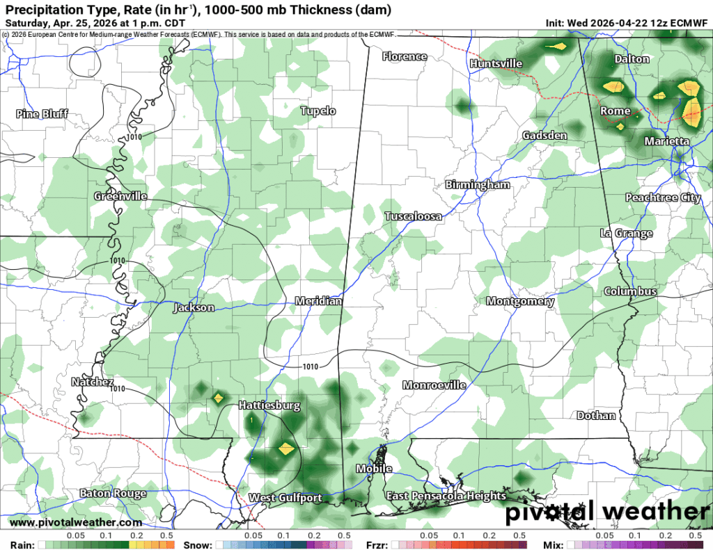
Saturday’s not looking like a washout, but we can expect some scattered showers across the Pine Belt and MS/AL coast in the mid-morning to early afternoon. It’s going to be a warm and humid day with a high in the mid 80s and partly to mostly cloudy skies. We’ll have a break from the rain on Sunday, however it’s going to be very warm with a high in the upper 80s. As we start the week, rain is likely on Monday through Wednesday. Overall totals look to be around 1.5-2″ which is good news for us. It may not be a drought buster, but it’ll help with fire weather and agriculture.