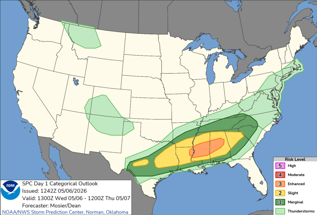
The title isn’t there to make anyone panic, but we do need to be aware that severe weather is likely today. The Storm Prediction Center has upgraded the Slight (2/5) to an Enhanced (3/5) risk for many areas north of Hwy 84 and keeps many areas south in the Pine Belt at a Slight risk. Considering the already warm and humid conditions, we have enough ingredients to spark off severe weather this afternoon into the evening.

Today’s Severe Weather
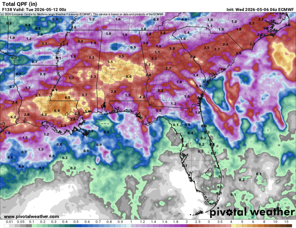
All storm modes are possible with today’s severe weather, plain and simple. The HRRR radar shows a mixed bag of cells developing during the afternoon, so tornado development is possible but conditional. If a discrete cell is able to form away from the cluster, a tornado is possible. Hail is possible but more likely to our north. High winds are likely along with some flash flooding. Minor river flooding is also possible with how much rain we receive as some areas may receive up to 5 inches in a 12-hour period.
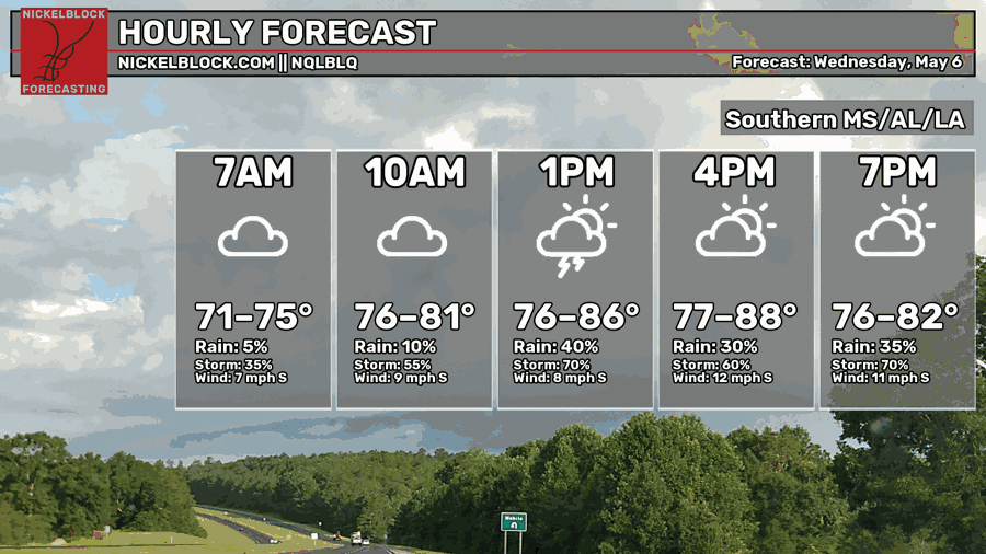
The window for these cells to develop is around 12-10pm. The strongest storms will likely develop between 1-7pm with a few more afterwards. The orientation of these storms is East Northeast indicating that they will move in that direction for the duration of the event. This also means that areas between Hwy 98 and Hwy 82 will see the majority of the severe weather.
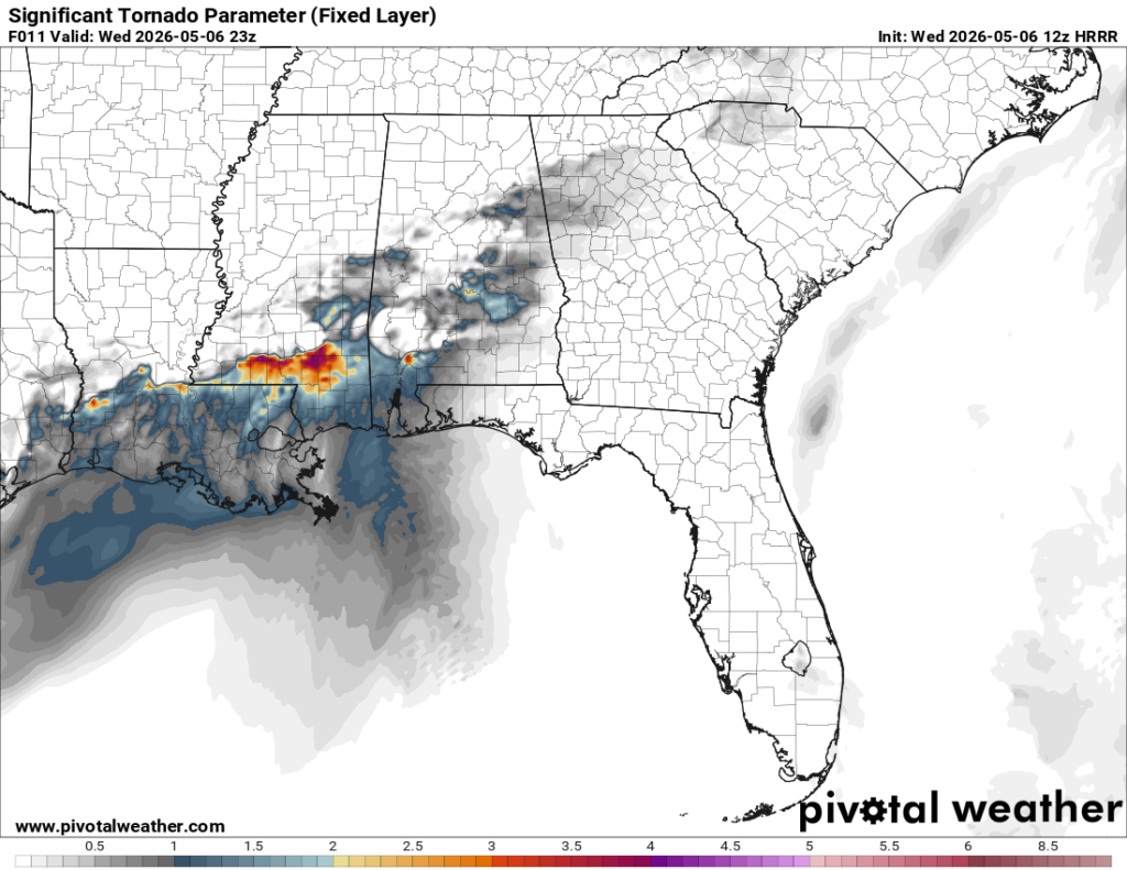
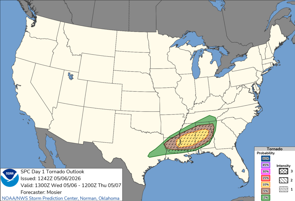
The Storm Prediction Center has highlighted most of Mississippi and Alabama under their Tornado outlook with a hatched chance for strong tornadoes. The HRRR model (left) confirms this with a SigTor parameter spread out across the Hwy 98 corridor. Our strongest SigTor signature is towards the Natchez Trace/I-55 corridor in the afternoon, then shifts to the east, weakens a bit, and spreads east towards the Pine Belt in the evening.
Bottom line: Severe weather is likely. Our window is from early afternoon to the early evening. Tornadoes are possible especially to our west and later in the Pine Belt. Heavy rain is a big factor with many areas seeing 3-5″. Lightning, hail and damaging winds are also likely.

Tomorrow
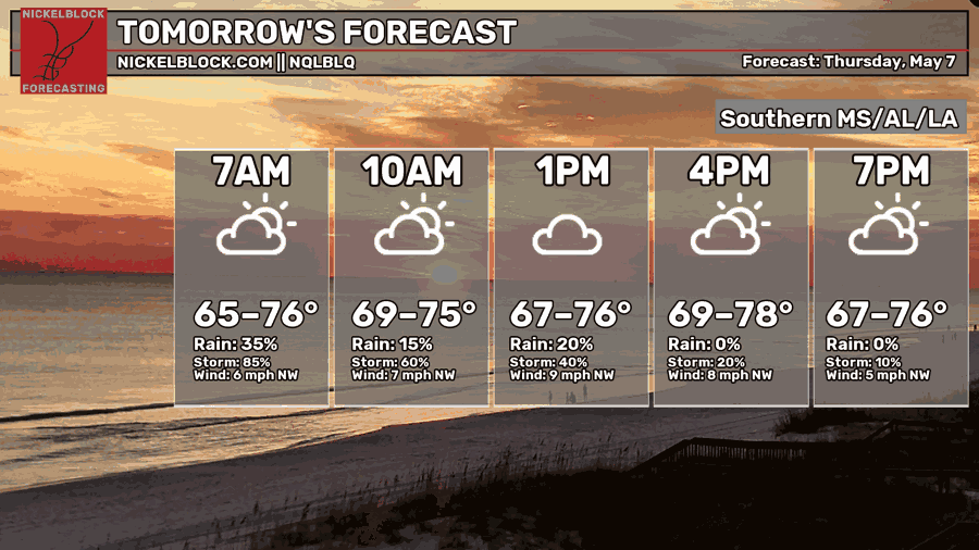
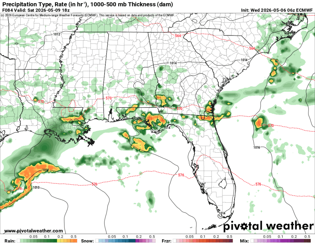
We’ll have a brief break from the rain tomorrow after the front passes through. The front itself will hang around just our south, so the clouds will stay in our midst for the day. Highs will be in the upper 70s with winds out of the northwest. Lows will fall into the upper 50s to low 60s overnight with rain moving into south Louisiana in the early morning hours.
Friday
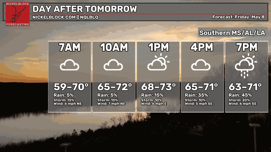
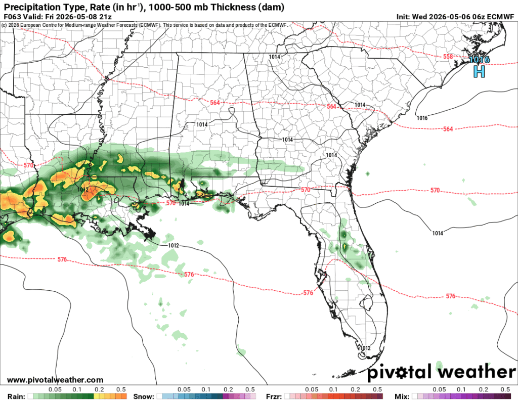
The rain sneaks in from the west and moves north towards much of the Pine Belt and Natchez Trace bringing more beneficial rain to our area. It’ll be an overall rainy day Friday, so keep your plans indoors if you’re going out Friday night. Highs in the low 70s and a low in the low 60s.
This Weekend
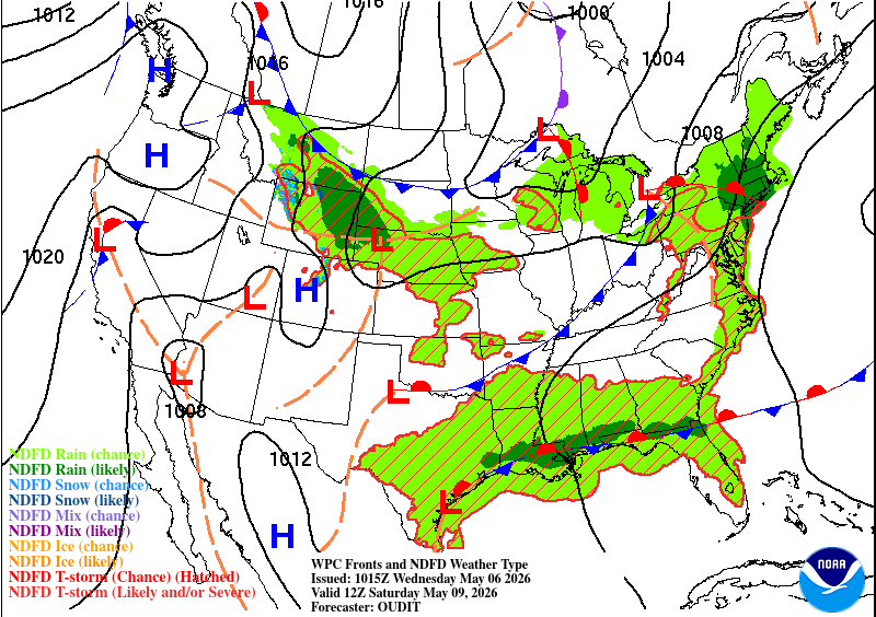
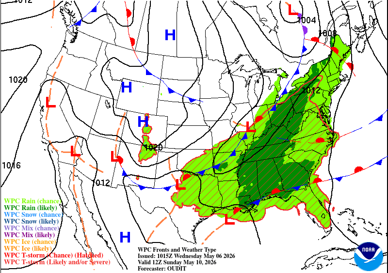
Unfortunately, another washout is possible this weekend. The front hangs around the coastline for the next couple of days until the next cold front moves in from the midwest. This means the moisture flow will ramp up letting more rain move in.
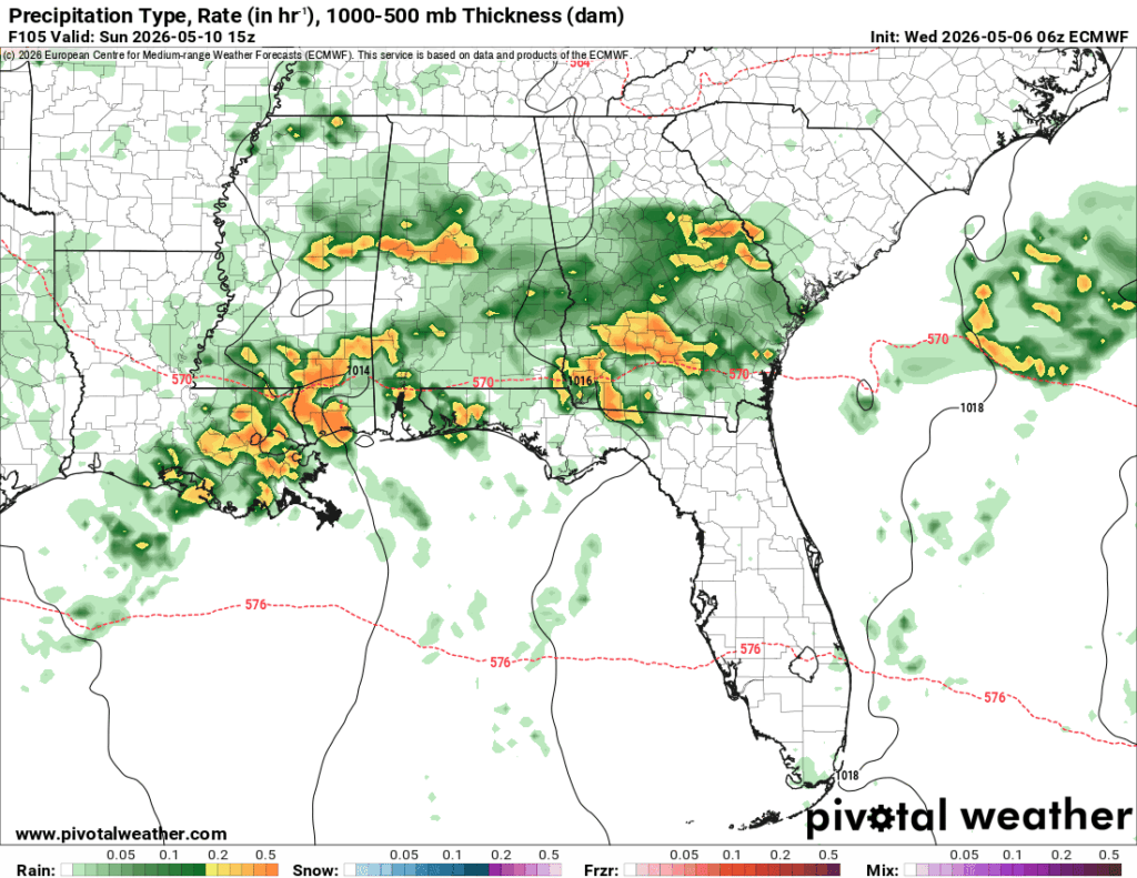
The semi-good news is that the Pine Belt will see a little less of the rain on Saturday, but the rain returns on Sunday. Temperatures will be below seasonal norms due to the cloud cover and rain (upper 70s), but humid. Lows will be in the low 60s.