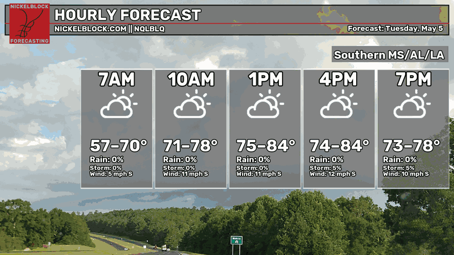
Things will be quiet today with some extra high clouds starting to filter into the area. Temperatures will be pretty mild. Then a shot for storms arrives tomorrow. With the opportunity for some severe weather, too. Behind the storms, we may have a chance for some lingering rain Thursday and Friday.
Today, things look, generally nice. Some clouds here and there, sure, but overall pretty good.
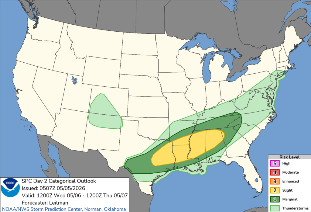
Then, as we move through tomorrow, the chance for rain increases.
The Storm Prediction Center has issued a Slight Risk for parts of the area and a Marginal Risk for other sections.
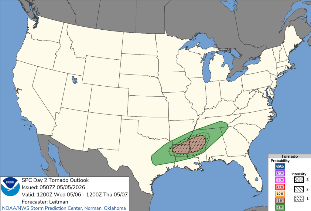
The main concern will be heavy rain, lightning, wind gusts up to 65mph, hail up to the size of ping pong balls and the chance for a tornado.
The SPC is also noting the risk for stronger than EF-2 tornadoes in our area.
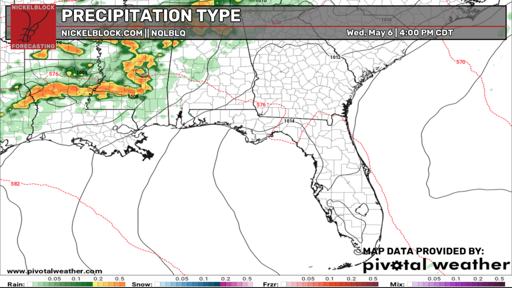
The timeline on this, based on the latest model guidance, suggests that storms coudl start as early as 1p and linger around as late as 10p. That doesn’t mean it will be raining at your house for 9 hours. If the rains start earlier, they’ll end earlier. And if the storms start later, they’ll stick around later.
The window for severe weather shouldn’t exceed 6 hours in total from start to finish.
If storms are clustery and messy looking on radar, the risk for tornadoes will go down. But if they can stay a bit more linear or isolated, then the risk for tornadoes will stick around.
…. I’ll try to have more specifics later tonight.
After the storms kick through, then the little boundary associated with them may hang around the region. It’ll mean a shot for rain and storms will continue for another 24-48 hours. Severe weather isn’t expected. But some rain and thunder will be possible.


