Welp. There’s some rain in the area right now. Who could’ve thought?
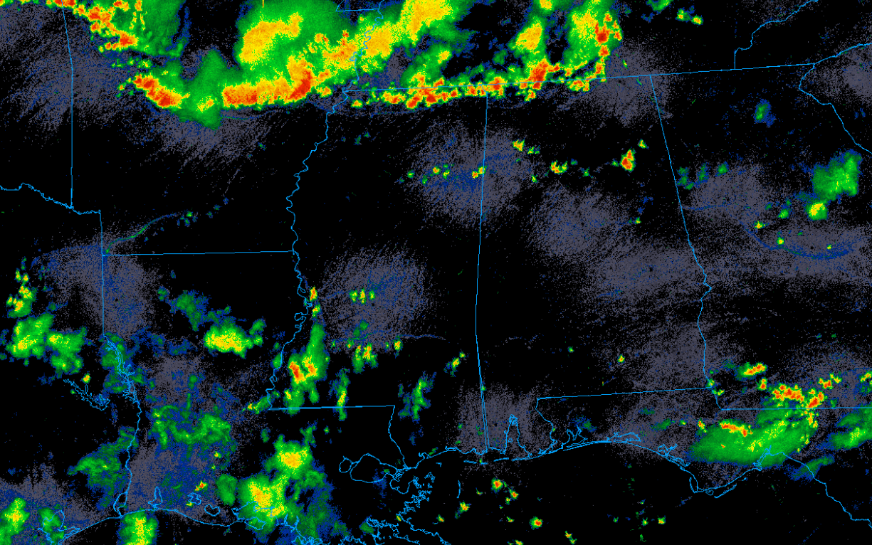
While there’s some scattered pulse storms down by us (that has produced some isolated flash flooding), the stronger convection is to the north in the mid south. Unfortunately, those storms are being forced by a frontal boundary that is…
Yup, you guessed it. Sinking south into our area.
This will lead to widespread showers and thunderstorms over the next couple days that may cause some flooding and wind damage. Thankfully widespread and significant severe weather chances look low.
The good news about all this rain is that it will help cool the temperatures down and give us a little break from the heat.

Tonight
Storms should be clearing by sunset and will quickly diminish with the loss of daytime heating. Cloud cover will also decrease as we head into the am hours. As the temperature drops, relative humidity will rapidly increase leading to near saturation.
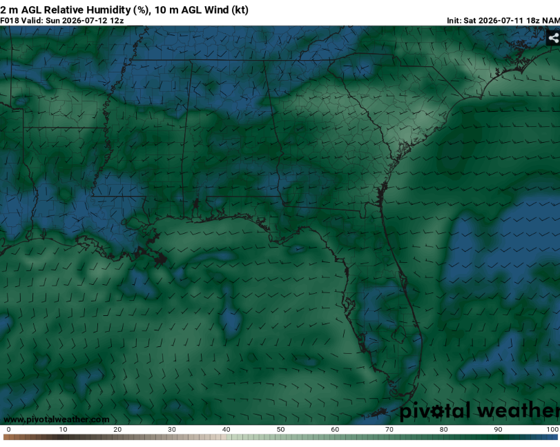
This may lead to the development of fog. Locations in river valleys or that have recently received rainfall will be at the highest risk. Make sure to use caution when encountering fog on the road ways.
Temperatures will bottom out in the mid 70s with the typical muggy feel of a humid summer night.
Tomorrow
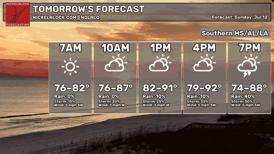
It’ll start off as another hot one. Temperatures will likely peak in the low 90s with heat indexes around 100. As the afternoon progresses, cumulus clouds will slowly build. The frontal boundary will gradually advance from the north leading to scattered thunderstorms developing by late afternoon or early evening.
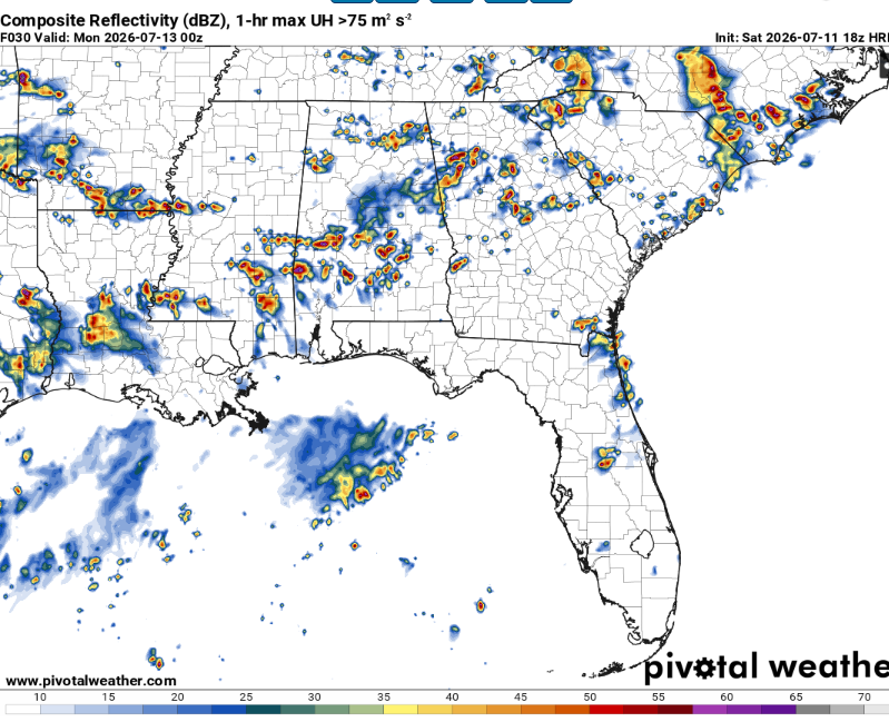
These storms will be most numerous over central Mississippi into northern Louisiana. As usual, they will be capable of heavy rain and frequent lightning and this time there is a threat for damaging downbursts.
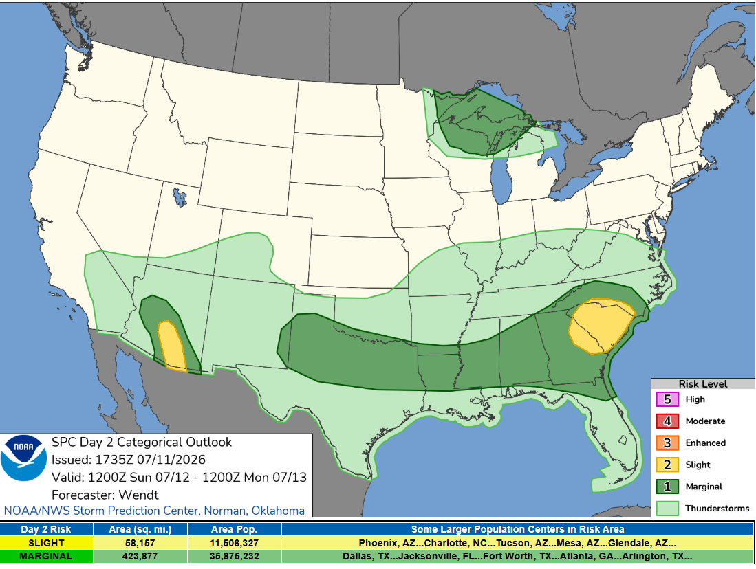
The Storm Prediction Center has outlined parts of our area in a level one out of five marginal risk for damaging winds (up to 60 mph). Chances for severe winds will increase if storms can conglomerate and form an intense cold pool.

The Day After Tomorrow
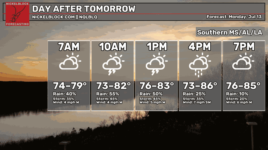
More storms.
The front will likely stall in the region allowing for multiple rounds of convection. Widespread storms will likely traverse the area throughout the day and into the evening.
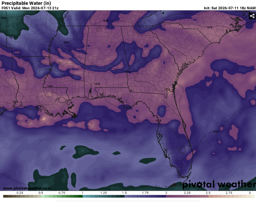
There will be plenty of moisture as tropical air converges with the front so flooding will definitely be possible. Fortunately, wind shear looks to be very weak which will keep storms from being able to organize much.
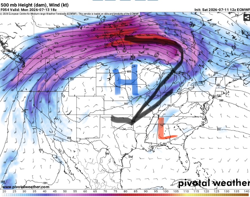
This is because the stronger flow in the jet stream remains far to north as ridging dominates the central United States. Slight ripples in the flow will rotate around the periphery of the ridge like the small low that will be hanging out with us. This will allow for enough lift for widespread storms but not much more.
As always these storms will be capable of strong downpours and cloud to ground lightning and a chance at damaging winds but nothing crazy.
Highs will likely be in the upper 80s for areas that are able to be storm free for a bit while areas that stay cloudy will likely remain in the low 80s.

Extended Outlook
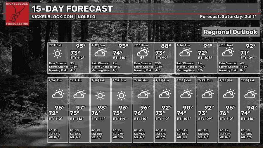
Rain chances will decrease towards the end of the work week as the frontal boundary washes out. This will allow us to heat up again (potentially to dangerous levels).
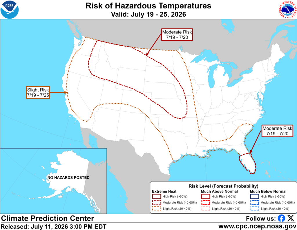
Indeed, the Climate Prediction Center has outlined much of the Gulf coast in a slight risk of excessive heat from the 19th through the 25th. This will likely be driven by very humid days and much warmer than average nights. As usual, you can never rule out some pop up afternoon storms but it does not appear to be a particularly wet pattern.
Day-By-Day Forecast
Tonight- Decreasing clouds with a low in the mid 70s. No rain, but a chance of fog towards sunrise.
Tomorrow- Increasing clouds with a high in the low 90s. Scattered afternoon thunderstorms likely.
Tomorrow Night- Mostly cloudy with a low in the mid 70s. Scattered showers and thunderstorms likely.
Monday- Cloudy with a high in the mid 80s. Numerous showers and thunderstorms.
Monday Night- Isolated storms possible. Mostly cloudy with a low in the low 70s.
Tuesday- Increasing clouds with afternoon thunderstorms likely. Highs in the upper 80s.
Tuesday Night- Isolated storms possible early. Partly cloudy with a low in the low 70s.
Wednesday- Scattered afternoon thunderstorms possible. Mostly sunny with a high in the low 90s.
Wednesday Night- Partly cloudy and dry with a low in the low 70s.
Thursday- Sunny with a high in the mid 90s. No rain.
Thursday Night- Mostly clear with a low in the mid 70s. Dry.
Friday- Mostly sunny with a high in the mid 90s. Isolated afternoon thunderstorms possible.
Friday Night- Partly cloudy and dry with a low in the mid 70s.


