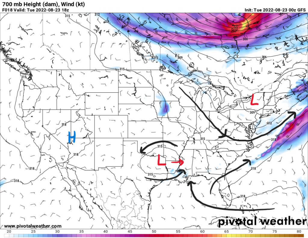
The next three weather days will be pretty similar across the Southeast with widespread showers and thunderstorms producing heavy and prolonged rainfall. A surface to mid-level low pressure center is over the Texarkana region and will interact with a stalled surface frontal boundary. Lower-level convergence will help initiate showers and storms throughout Tuesday and into Wednesday.
Mid-level pattern showing the low pressure moving towards the east from Texas.
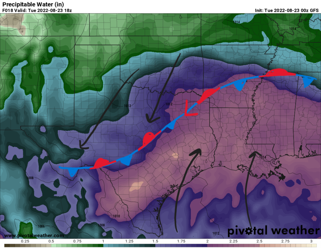
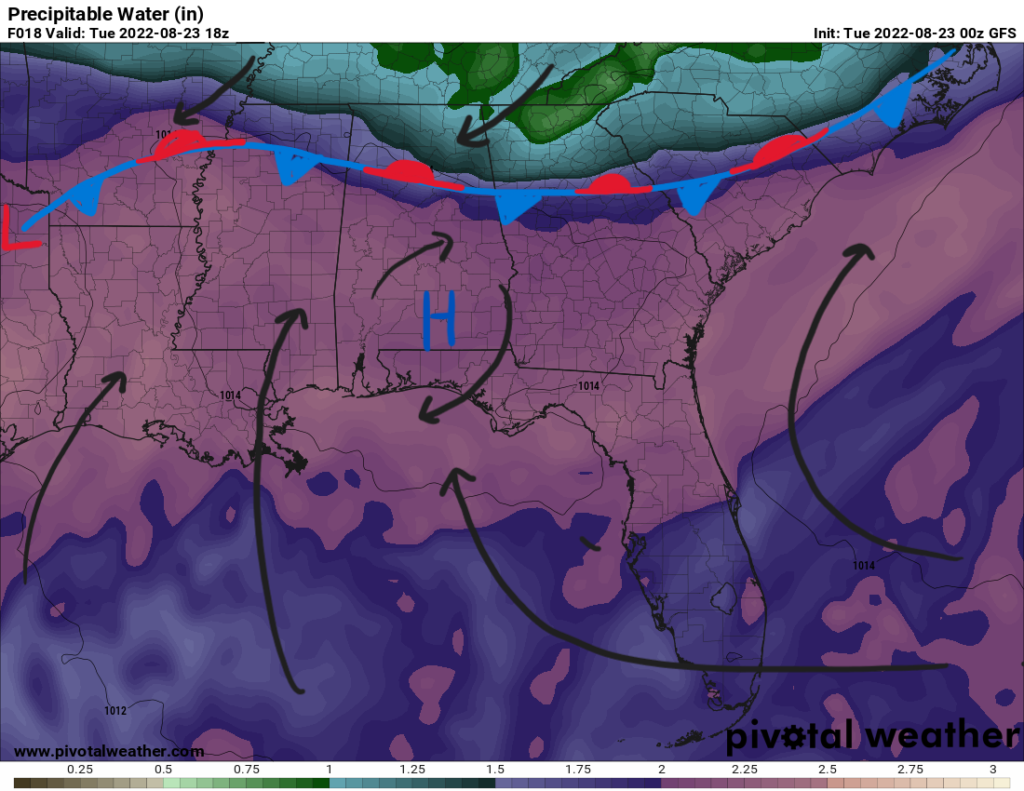
South of the boundary is a moisture rich environment. The Bermuda high stretching past Florida is bringing southerly winds into the Gulf Coast. Tropical moisture is therefore advecting from the Gulf of Mexico into Texas eastward to the Atlantic Coast. This elevated moisture is trapped south of the boundary focusing all the rainfall over the same areas. Precipitable water values are above average ranging between 2″ to 2.5″ across the region denoted by the lighter purple colors below. Along with dewpoints in the 70s, this supports heavy rainfall with the risk of flooding.
High precipitable water values below the boundary will help support heavy rainfall for the short term. || Courtesy: Pivotal Weather
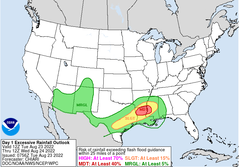
Many training storms will dump heavy rains over the same area and can cause flash flooding, especially since the soil is very saturated from previous rainfall. Flash flooding will be a big concern for urban and low lying areas. For these reasons, there remains a flood watch for portions of Eastern Texas, Northern Louisiana, and Eastern Mississippi. The Weather Prediction Center has outlined this area with a moderate risk (3/4) for at least a 40-percent chance of excessive rainfall exceeding flash flood guidance.
WPC day one outlook for Tuesday highlighting the risk for excessive rainfall. || Courtesy: NWS Weather Prediction Center
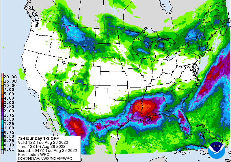
This stalled front along with the low pressure center will persist for the next few days allowing for heavy rainfall to continue to be center over the Lower Southeast. The WPC has outlined a slight risk over the same area for Wednesday and a marginal risk for Thursday. The boundary should begin to weaken by the weekend when rain chances will decrease. However, for the next three days, expect rainfall totals between 5″ and 7″ with locally higher totals. Rainfall totals on Tuesday alone could be between 2″ and 4″.
Rainfall totals over the next three days. || Courtesy: NWS Weather Prediction Center
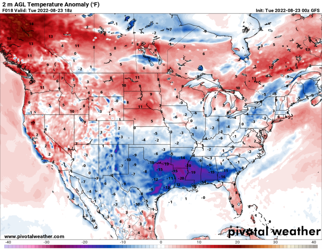
The increased precipitation a and cloud cover will keep temperatures below average by anywhere from 10F to 20F. Highs on Tuesday will be from the upper 70s to 80s in most places. Temperatures will slowly climb again as the week progresses and rain chances become lower and storms are more so driven by daytime heating by the weekend.
Below average temperatures for Tuesday due to increase rain coverage. || Courtesy: Pivotal Weather
3-Day Forecast
Dallas, TX
Tuesday
Wednesday
Thursday
High: 85
High: 85
High: 87
Low: 72
Low: 72
Low: 74
Precip: 50-percent
Precip: 40-percent
Precip: 20-percent
Houston, TX
Tuesday
Wednesday
Thursday
High: 85
High: 88
High: 88
Low: 75
Low: 75
Low: 75
Precip: 60-percent
Precip: 80-percent
Precip: 70-percent
New Orleans, LA
Tuesday
Wednesday
Thursday
High: 85
High: 85
High: 83
Low: 77
Low: 77
Low: 75
Precip: 90-percent
Precip: 90-percent
Precip: 90-percent
Little Rock, AR
Tuesday
Wednesday
Thursday
High: 81
High: 82
High: 84
Low: 70
Low: 70
Low: 72
Precip: 40-percent
Precip: 40-percent
Precip: 40-percent
Memphis, TN
Tuesday
Wednesday
Thursday
High: 86
High: 86
High: 88
Low: 70
Low: 70
Low: 72
Precip: 30-percent
Precip: 50-percent
Precip: 50-percent
Birmingham, AL
Tuesday
Wednesday
Thursday
High: 84
High: 84
High: 85
Low: 68
Low: 70
Low: 70
Precip: 50-percent
Precip: 70-percent
Precip: 70-percent
Atlanta, GA
Tuesday
Wednesday
Thursday
High: 85
High: 85
High: 83
Low: 68
Low: 70
Low: 70
Precip: 40-percent
Precip: 60-percent
Precip: 80-percent
Author of the article:
Brandon Lashbrook
Brandon is a degreed meteorologist with a Bachelors in Meteorology from Florida State University. At FSU, he worked on the FSU Weather show. Originally from Tampa Bay, FL, he will be at Fox 44/NBC 33 in Baton Rouge, LA as the weekend meteorologist in September.