This cold and rainy pattern is not an uncommon one for South Mississippi in the late fall / early winter. Especially during a weak El Nino year.
Wait, this is – GULP! – normal?
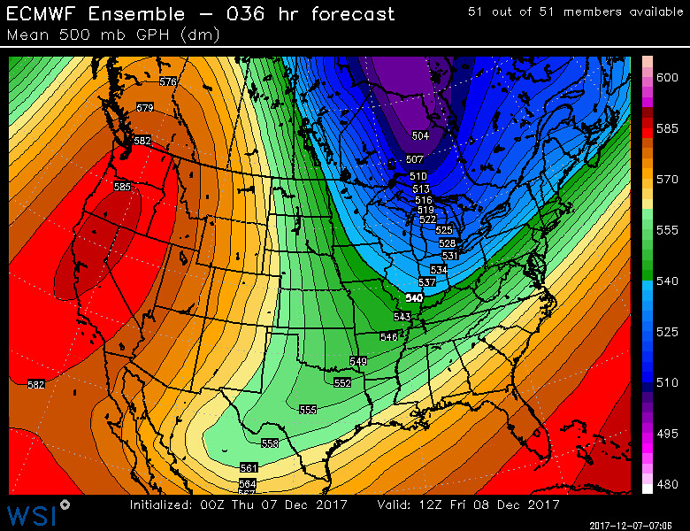
And, in fact, this is the same – general – setup that brought us all of that snow last year on December 8th. Yup! No joke!
So why no snow this time? A great question.
Because getting snow out of this kind of a setup is a once-in-a-lifetime event. Last year, South Mississippi had a few extra things happen that gave us all of the snow.
Last year, (1) the cold air over performed at every level in the atmosphere, (2) moisture over-performed, and (3) forcing over-performed.

Take a look at the Skew-T data above. Notice that the temperature (red) line is below zero Celsius through the entire atmosphere. And it is saturated (red and green line are touching) meaning that precipitation is possible with forcing, and there is forcing and that forcing is happening in the Dendritic Growth Zone.
For more information about reading a Skew-T, check this out!
So what isn’t it snowing, then?
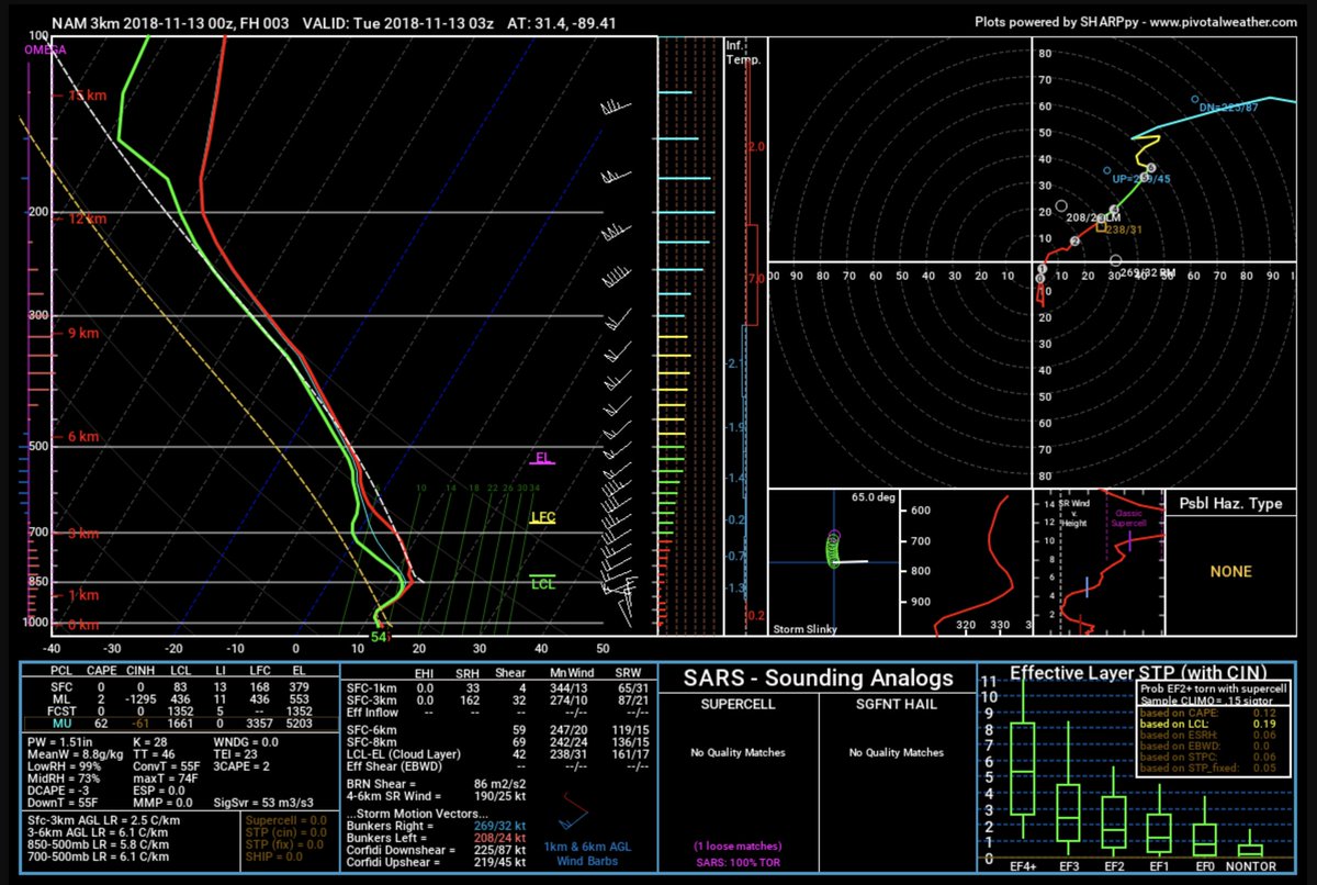
Right now? Well, the cold air is late, the moisture isn’t as deep, and the forcing is there, but it is quite a bit lower in the atmosphere.
But the setup is similar.
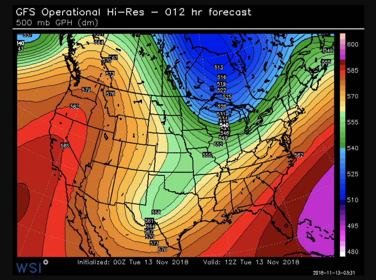
While it isn’t a carbon-copy by any means, the 500mb map does show a distinct southwest flow aloft. It is just a bit warmer this time around than last time.
And the Skew-T shows a similar trend. Warmer, drier, less forcing in the Dendritic Growth Zone.
Sadly, getting snow is rarely about how cold it is outside our door. It is more about a lot of cool stuff that is happening way above our heads in the atmosphere.
What about that 5% chance for snow Thursday?
The morning numbers have it back down between a two- and three-percent chance now. And mainly for late Wednesday night.

No, not great. But I suppose there is still a chance! Take a look at the Skew-T
The little spot where the red and green meet very low on the graph may be the spot where ice crystals form. The question is will there be enough forcing within that zone to exceed saturation and make precipitation occur.
Chances are pretty slim.
I’d say between two-or-three percent…


