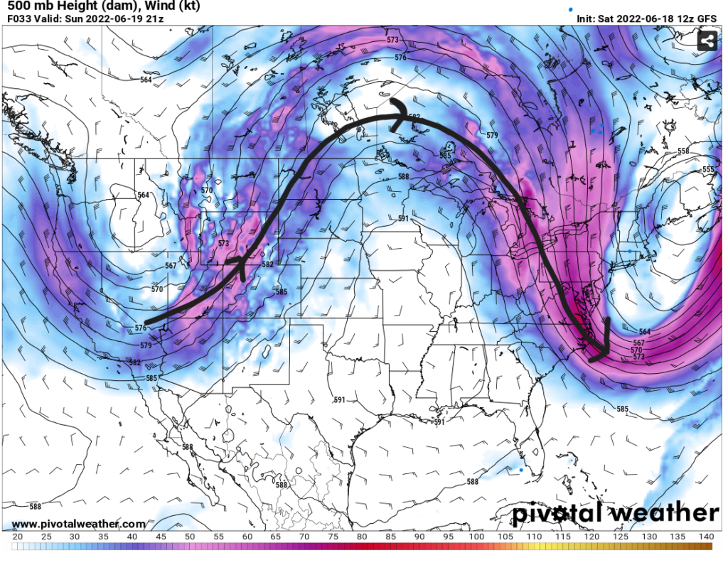
I hope everyone is staying safe from the heat as this upper-level high pressure ridge continues to dominate the U.S. The high/low pressure regime over the country is in what is called an omega pattern with two low pressures on either side of the main high pressure ridge. This pattern obtains its name from how it resembles the Greek letter omega, Ω.
The trough over the Northeast is helping to bring some cooler, drier conditions to the northeast and mid-Atlantic states. Temperatures range from the 50s in Maine to the 70s in Washington D.C. with lower dewpoints in the upper 30s. Unfortunately, these nice conditions will not reach all the way to our coastal areas in MS/LA/AL.
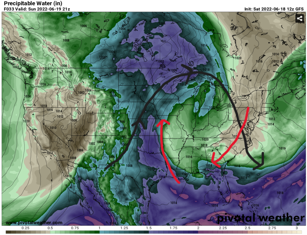
In addition to the ongoing heat, in the next couple days the rain chances will be low as some of that drier air works its way towards the Southeast. Below is a map of precipitable water, PW. PW is a measure in inches of all the water vapor in a vertical column at a single location. In other words, how much water can be pulled from the atmosphere for rain. Lower PW values introduce themselves to the coastal region on Sunday limiting any convection
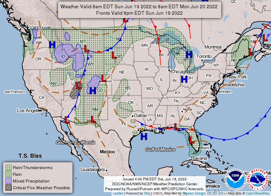
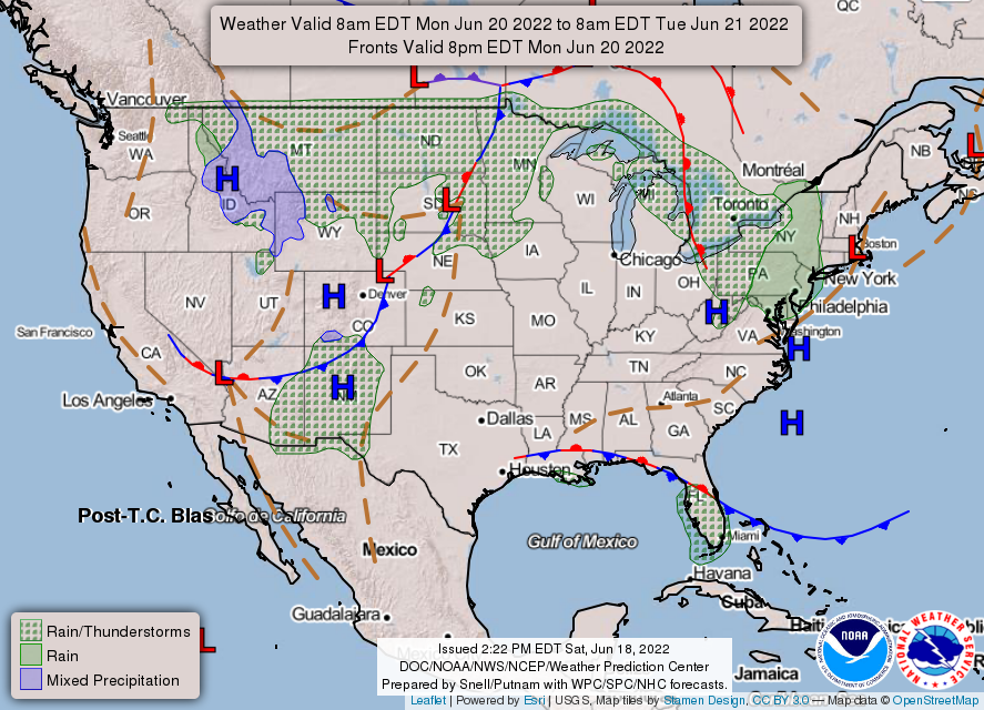
A backdoor cold front is coming from the Northeast bringing those drier conditions with it. Dewpoints will dip into the mid 60s helping to keep the heat index in check at or below 100F. These drier conditions will last until around late Tuesday when the wind will shift to a southeasterly flow bringing gulf moisture to kick the dewpoints back into the mid 70s. This frontal boundary could bring some rain; however, the overall sinking motion from the high will limit storms for the net few days. The best rain chances for Sunday will be around the central to west Louisiana coast below the stationary front.
The rest of the week will consist of continued high temperatures and heat indices. Those later heat indices could reach 105F and possibly 110F in the back half of the week. Stay informed to any excessive heat advisories or warnings posted. As always, avoid being outdoors during the hottest times of the day, stay hydrated, and have a way to cool off. Rain seems limited to the sea breeze to attempt initiation of convection, but even that seems suppressed.
Day-to-Day Forecast
Sunday
Mostly sunny with no expected rain. High temperatures in the upper 90s with overnight lows in the upper 70s and low 80s. Heat indices reaching 100F.
Monday
Sunny with no expected rain. High temperatures in the mid 90s with overnight lows in the upper 70s and low 80s. Heat indices ranging between 95F and 100F.
Tuesday
Mostly sunny with no expected rain. High temperatures in the mid-to-upper 90s with overnight lows in the upper 70s and low 80s. Heat indices ranging between 95F and 100F.
Wednesday
Mostly sunny with a 20-percent chance of rain. Highs will increase to upper 90s to possible low 100s. Heat indices from 95F to 105F. Overnight lows in the upper 70s and low 80s.
Thursday
Sunny and very hot with a 10-percent chance of rain. High temperatures between 95F near the water and 105F more inland. Overnight lows in the upper 70s and low 80s.
Friday
Mostly sunny with a 10-percent chance of rain. Highs will be in the upper 90s and possibly passing 100F. Heat indices reaching 105F in some places. Lows in the upper 70s.
Saturday
Mostly Sunny with a 20-percent chance of rain. High temperatures between 95F near the water and 105F more inland. Heat indices between 100F and 110F. Over night lows around 80F.


