Well, it sure felt like a wet and mild winter, but feelings can be vastly different from fact. And they usually are. Our brain tends to get int eh way of remembering objective observations.
That is why “things were better when I was a kid” is such a common phrase. The human brain is unable to recall things as objectively factual.
The Outlook vs. The Actual
The 2019 – 2020 Winter Outlook (posted on October 6th):
November: Warmer & Drier
December: Cooler & Drier
January: Average & Drier
February: Cooler & Drier
The 2019 – 2020 Winter Actual:
November – Cooler & Drier
AVERAGE MONTHLY TEMPERATURE: 53.8
DEPARTURE FROM NORMAL: -3.7
PRECIPITATION TOTAL FOR MONTH: 0.86
DEPARTURE FROM NORMAL: -3.41
December – Warmer & Drier
AVERAGE MONTHLY TEMPERATURE: 54.3
DEPARTURE FROM NORMAL: 3.6
PRECIPITATION TOTAL FOR MONTH: 3.90
DEPARTURE FROM NORMAL: -1.01
Jan – Warmer & Wetter
AVERAGE MONTHLY TEMPERATURE: 52.6
DEPARTURE FROM NORMAL: 4.0
PRECIPITATION TOTAL FOR MONTH: 6.88
DEPARTURE FROM NORMAL: 1.14
Feb – Warmer & Drier
AVERAGE MONTHLY TEMPERATURE: 55.2
DEPARTURE FROM NORMAL: 3.4
PRECIPITATION TOTAL FOR MONTH: 4.55
DEPARTURE FROM NORMAL: -0.84
Outlook Grade
GRADE: C-
Not great. Probably the worst outlook to-date. While the outlook did do well predicting the “drier” part, the prediction for the temperatures missed by quite a bit.
Pulling notes worth knowing out of the data
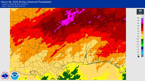
The “Winter” was – on average – 1.84 degrees above normal and was -1.03″ drier than normal per month.
November
November featured more cold days than warm days. There were 17 days below average and 9 that were above average. On days that were cooler than average, the temperature was, on average, 9.4 degrees below normal. On “warmer” days, the temperature was 6.3 degrees above normal.
There were only 9 days with precipitation. And since only 0.86″ of rain fell for the month, that means of the days where it rain, the average total wasn’t even 0.10″ of rain! On any day of precipitation, on average, only 0.096″ fell.
No wonder it was “bone dry” in November. Even when it did rain, there was barely enough to wet the soil.
December
December featured 20 days of above average temperatures and 10 days of below average temperatures. So warm out-paced cold 2-to-1. The warm days were, on average, 8.75 degrees above average while the cool days were, on average, 6 degrees below average.
There were 16 days of rainfall. So it rained, on average, every other day. And each day had, on average, 0.24″ of rain.
So, it may have “felt” wet, but it was actually drier than normal.
January
January featured more warm days than cold days – 19 vs. 9 – and the warmer days were also, on average, twice as warm than the cold days were cold. For this month, the average “warm” day was 9.1 degrees above normal, while the average “cool” day was only 4.3 degrees below normal.
There were 16 days that it rained in January. That means, on average, it rained every other day. And, on average, each day featured 0.43″ of rain.
That is why it felt wet, and was wet. Because, well, it was pretty wet.
February
Interesting to note that during this month, the days of “warmer” and “cooler” were about even, but the magnitude of the warmth outpaced the cool by about 2-to-1. The average “warm” day was 11.8 degrees above average, while the average “cool” day was only 5.7 degrees cooler than average.
While, for the month, the area received 4.55″ of rain, that fell over 15 days. So it rained, on average, every other day. But on any one particular day of precipitation, the average rainfall was about 0.30″
That is how it “felt” wet, but actually came out to be drier.
In summation
Pretty incredible to see that this winter was “drier than average” when looking at the data, given how wet it felt. Even I was surprised! And I look at this stuff every day!
Temperatures ran above normal, likely, because the storm track kept the area in the warm-sector of the areas of low pressure as they passed. The 2-to-1 ratio of warm days to cool days was pretty surprising, too.
The coldest day? November 13th, the overnight low was 23 degrees.
The warmest day? A tie between November 7th and December 16th, when the area got up to 79 degrees.
Today’s Severe Risk

Today’s Tornado Risk


