So far, all’s quiet on the southern front. With the stationary front moving towards the Gulf of Mexico for the next few days, we will experience quite drier air for the next few days as dewpoints dip into the upper 50s and low 60s until midweek. The influence of northwestern wind at the upper levels will also hinder much of the rain chances for the next few days as well. AT the surface, north to northeast winds will be prevalent.
Today, highs will top out around 90 and begin to dry out with clouds moving out by the afternoon. Overall conditions will be much better than yesterday and fairly pleasant for a mid-summer day. Monday and Tuesday will both start to warm up into the low to mid 90s with heat indices reaching up to 100 in some areas.
Turning Wednesday, we’ll be back to our more southerly influence in the winds at the surface. Heat indices will begin to climb to the high 90s and low 100s. Rain chances will also increase from the sea breeze and we’ll see a few isolated and scattered showers possible in the afternoon. More scattered showers will be prevalent during the weekend since the Bermuda high will be present in the Gulf and heat indices will be in the 100s.
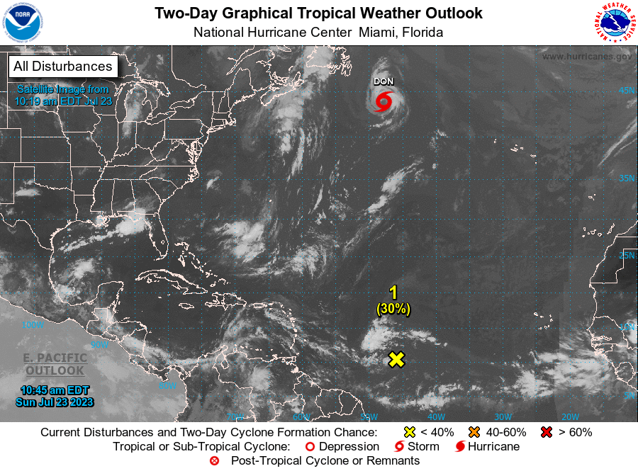
So far the Tropics have been quiet, but some waves have tried to develop off the western African coast. AL96 has formed but is still disorganized. So far, the National Hurricane Center says this has a low chance of development, and looking at the upper levels, they seem to be working against it, which means that the chances of it becoming more than a disturbance seem low going into the midweek. For now, we wait and see.
[wpcode id=”41179″]
Regional Day-to-Day Forecast
Today – Mostly sunny, with a high near 90. North wind around 5 mph.
Tonight – Mostly clear, with a low around 70. North wind around 5 mph becoming calm in the evening.
Monday – Sunny, with a high near 93. Calm wind becoming north northeast around 5 mph in the afternoon.
Monday Night – Patchy fog starting before sunrise. Otherwise, clear, with a low around 71. Southwest wind around 5 mph becoming calm.
Tuesday – Patchy fog after sunrise. Otherwise, sunny, with a high near 95. Calm wind becoming south southwest around 5 mph in the afternoon.
Tuesday Night – Mostly clear, with a low around 73. Southwest wind around 5 mph becoming calm in the evening.
Wednesday – A 20 percent chance of showers and thunderstorms in the early afternoon. Sunny, with a high near 95. Calm wind becoming south southeast around 5 mph.
Wednesday Night – Mostly clear, with a low around 73. South southeast wind around 5 mph becoming calm.
Thursday – A 30 percent chance of showers and thunderstorms in the early afternoon. Sunny, with a high near 95. Calm wind becoming south southeast around 5 mph in the afternoon.
Thursday Night – Mostly clear, with a low around 73.
Friday – A 20 percent chance of showers and thunderstorms. Sunny, with a high near 94.
Friday Night – Partly cloudy, with a low around 73.
Saturday – A 20 percent chance of showers and thunderstorms. Sunny, with a high near 96.
[wpcode id=”41149″]


