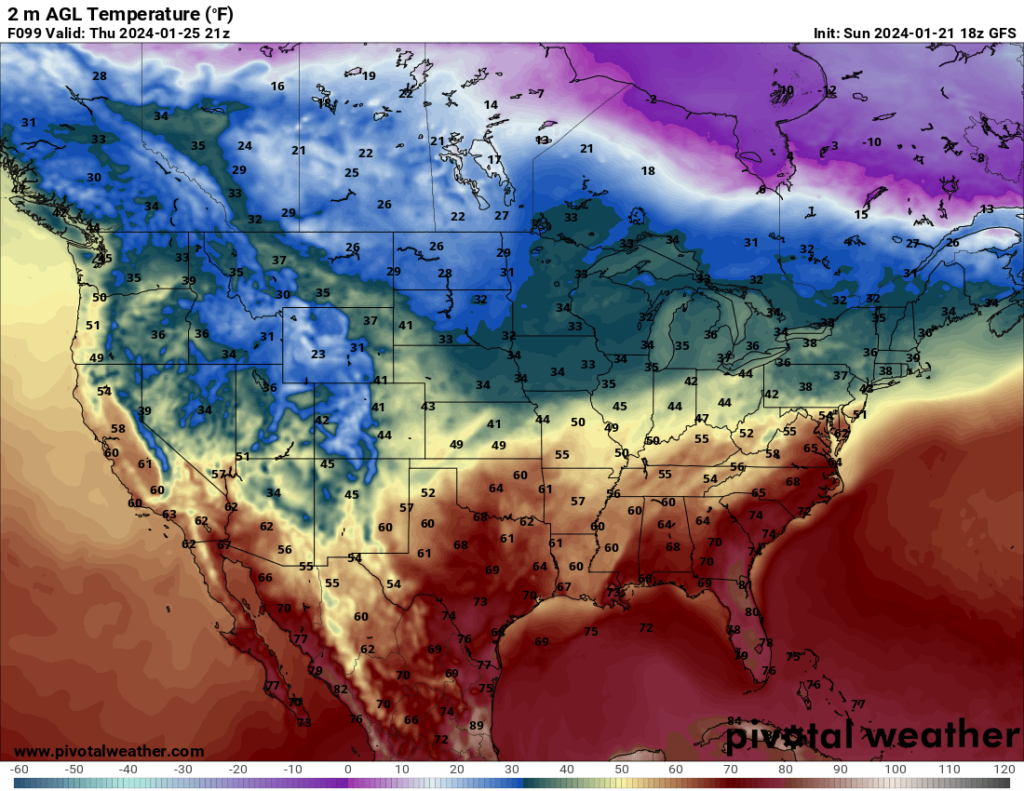
After a nasty cold spell last week, temperatures will warm up again. While not everywhere will experience pleasant temperatures, they will be much more bearable than what we had last week.
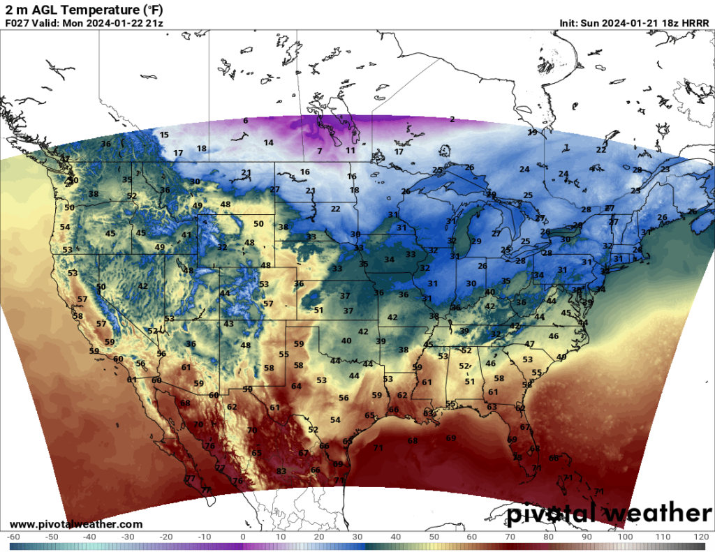
The upper level pattern will more or less hold consistent for the first half of the week, with ridging in the east and troughing in the west. This will result in mild temperatures in the Southeast and cool to cold temperatures in the western states.
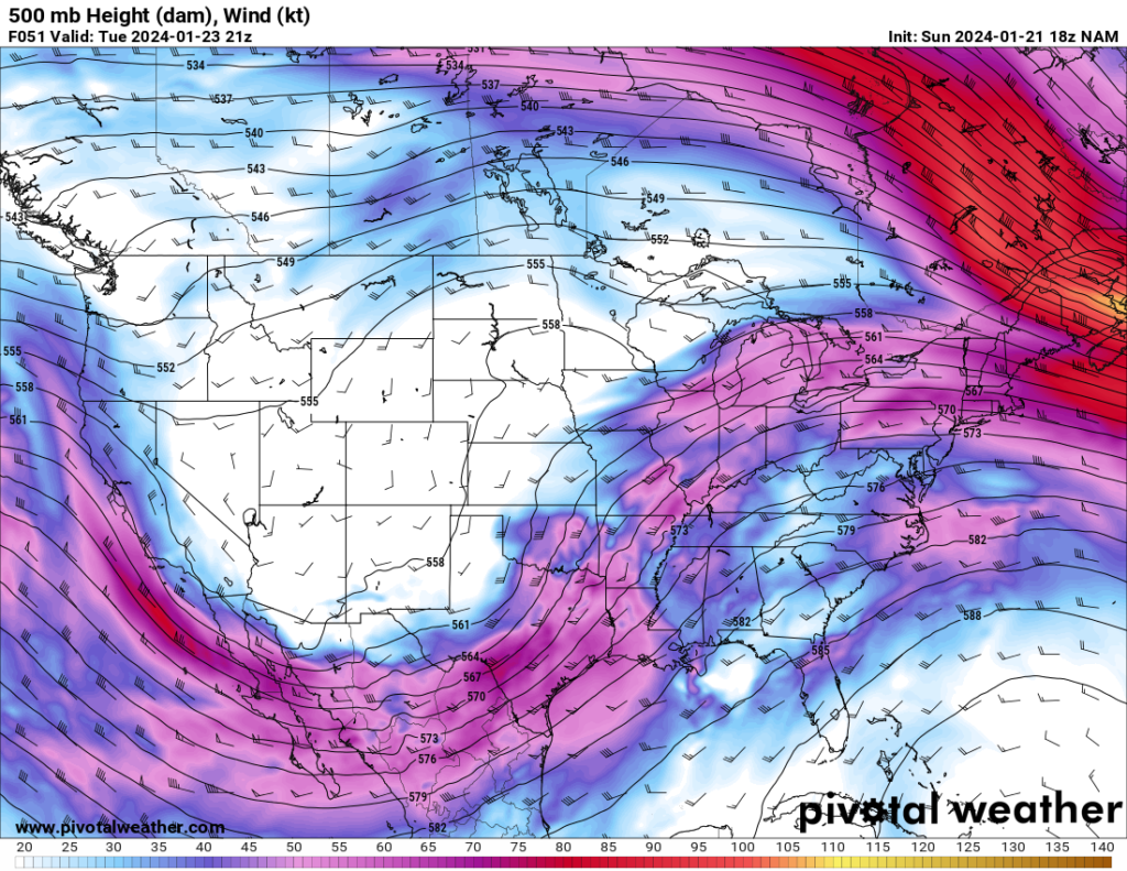
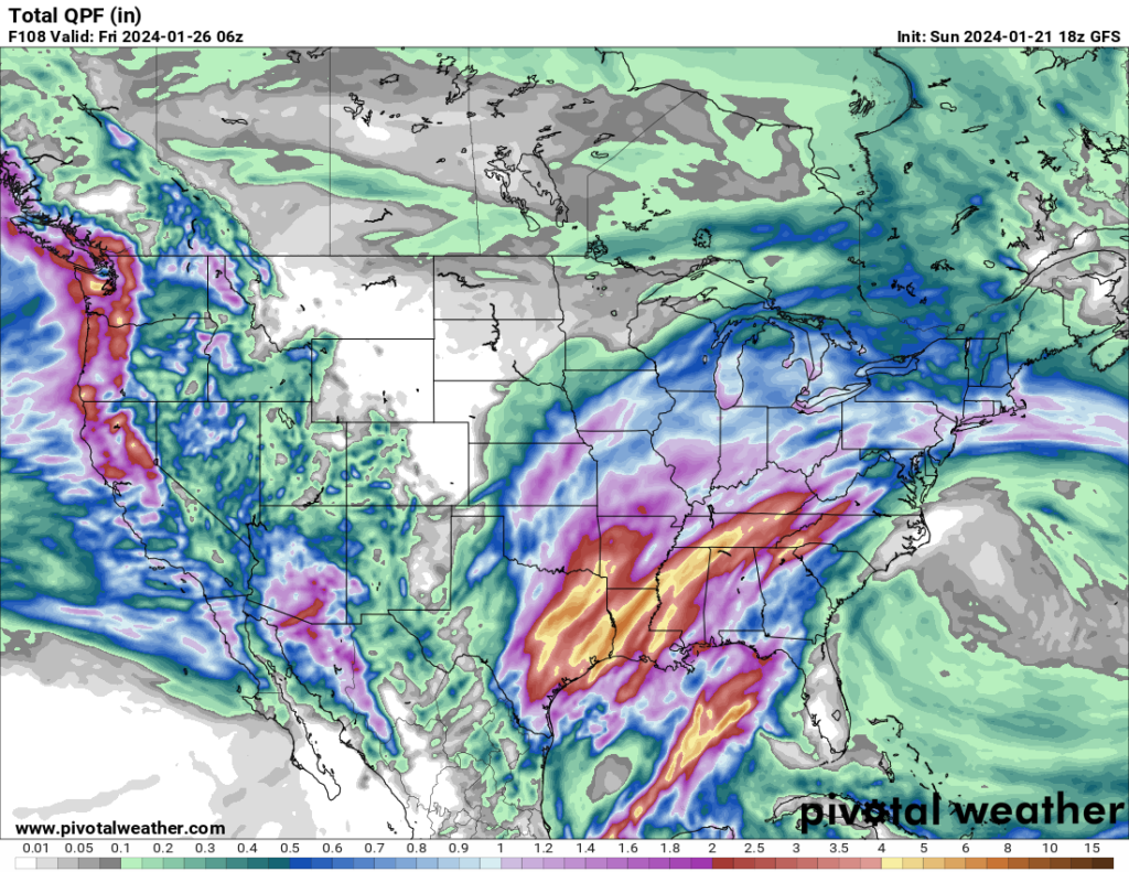
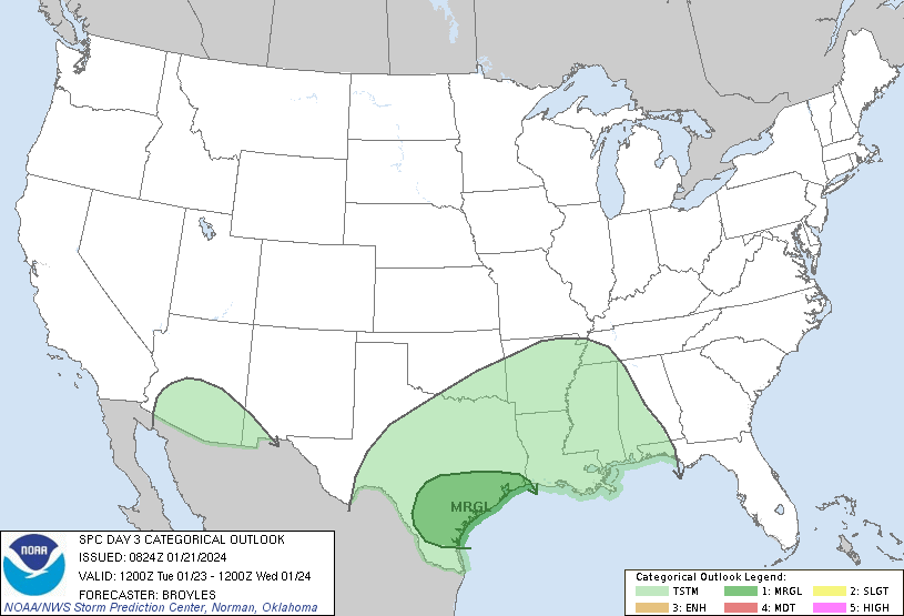
Because the upper level pattern and associated cold front are basically stalled for the first half of the week, persistent heavy rain can be expected in some parts of the South ahead of the cold front. Some areas will likely see flooding. I wouldn’t rule out a severe threat during the week either, but there’s still uncertainty regarding which areas will receive the best instability, so the SPC isn’t issuing any specific risk areas aside from a Marginal Risk in Southeast Texas on Tuesday, with wind and hail being the main concerns at this point.