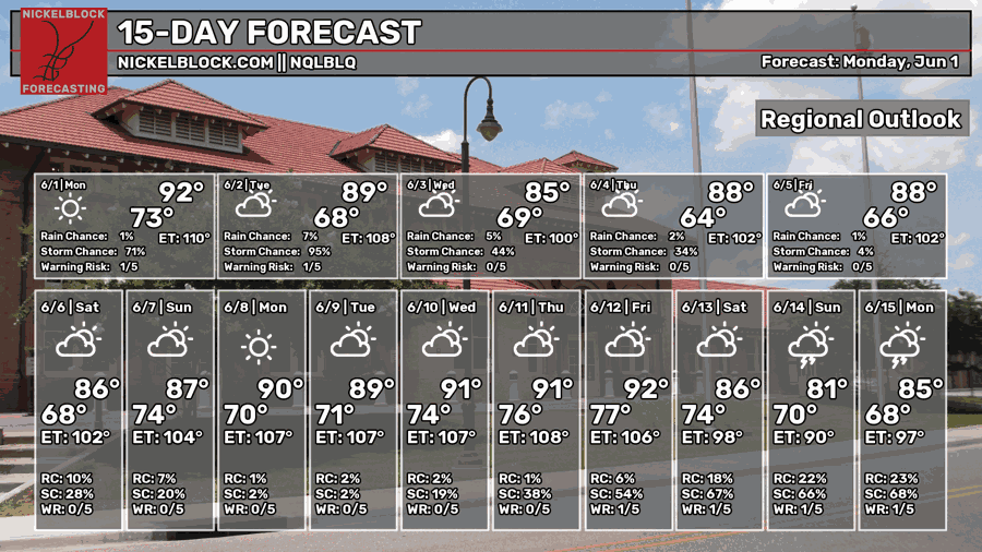
We made it almost six months out without it feeling like Summer, but we’re very close! The weather pattern is shifting towards a full ridge over the southern US which means we’re gearing towards our standard hot day and daily thunderstorm pattern. Early this week, we’ll deal with an incoming MCS from the mid-South before we deal with drier weather in the mid-week.

Today’s Setup
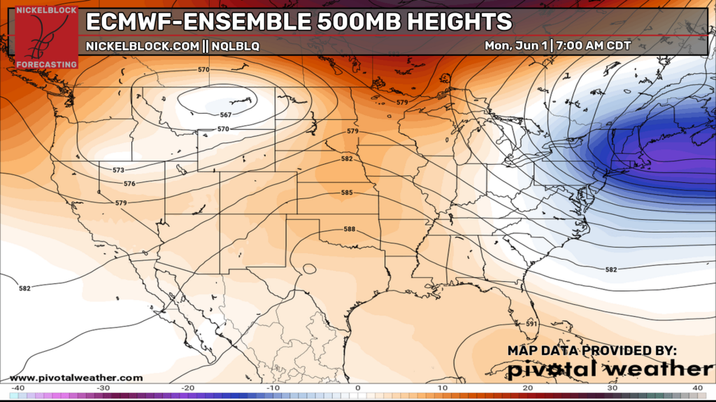
Looking at the 500mb map above, it looks like we’re in a ridging pattern just over Texas while the northern Rockies have a trough trapped between it and a ridge in Canada. The surface has a slightly different idea though.
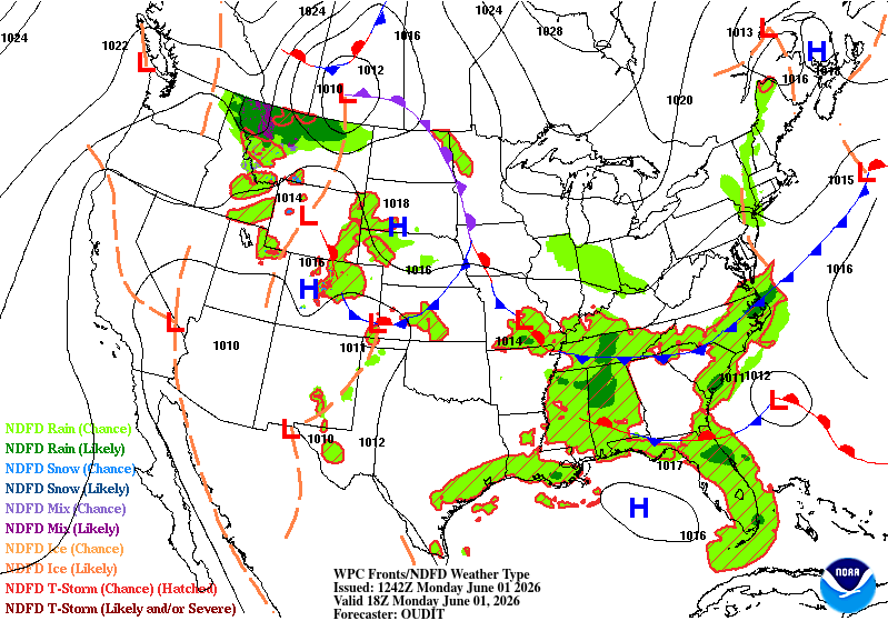
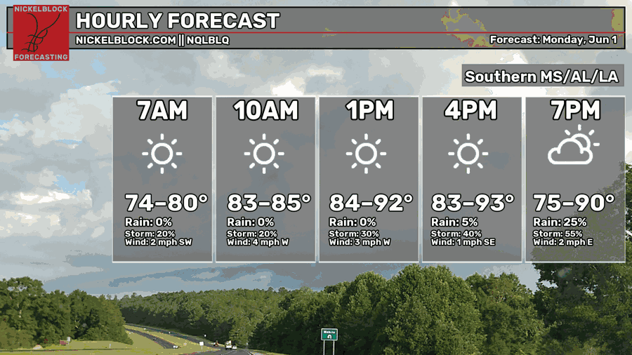
At the surface, a slow moving cold front is moving southward. It won’t make it here for a couple of days, but it will send an MCS (organized cluster of storms) our way overnight tonight. So far, the HRRR model shows a few developing storms moving in from the Gulf first (early evening) and the MCS moves southward. The MCS also looks to fall apart as it moves in, however northern MS may see severe weather with high winds and lightning possible. A few of those storms may develop into severe storms as they move southward, however they lose steam by the time they reach the Pine Belt.
Otherwise, it’s going to be a hot and humid day ahead of us. Temperature will reach the upper 80s-low 90s with mostly sunny skies. A few afternoon showers are possible, but otherwise it’ll just be another hot one. Overnight, expect the storms to move in so you might wake up to some thunder. Lows in the low 70s.

Tomorrow

As we start off another humid morning, the remnants from the MCS will linger leaving us partly cloudy during the day. The sea breeze will kick in bringing a line of thunderstorms towards the coastal parts of MS/AL/LA. A few could make their way up towards the Pine Belt, but the northern wind may limit that. Another hot and humid day is upon us with highs around 90 and lows in the low 70s.
Wednesday
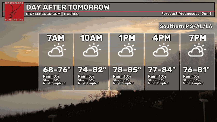
A few sea breeze thunderstorms are possible on Wednesday that may move into the Pine Belt by the mid-afternoon. We’ll be under partly cloudy skies with a slightly cooler day ahead thanks to the incoming cold front. Highs in the mid 80s and lows in the mid 60s, so it’ll feel less muggy at night!
The End of the Week
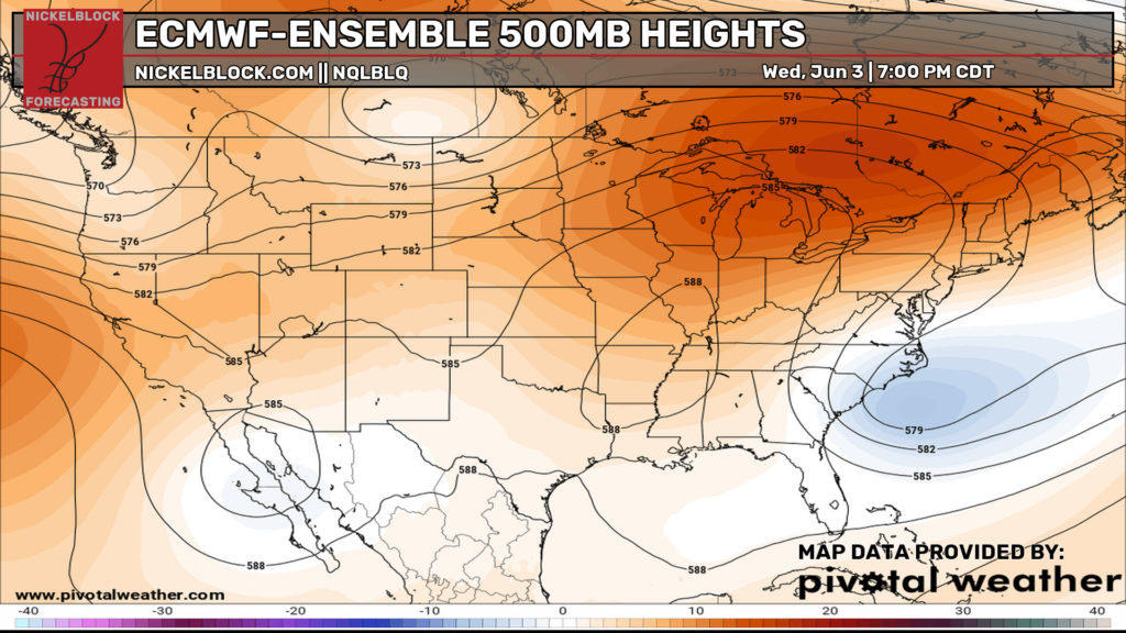
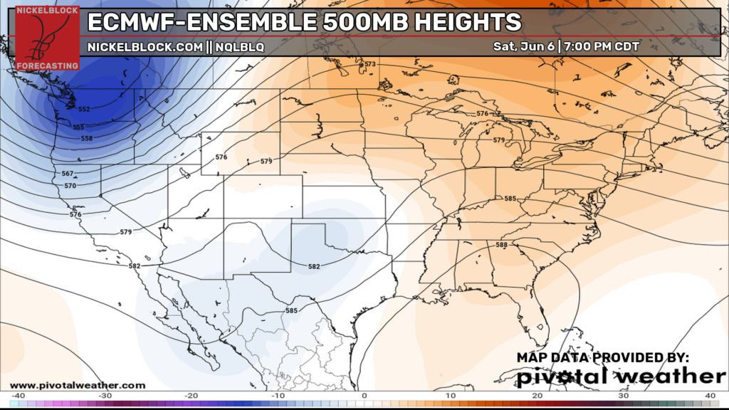
Looking at the 500mb maps (above) from Wednesday to Saturday, there’s a significant change in pattern with the upper atmosphere. Like Nick mentioned yesterday, there’s an anomalous trough in Baja California that will eventually eject towards the southwestern US and later the Great Lakes, leaving us with a ridging pattern. The ridging pattern will shift from a midwestern ridge (left from the cold front) to a Gulf ridge, which means we’re officially in the Summer pattern.
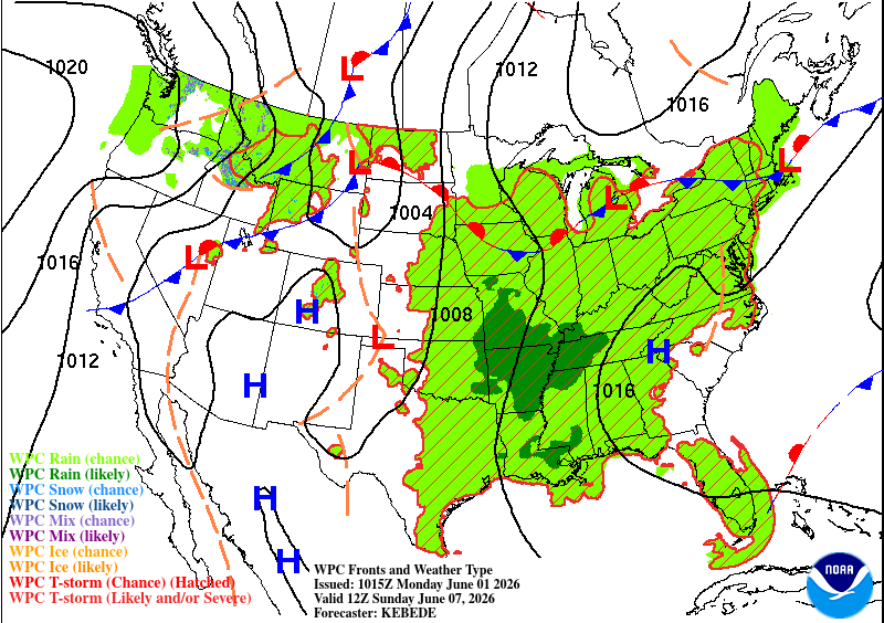
To end off the week, we’ll have a few days of slightly cooler weather thanks to the outgoing front. Temperatures will average in the mid 80s with lows in the mid to upper 60s indicating drier conditions and lower dewpoints. By the weekend, a few showers and thunderstorms are likely both Saturday and Sunday afternoon. While temperatures will be cooler, this will also be thanks to the higher rain chance. Afterwards, we’ll be in a more general summer pattern with afternoon thunderstorms and hot days, so be prepared! We’ll be in full summer mode which means sunscreen, water, and shade if you’re outside.

Tropical Outlook
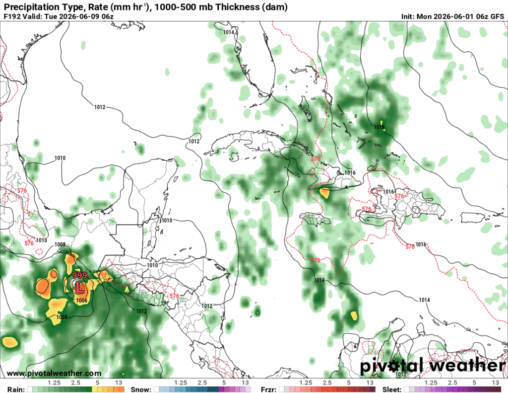
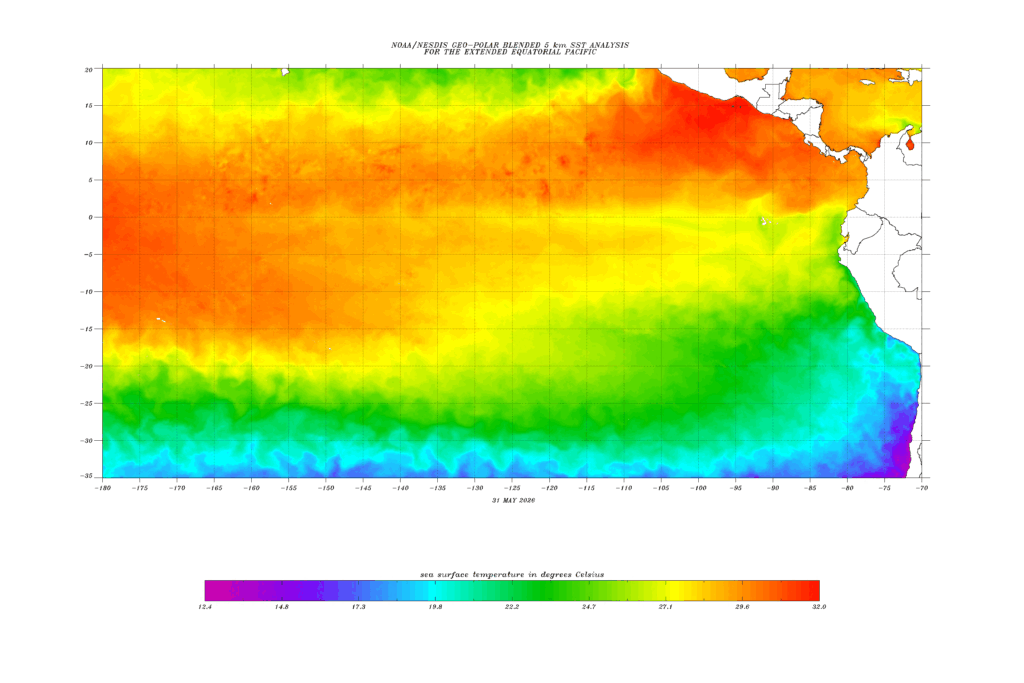
Hey, it’s in the title, so roll credits! The good news is that there’s nothing on the Atlantic or Pacific front currently. The bad news? Well, the European and GFS models are picking up on a possible tropical development in the eastern Pacific near El Salvador and Guatemala by next week. Any areas around there should be aware as it begins to gain strength. Considering the already very warm waters thanks to the strong El Nino conditions, I feel like more may develop during the Summer.
15 Day Outlook