

Scattered Thunderstorms and Intense Winds to the Northwest
Looking at the continental surface map above, we can see that cold front stretching from Oklahoma into Georgia stalling further into the Central Southeast. While this front struggles to move south, the enhanced vorticity will lead to scattered thunderstorms across the northern half of our forecast area with the greatest risk of severe weather across Northern and Central Alabama today. Louisiana and Southern Mississippi will be looking much drier as upper-level ridging begins to build over our area for hot and sunny days to come.
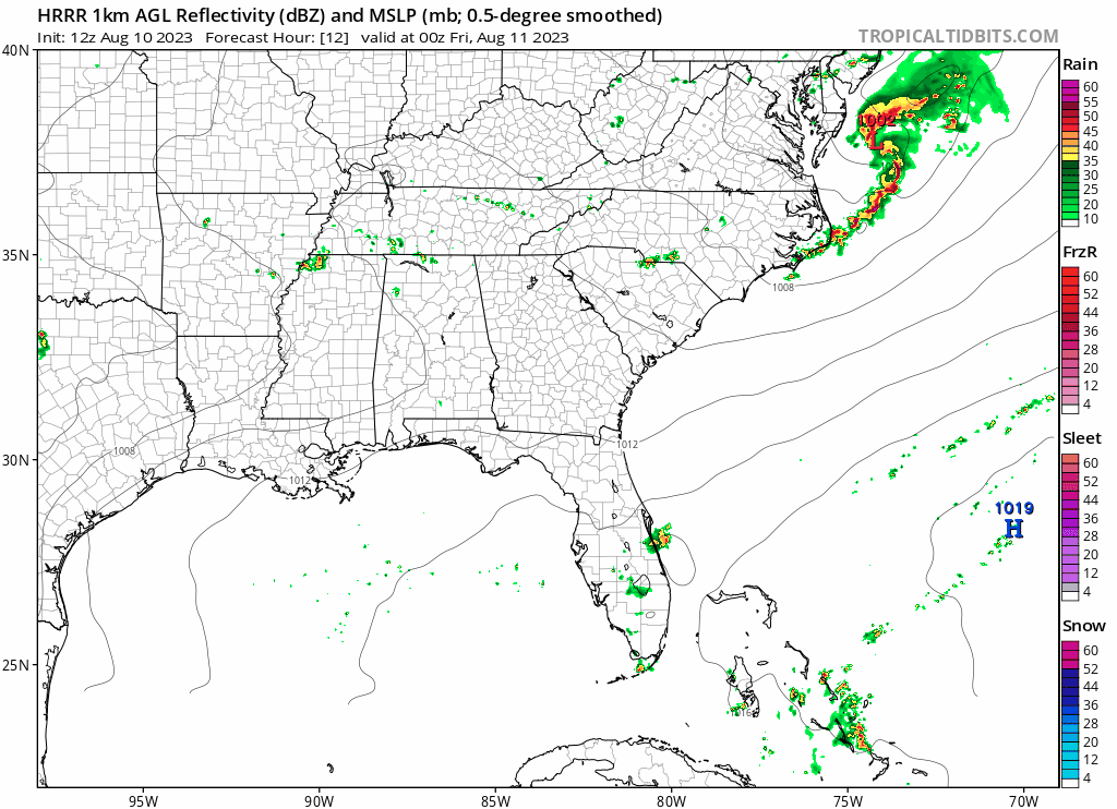
The main system of storms will begin developing early in the morning as it moves southeast across Northwest Mississippi and Alabama. Outflow boundaries from these storms will continue to instigate storms throughout the southern half of Alabama heading into the evening hours.
Summer Heat Lingering Around This Weekend
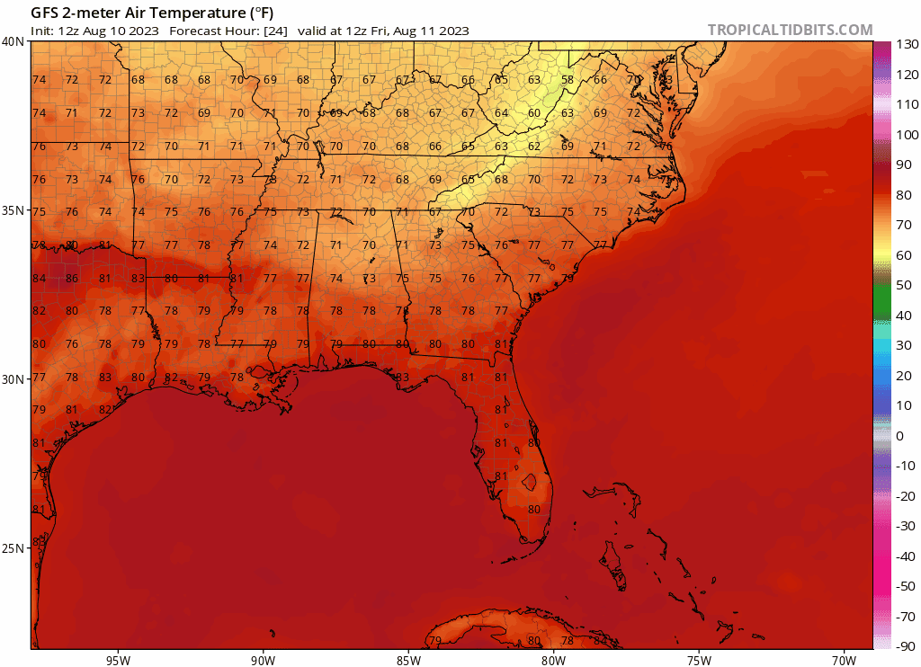
Extremely dangerous temperatures will continue to dominate the local area with the highest heats being felt in Louisiana where temperatures are nearing 105. The rest of Southern Mississippi and Southern Alabama will also have high temperatures well over 100 degrees throughout the weekend. There is a pocket of cooler air pushing into Northern Alabama as a small upper-level trough propagates east. Overall, this heat index will be pushing 110 to 115 degrees in most parts of the Southeast as this heat will continue to linger for the weekend.
Extended Outlook
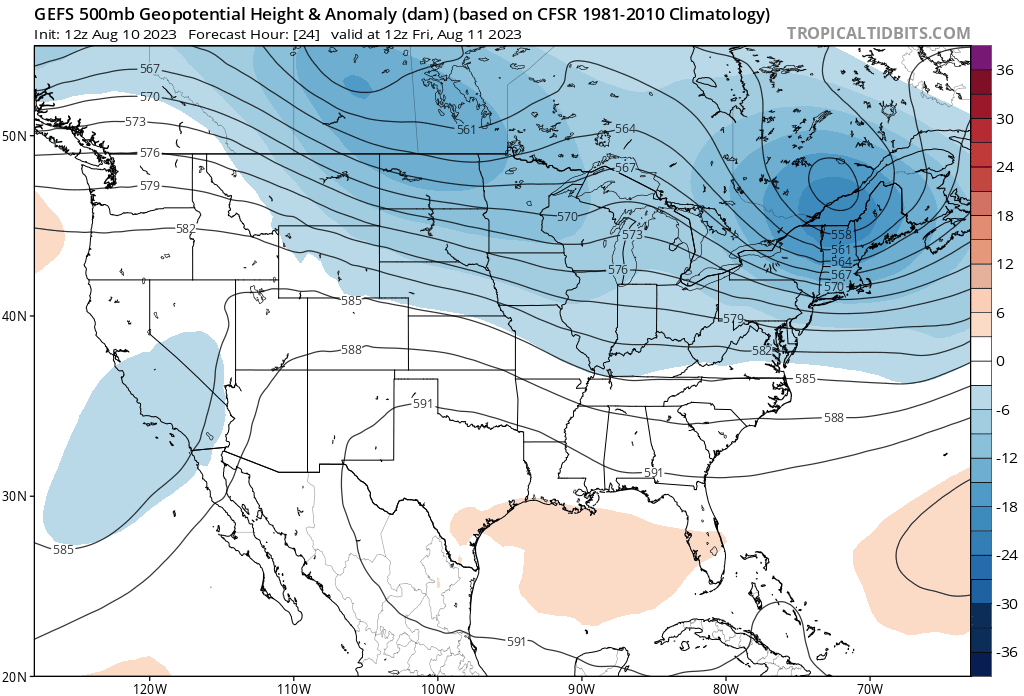
As this upcoming week progresses, upper-level ridging centered over the Southeast will move back west, relieving some of the most extreme heat from this weekend. But more interestingly is the extended temperature outlook for 11-15 days out. Among the models, there is strong agreement of intense heat invading the Midwest with no relief anywhere across the US. This is linked to the extremely amplified ridge that will be likely in around two weeks. There will be escaping this heat anywhere so be prepared this August.


Regional Day-To-Day Forecast
Today: Sunny. 40% Chance of showers and thunderstorms in the afternoon. High temperatures in the upper 90s to low 100s. West winds around 5 mph.
Tonight: Mostly clear. Low temperatures in the upper 70s.West winds around 5 mph getting lighter.
Saturday: Mostly sunny. 30% Chance of showers and thunderstorms in the afternoon. High temperatures in the upper 90s to low 100s. Southwest winds around 5 mph.
Saturday Night: Partly cloudy. Low temperatures in the upper 70s. South winds around 5 mph.
Sunday: Sunny. 30% Chance of showers and thunderstorms in the afternoon. High temperatures in the upper 90s to low 100s. West winds around 5 mph.
Sunday Night: Partly cloudy. Low temperatures in the upper 70s. Southwest winds at 5 to 10 mph.
Monday: Mostly sunny. 30% Chance of showers and thunderstorms. High temperatures in the upper 90s to low 100s. Winds west at 5 to 10 mph.
Monday Night: Partly cloudy. 20% Chance of showers and thunderstorms. Low temperatures in the upper 70s. South winds at 5 to 10 mph.
Tuesday: Sunny. 30% Chance of showers and thunderstorms. High temperatures in the upper 90s to low 100s. West winds at 5 to 10 mph.
Tuesday Night: Partly cloudy. 30% Chance of showers and thunderstorms. Low temperatures in the upper 70s. West winds 5 to 10 mph.
Wednesday: Sunny. 30% Chance of showers and thunderstorms. High temperatures in the upper 90s to low 100s. South winds around 5 to 10 mph.


