Oh boy.
There are a couple of things I will – purposefully – under-forecast in South Mississippi:
1. Snowfall totals
2. Wintertime overnight temperatures when there is any wind
3. First cool down in September
In general, I won’t forecast these things more than 5 days out. And If I do, it’ll only happen when the confidence is pretty high. And even then, like I said, I under-forecast it. Meaning I won’t go as high, or low, as the computer models suggest.
So when the GEFS, Euro, GFS, and CIPS Analogs all pointed at a marked cool down around the first of October, I felt pretty good about jumping on board. The computer model guidance even pointed toward temperatures in the 70s for HIGHS! Holy moly!
Take a look…
Everyone agrees, they missed it
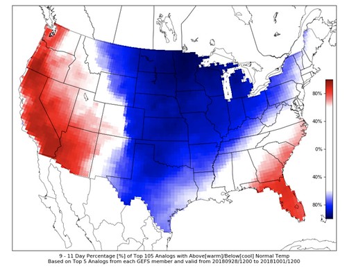
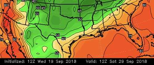
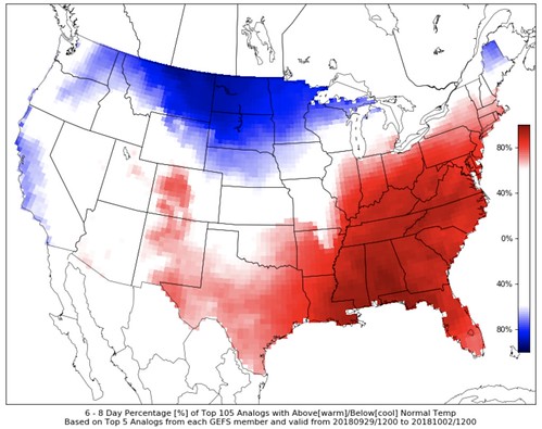
Here are some snapshots taken from the CIPS (uses the GEFS), the Euro and the GFS computer weather models:
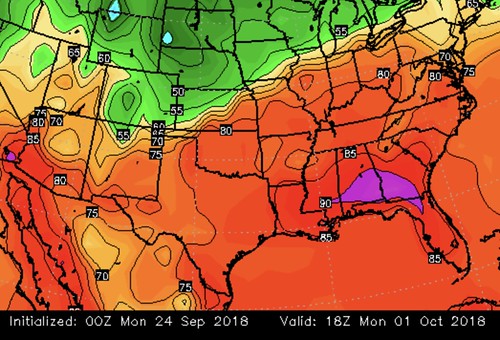
The CIPS Analogs:
The Euro:
The GFS:
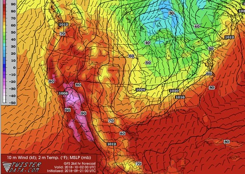
At this point, I’m not saying it is a slam dunk that we are going to get a BIG cold front, but when all three of these things tell meteorologists the same thing, 99 times out of 100 the outcome is going to be pretty close to what was forecast. So, in the forecast, instead of highs in the 70s, we went with highs in the low to mid 80s.
Welp, welcome to that one time out of 100 when the models pull a full 180.
I downloaded a bunch of graphics, and I have this great explanation as to what – I think – happened to get the models to show a big cold front slamming across the United States. But, that is going to take way too long for a Monday morning, and I doubt many of you care.
For reference, here are those graphics:
Instead, I’ll cut to the chase.
The models missed it. We trusted the model consensus. We got hosed.
So what is the forecast now?
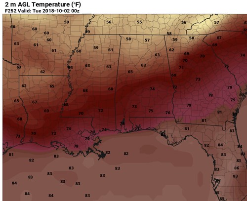
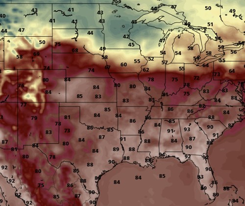
Not as cool. Both literally and figuratively. Here are the same models shown above, showing the same time frame. With much warmer model guidance data.
With the cold front stuck way to the north.
As noted by the Euro:
The CIPS Analogs:
And the GFS:
So, like, when does fall get here?
I guess I’ll go back to my original thought of, “Some time around October 13th.”
At least, that is what I told Karrie back in August.


