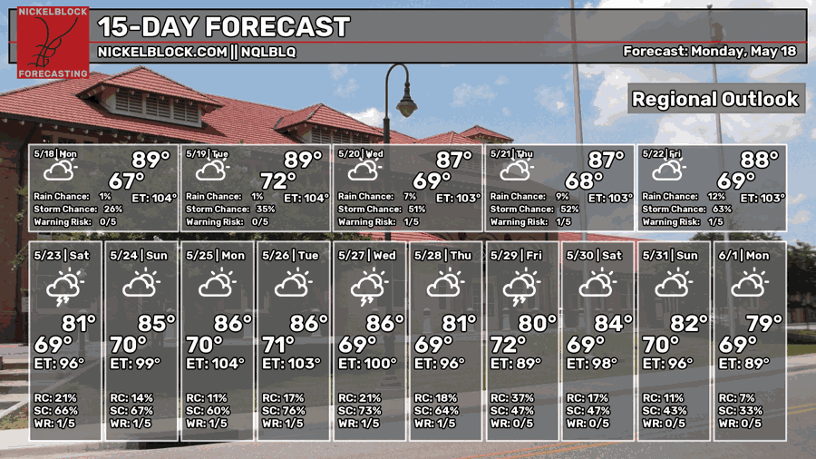
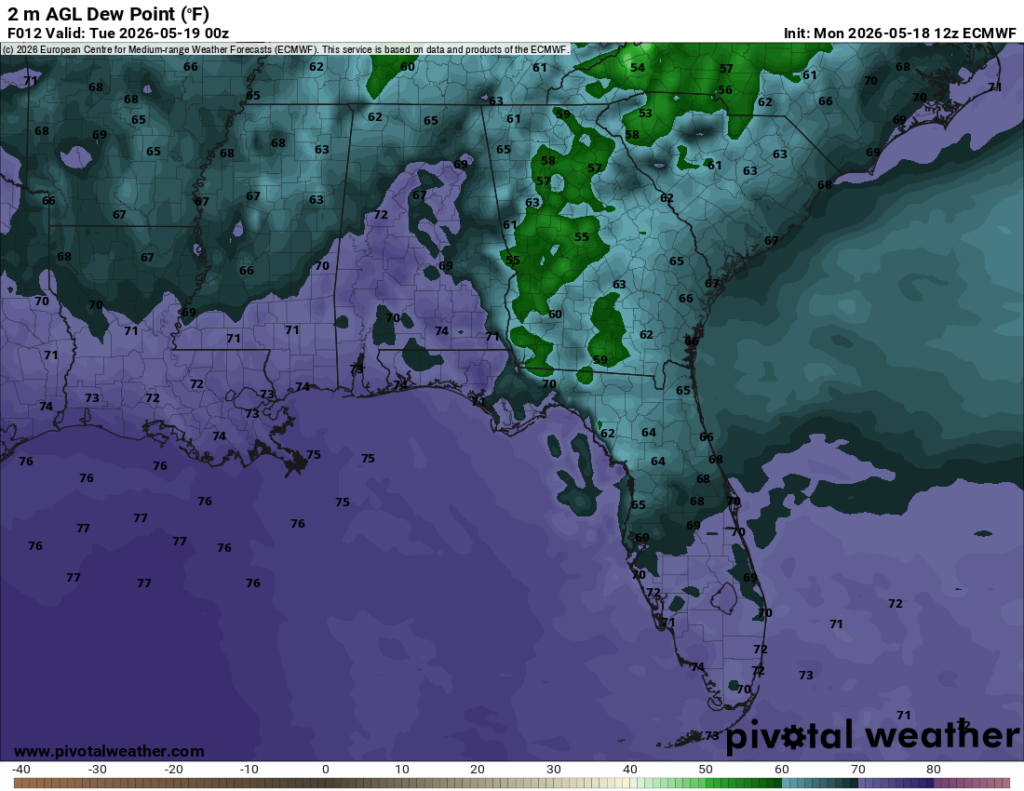
We’re not in the normal Summer pattern just yet, but it feels pretty darn warm and humid! A lot of east and southerly flow is contributing to the humidity and the dewpoints are only going to go up during the week. Not only that, but the rain will also move in with an incoming and stalling front.

Today
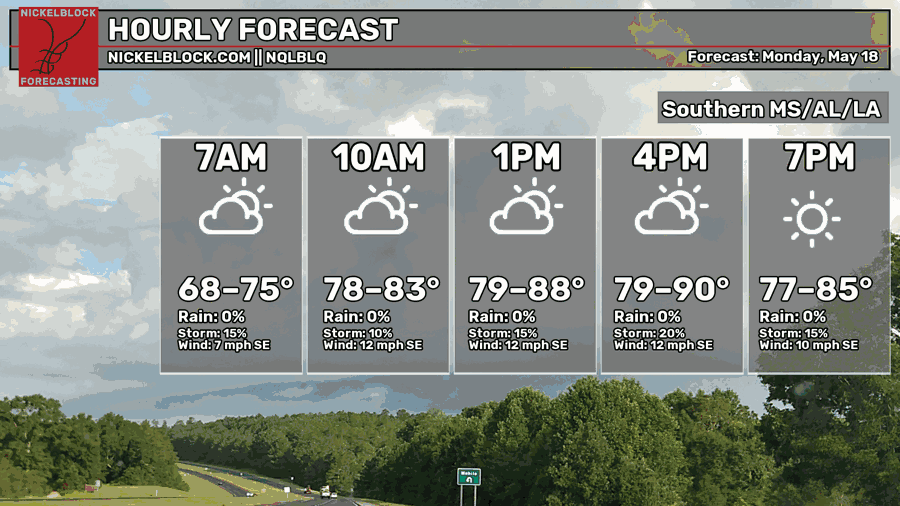
It’s been a very humid day already and the wind has been the only relief. Highs are topping out to 90 in some areas, so it definitely feels like Summer already. More clouds will move in until tonight, but the dewpoint will increase into the 70s keeping things pretty muggy. Lows will fall into the low 70s.

Tomorrow
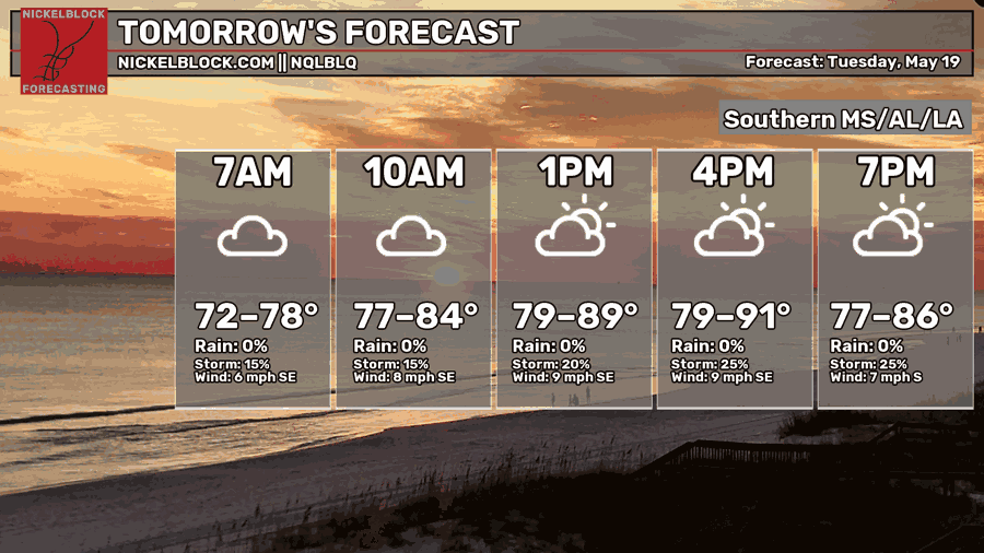
It’ll be another warm and humid day tomorrow with more clouds rolling in. Highs will top out to around 90 especially further inland. The rain will move in further west with a few storms on the Louisiana/Mississippi border and near the southern Delta. Overnight, another muggy one is expected as temperatures fall into the low 70s.
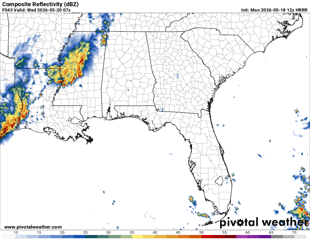
Wednesday
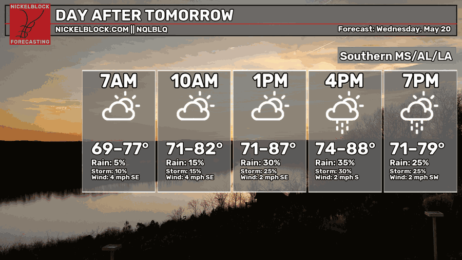
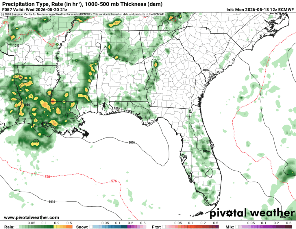
A line of showers and thunderstorms will move in Wednesday afternoon. Most of these are scattered but will provide a bit of relief from the humidity. None of these are expected to be severe, but we could see some lightning and locally heavy rainfall. Otherwise, it’s going to be another warm humid day with some areas reaching the upper 80s for the high and low 70s for the low.
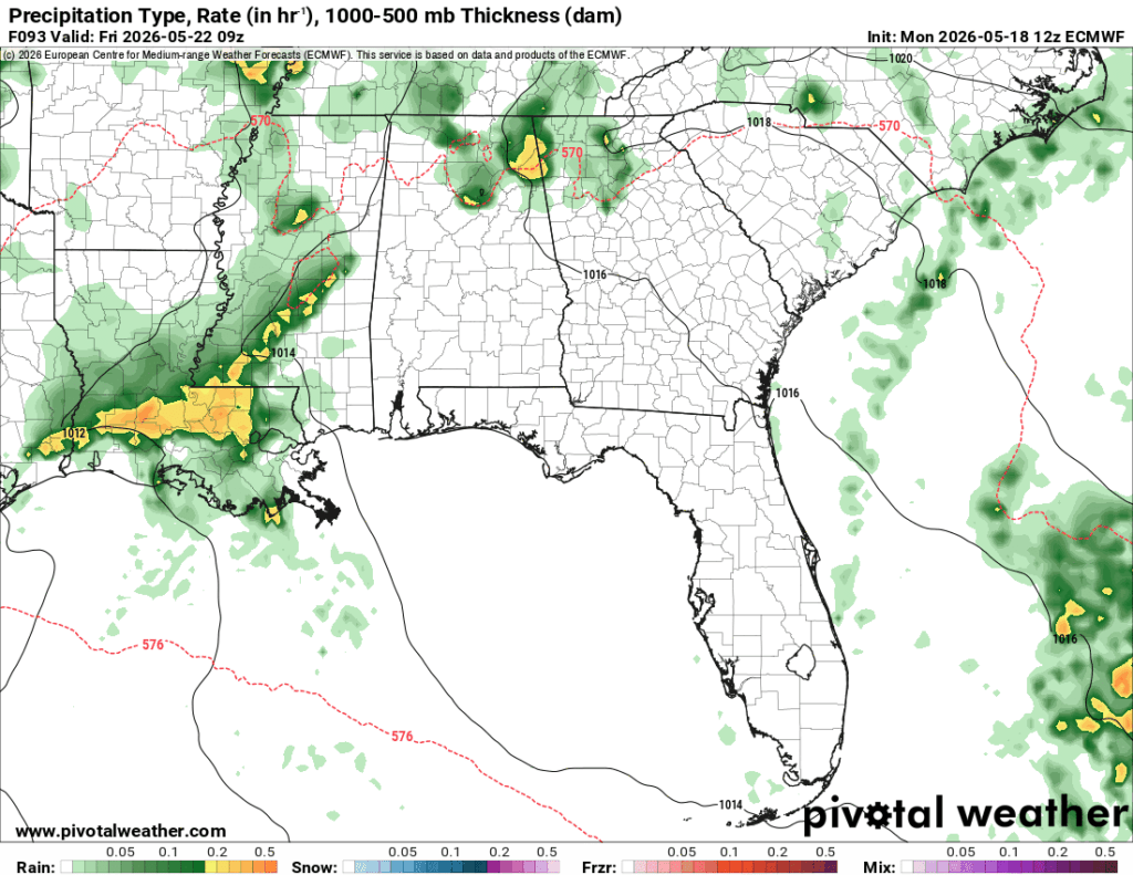
End of the Week
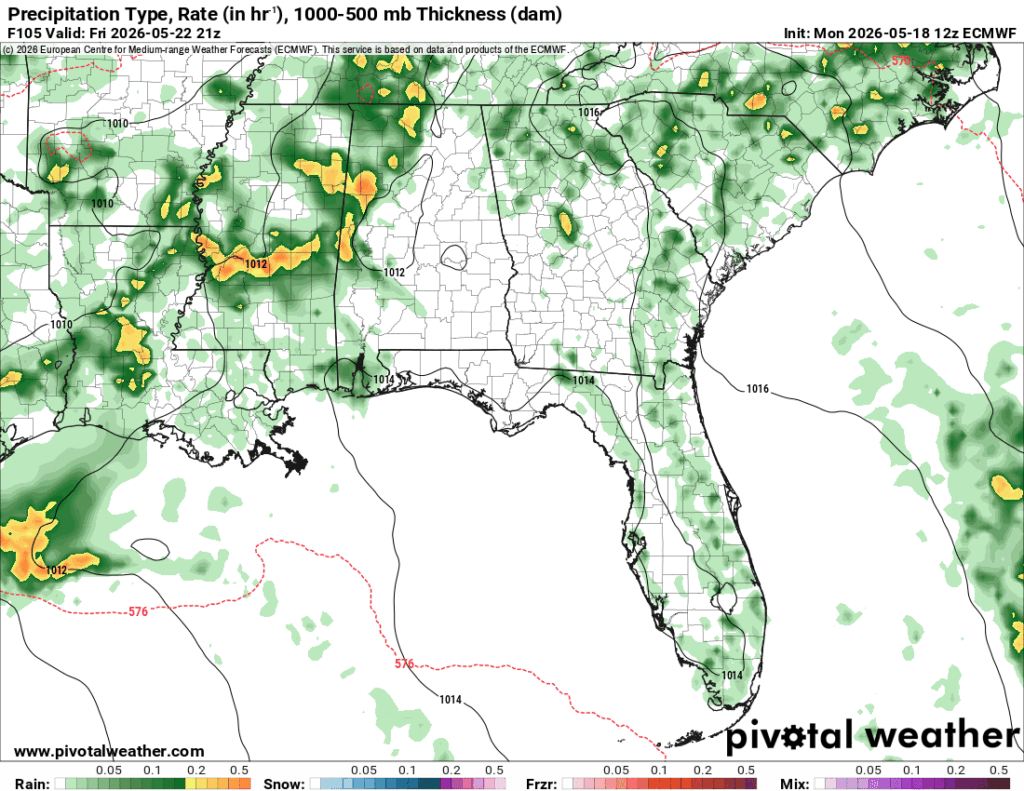
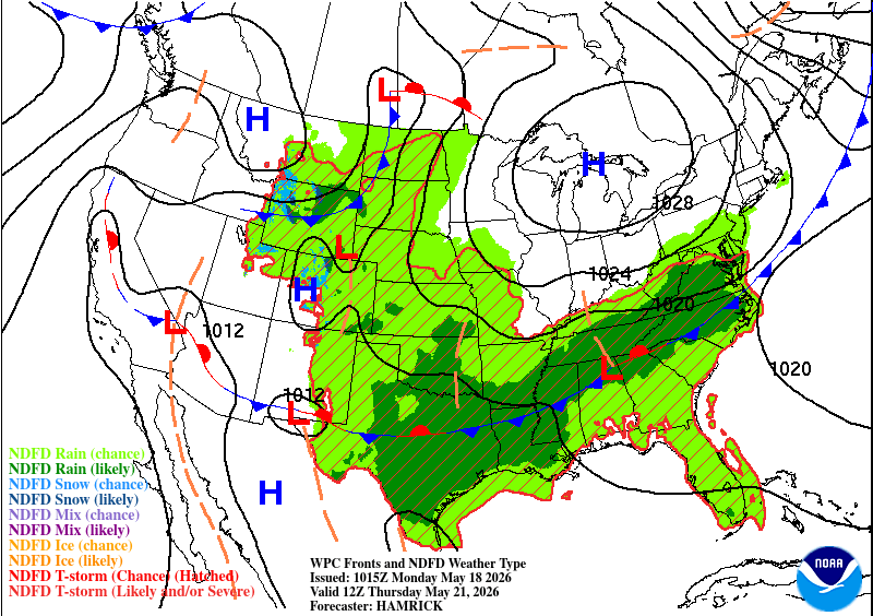
The stationary front is stalled out between two large high pressure systems and one is pushing it further north: the Atlantic High. Thursday’s rain chances are moving in from the northwest while Friday’s have a little less “umph” but the same effects. Some strong to severe storms are possible both days, but mainly relegated to a few storms under the right conditions. Strong winds, lightning, and hail are possible with a pretty low tornado threat. Temperatures will range in the mid to upper 80s and lows will fall into the upper 60s. Be wary too, with the humidity comes a higher heat index, so if you’re outside, bring plenty of water and electrolytes with you!

Extended Forecast
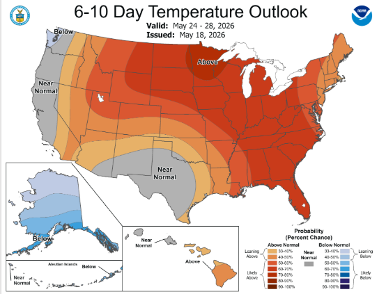
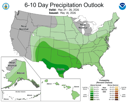
Looking at the Climate Prediction Center’s forecast, we can see that there’s a distinct line where the rain will be and where the temperatures average out in south/west Texas. A dry line will form in southwest Texas pushing moisture our way and the high pressure system will broaden in the Atlantic helping with more moisture flow.