Hurricane Dora is still spinning around in the central Pacific while we watch three other disturbances follow behind Dora. This pattern is likely to stay in the Pacific but in the Atlantic this quiet pattern remains. Let’s dive into the details!
[wpcode id=”41149″]
Dora and the Central Pacific
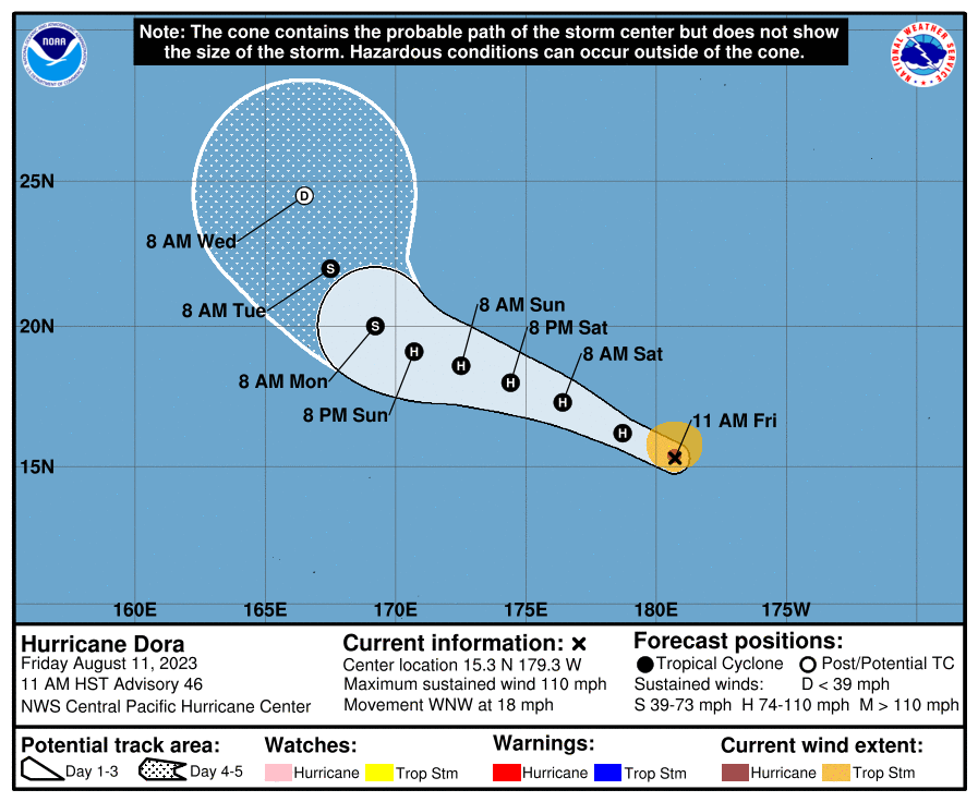
Hurricane Dora is still spinning around in the central Pacific. It is currently moving west northwest at 18 mph but will gradually start to slow down over the weekend. The storm still holds category 2 hurricane status but is likely to weaken over the next few days. This storm is going to fizzle out by the end of the week.
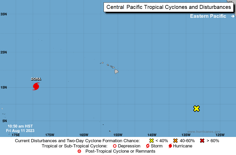
Following behind Dora is an area of low pressure with disorganized showers a few hundred miles southeast of Hawaii. It has a 40% chance of development in the next 2 days and a 60% chance of developing in the next week. This storm is unlikely to bring any storms to Hawaii and most likely will spin on a path similar to Dora.
[wpcode id=”41149″]
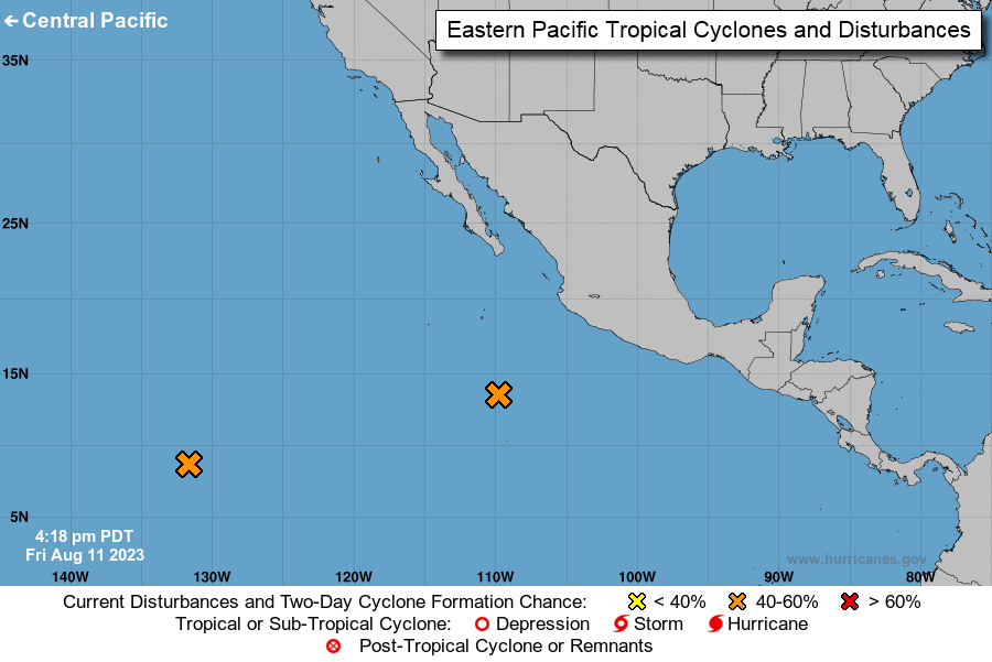
Eastern Pacific Disturbance
We are looking at another disturbance in the eastern Pacific. This disturbance is currently right off the southern coast of Mexico moving northwestward. This low pressure system of scattered showers is starting to become more defined. It has a 50% chance of development in the next 2 days and a 80% chance of development in the next week. Conditions are favorable which means this development may be strong.
[wpcode id=”41149″]
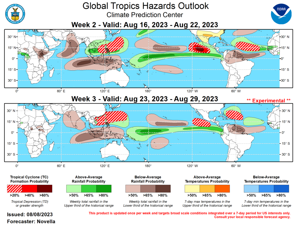
Extended Outlook
Looking ahead we see the eastern and central Pacific continue to produce tropical activity especially in the middle of the month. This pattern of warm, moist air will likely continue to the end of the month. As for the Atlantic, we see some action in the next two weeks along the coast of Africa and towards the Caribbean. The El Niño season has kept the area quiet but this may change soon. This will be something to watch out for as we head deeper into August.
[wpcode id=”41149″]
Conclusion
We see Dora starting to lose its strength as it continues to spin in the Pacific. Following closely behind three more disturbances in the Pacific to watch in the coming week. The Pacific will remain in favorable conditions for more tropical activity. The El Niño is keeping the Atlantic quiet for now. Be sure to keep updated on all the tropical activity!


