Hurricane Hilary is nearing landfall on the Baja California coast and is likely to bring damaging winds and heavy rain to the peninsula and southern California. The path of Hilary will be something to watch. Across to the Atlantic, we see some disturbances forming as conditions become more favorable in the basin. Let’s get into the details of everything to watch for in the tropics!
[wpcode id=”41149″]
Hurricane Hilary
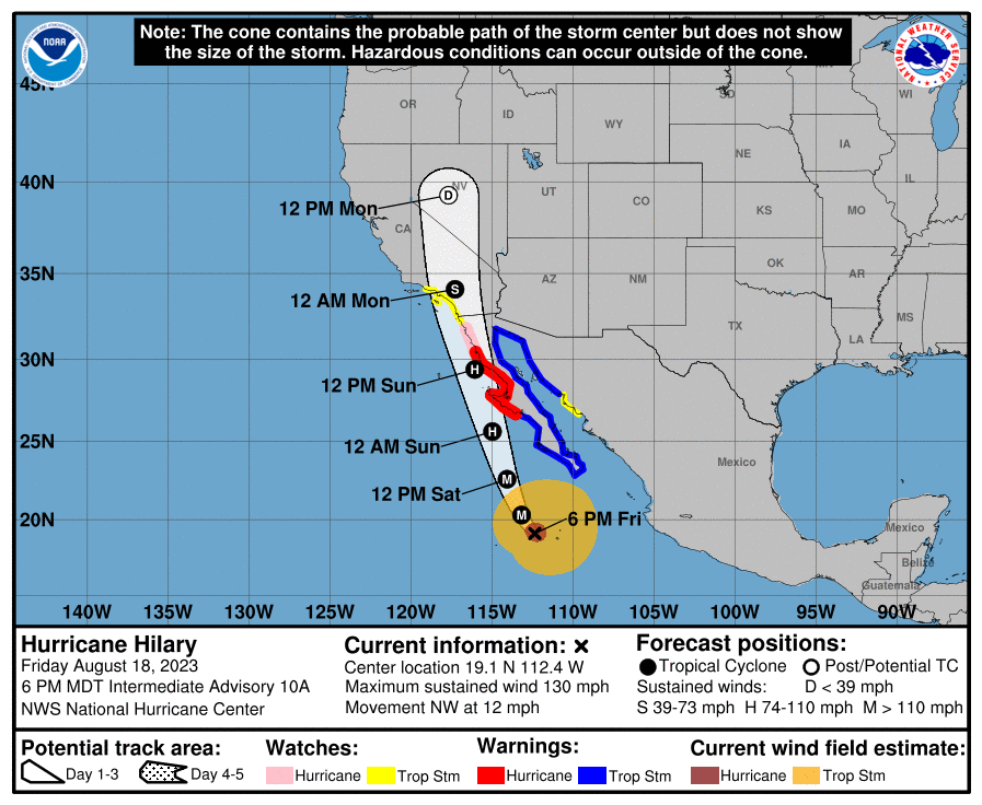

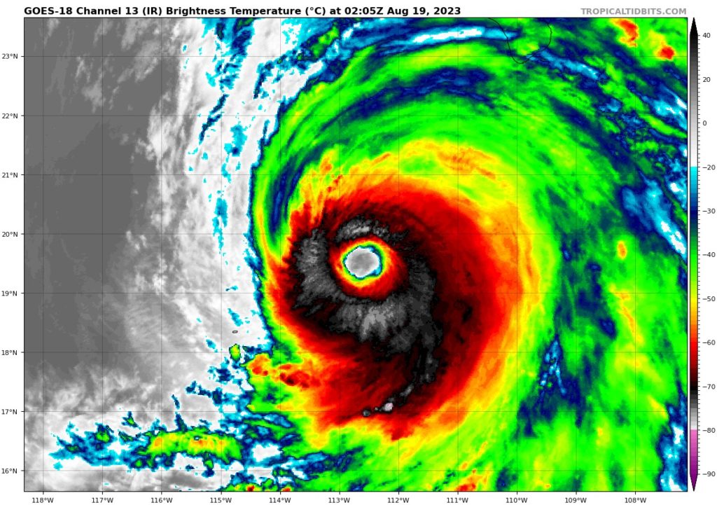
Hurricane Hilary is currently 285 miles off the southern tip of the Baja California coast moving north at around 13 mph. As a category 4 storm Hilary has a minimum low pressure of 948mb with maximum sustained winds of 130 mph. This has caused hurricane warnings for the western Baja coast, a hurricane watch for the northwestern part of the Baja coast, tropical storm warnings for the southern and eastern Baja coast and the northwestern mainland Mexican border, and tropical storm watches for more of mainland Mexico and souther California. Hilary is likely to hit the Baja peninsula Sunday night and make its way north early next week. Hilary will bring intense winds and heavy rainfall to much of the region and flooding and damage is likely to occur. This storm is very dangerous and if your lives near this area be sure to follow local guidelines and keep your self up to date.
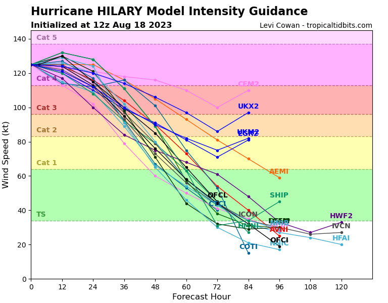
As Hilary travels into the US it will start to weaken as it peaks today in intensity. This is due to the less favorable conditions over land and as shear begins to increase. Hilary is likely to weaken into a tropical storm on Sunday as it moves into southern California. As the system moves north along the west coast of the US it will further weaken into a tropical depression as it continues northward. Hilary is likely to not last long and will lose all intensity mid week.
[wpcode id=”41149″]
Atlantic Wakes Up
The Atlantic finally starts to see some action as we watch 4 disturbances make their way across. The Caribbean is likely to see lots of rain with these disturbances as some of the later ones have a higher chance of being cyclonic developments. Some of these storms have potential to grow and become major systems. The Gulf of Mexico may see some storms within the next week or two as environmental conditions in the Atlantic start to become more favorable for cyclonic action.
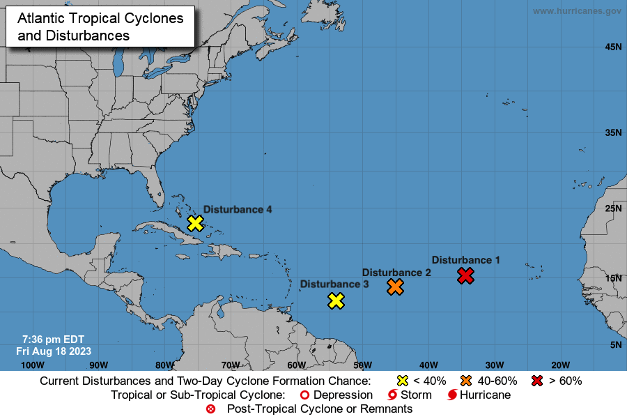
The closest disturbance to CONUS is disturbance 4 which is currently over the Bahamas is moving towards the Gulf of Mexico. This area of low pressure could form into a more organized system of showers and even up to a tropical depression. As of now it has a 0% chance of formation within the next 2 days and a 50% chance in the next 7 days. This system is likely to bring showers to the Mexican coastline and southeastern US.
Disturbance 3 is following a similar path to disturbance 4 and is currently sitting east-southeast of the Lesser Antilles. This area of low pressure is likely to form into a more developed storm system as it moves westward. It currently has a 10% chance of development in the next 2 days and a 30% chance of development in the next 7 days. This system is likely to bring rain and winds to the Caribbean islands.
Right behind disturbance 3 is disturbance 2 which is a low pressure system of showers and thunderstorms halfway between the Cabo Verde Islands and the Lesser Antilles. This system has the potential to develop into a tropical depression as it moves westward. There is a 40% chance of development within the next 2 days and 40% chance in the next 7 days. Disturbance 2 may be something to watch as it starts to strengthen.
Disturbance 1 is currently our one to watch for the soonest development. It is currently behind disturbance 2 a few hundred miles west of the Cabo Verde Islands and is moving west-northwest around 10 mph. This low pressure system has some organized showers and thunderstorms and is likely to become a tropical depression over the weekend. Right now disturbance 1 has a 70% chance of development in the next 2 days and a 70% chance in the next 7 days. As of now this system will be the one to watch for the greatest development over the next week.
[wpcode id=”41149″]
Extended Outlook
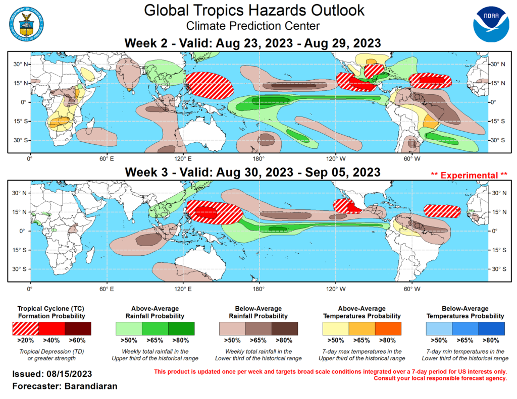
The Pacific will remain busy in the next 3 weeks as hurricane season is in full force. A lot of the developments will come off the southwestern coast of Mexico as conditions remain very favorable for cyclonic action. On the flip side the Atlantic starts to warm up as we approach the end of August. This time of year can produce major hurricanes in the Atlantic and we see that possibility happen especially in the Caribbean. Lots of tropical action is likely in both basins as August comes to a close soon.
[wpcode id=”41149″]
Conclusion
Hurricane Hilary is the biggest thing to lookout for this weekend and early next week as some major damage will occur in the Baja California peninsula and souther California. Hilary is likely to weaken as it makes landfall due to the vertical shear and less favorable conditions. As for the Atlantic we will start to see lots of cyclonic formations within the next week as the moisture starts to kick in the area. The end of August is known for producing some big storms in the basin so seeing a lot of disturbances could mean some major potential soon. A lot of things to watch in the tropics this weekend into next week as hurricane season kicks into high gear. Always be sure to check your local forecast especially if you are in the forecasted cone area for Hilary for warnings and advisories.


