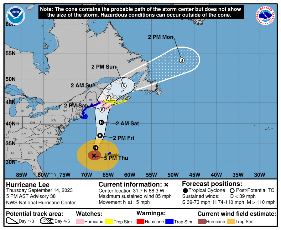
As we head into the weekend, the most pressing weather concern is Hurricane Lee. Hurricane Lee is currently forecast to make landfall sometime on Saturday. Current models indicate it is likely to make landfall in Nova Scotia or New Brunswick, Canada, but it may steer close enough to the US to also affect parts of coastal New England. One important thing to note here is that although the center of the hurricane will likely miss the US, the radius of strong winds tends to get fairly large when hurricanes get this far north, so you could be over 100 miles from the center and still feel tropical-storm-force winds. It is also possible that even though the storm may downgrade to tropical storm status when it makes landfall, it could still be hurricane strength as it approaches land, which may mean the strongest winds hit before it makes landfall. This is why the NHC has hurricane watches issued for parts of Nova Scotia, New Brunswick, and eastern Maine. Additionally, even outside the hazardous wind range, dangerous surf and rip currents are currently being felt on the East Coast of the US and will likely continue for a few days in some areas.
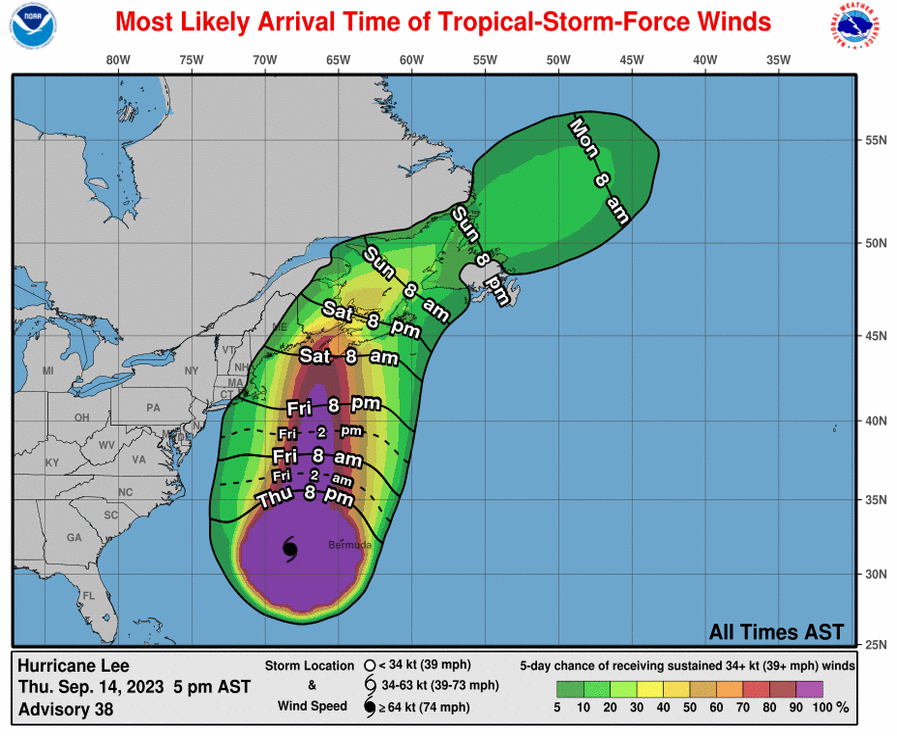
Below is a map from the NHC that estimates the most likely arrival time of tropical storm force winds for a given area as well as the probability of receiving tropical-storm-force-winds. This is the most likely time of arrival, so it is still possible they could arrive earlier, and any preparation plans should be in place well before these times.
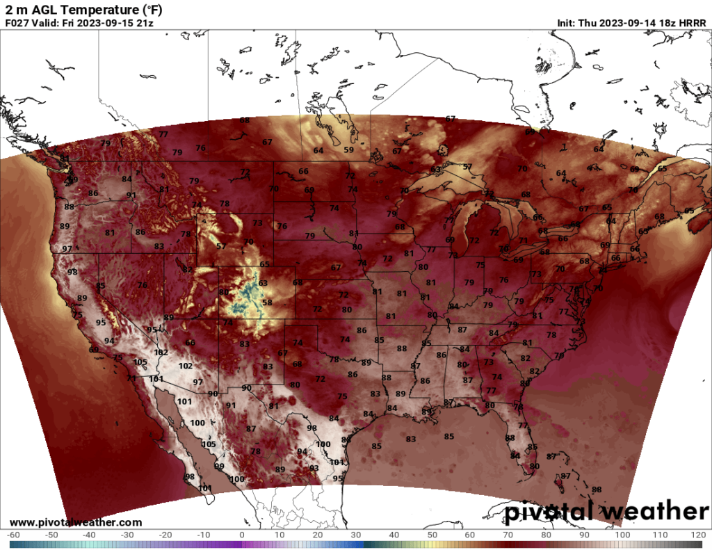
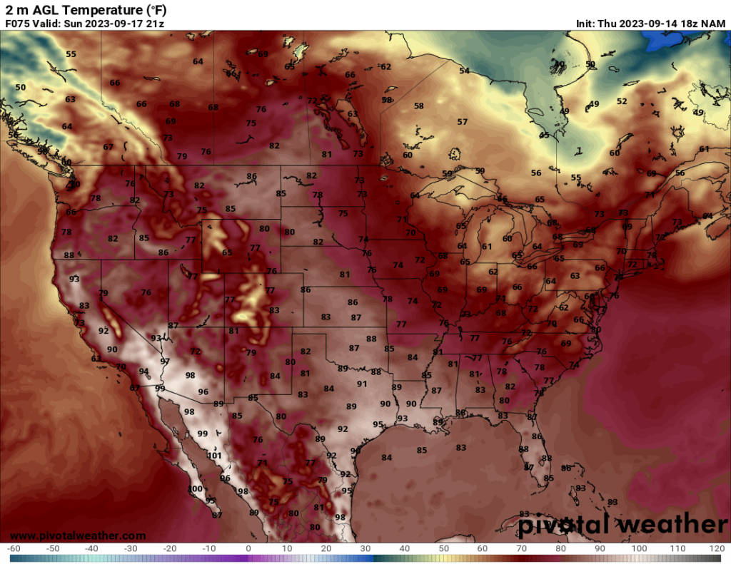
Looking to the temperatures, a lot of the US will see pleasant temperatures this weekend, with 60s, 70s, and 80s for highs depending on the location. A ridge over the western CONUS will bring warm to hot temperatures to that part of the country, with above average high temperatures in the Pacific Northwest. Still, most of the country will have mild to warm temperatures that are suitable for outdoor activities.
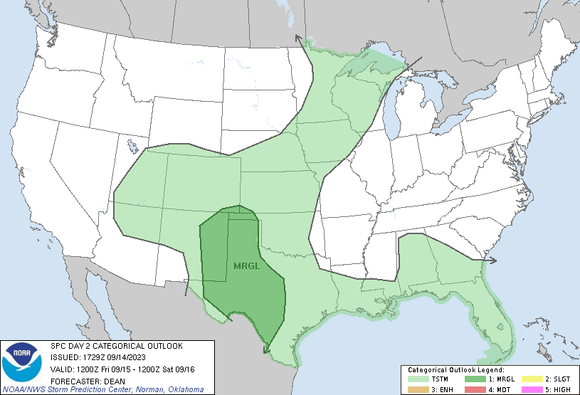
I do want to note that the SPC currently has a Marginal Risk for Friday across much of the southwest Great Plains region. This one is a bit uncertain right now, which is why they have a broad area of Marginal Risk at this time. The risk is mainly for wind and hail, and I am not sure if the SPC will put in a tornado risk in a future update or not. A lot of the severe potential tomorrow depends on morning storms (which may have a marginal wind risk themselves), as morning storms tend to stabilize the atmosphere and hinder severe potential, so a lot of the severe risk depends on how soon the skies clear and instability can build up. Shear and moisture should be sufficient in many areas highlighted under the risk, so instability will be the biggest factor to watch for in determining how much of a severe potential will be present. The SPC may upgrade some areas to Slight in an update tomorrow if favorable conditions for severe weather become more apparent, but as of right now, there is too much uncertainty.


