Welp. It was a nice weekend! A bit cloudy. Sort of cool. But in all a nice weekend. The drier, cooler weather is exiting starting Monday and replacing it will be warmer, and much more humid air.
Like, really humid.
How humid is really humid?

Lotta juice
Take a look at the map below. This is a measure of Precipitable Water. In general, Precipitable WATer (PWAT) is a good measure of how much water is in the air. You can almost think of it as if you took a column of air and soaked all of the water in the column into a sponge, and then rang it out into a bucket… how much water would you have?

This this case, for the month of March, the “Max” PWAT value possible is about “1.8 – 2.2” for the Gulf Coast. That is the Max. The idea is that it doesn’t really get much higher than that. And that “1.8 – 2.2” is also more than two standard deviations above the mean (remember that a standard deviation is the average distance between data points within a group of data).
The average PWAT values range from 0.6 – 1.0. So the range isn’t terribly wide. A dry day is 0.25 – 0.5. A humid day is around 1.0.
The PWAT values with this next system starting Tuesday and lasting through Thursday will run between 1.25 and 1.90.
In other words, ‘our cup runeth over.’

Here comes the rain again
Eurythmics references aside, this is looking like a soggy week. Because a lot like Selena Gomez’ pouring skills above, when you try to put more water in a container that can’t hold it, it overflows.
The container this week will the atmosphere. And the Gulf and Caribbean will continue to try to put more water vapor into the atmosphere when it won’t be able to hold anymore – and it will precipitate. Perhaps a lot.
And there will be multiple rounds of rain. It will be like we are all stuck in the Flock of Seagulls music video. Seeing the same thing over and over and over again.

I know, I know. Too many 80s references.
Take a look at the afternoon model guidance for Tuesday, Wednesday and Thursday from the GFS computer weather model…


The GFS is showing three consecutive days of potential rainfall across the same areas. And the rain will be heavy at times. And the showers will be very proficient at dropping a lot of water (goes back to the higher PWAT values).
The CIPS Analogs is even picking up on the chance for a lot of rain.
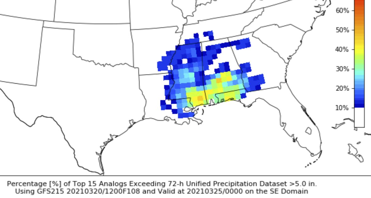
CIPS is showing two splotches of ‘greater than 40-percent’ of the Top 15 analogs dropped more than five inches of rain.
Given that, right now the area with the highest risk for seeing the most rain seems to be the southernmost sections of Louisiana, Mississippi and Alabama as well as the Florida panhandle.

The area of greatest concern will likely shift in the coming days as more data becomes available. Please check back for updates.
No jokes here: More severe weather possible, too
This threat may end up being pretty conditional. And on top of that, it may end up being a low-end threat, too. But it all depends on how things shake out Tuesday and Wednesday.
For the most parts, Tuesday and Wednesday will feature showers and regular storms. Severe weather doesn’t look as likely on those two days. So far model guidance keeps the atmosphere stable closer tot h surface and any instability in the mid-levels will be pretty meager. Take a look at the sounding data.

Notice that there is plenty of spin in the atmosphere (the graph in the upper right is a hodograph and any time the red/yellow line crosses a single radial, there is some sort of spin. when it crosses two there is a lot) but there isn’t much CAPE. Also the PWAT is 1.44. So any rain shower will be able to drop a fair amount of rain rather quickly.
With not much instability, those two days are looking like they will be “setting the table” for a stronger system to move through on Thursday. There will be plenty of moisture, heat and energy for the next system to use.


Notice that the Skew-T charts are similar, but not identical. Same with the hodographs. And the stats below are about the same, but do tell a different story between the two models.
But both have thunderstorms and the potential for severe weather by Thursday afternoon.
How severe? That is still “To Be Determined” but it is worth watching in the coming days for certain.
I did run the Karrie Meter based on the 00z GFS data.
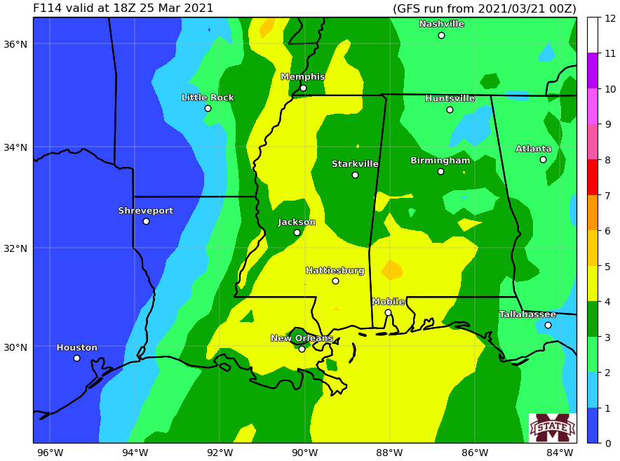
Notice that there is a healthy swath of yellow (4) during the afternoon. But the earlier data did include a decent portion of orange (5) across Louisiana and parts of Mississippi. So this will need to be monitored in the coming days.
The Bottom Line
Right now it looks like there will be a multi-day rainfall event that may lead to flooding in some areas. In particular places closer to the Coast, but perhaps as far inland as I-20 in some spots. The rain arrives Tuesday and lingers around through Wednesday. Then a second system arrives Thursday to bring more rain and the potential for some severe weather.
So far it looks like 3″ to 5″ of rain may be possible by the time Friday morning rolls around. And there may be some spots seeing up to 8″ of rain potentially by Friday morning.
On top of that, there is the chance for severe weather on Thursday. The main concerns would be heavy rain (along with the flooding) and wind gusts up to 70mph. Right now, it also looks like tornadoes may be possible, too. And the data suggest up to an EF2 tornado may be possible. But there may be a limit to just how strong tornadoes can get given some other parameters and all of the rain that will be in the area.


