Good morning, everyone! I want to offer an update about the severe weather threat for southern Mississippi as the new morning numbers have come in and I’ve had a chance to update the Severe Weather Worksheet.
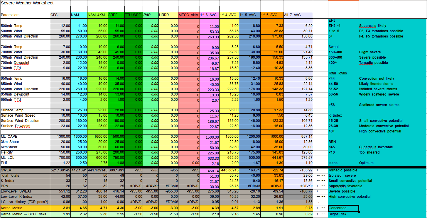
Above, you can see that the overall severe parameters for southern Mississippi aren’t has high as they’ve been in recent days. As the system continues to evolve and the computer models get a better handle on what things may looks like, the overall threat – according to the raw data – isn’t quite as high.
That said, it is still above a “4” on the Karrie Metric and above a “2” when converted to the SPC scale. And during the last few months, when we hit both of those numbers, there is a true tornado threat across the area. So please take this system seriously.
Speaking of the Storm Prediction Center (SPC), they have put the area under a Slight Risk, Enhanced Risk and Slight Risk for Wednesday, Thursday and Friday, respectively.
All modes of severe weather will be possible during the next few days in the area. That means heavy rain, flash flooding, frequent lightning, gusty to damaging winds, hail and isolated tornadoes will be possible. Please have a severe weather plan and have your NOAA Weather Radio handy during the next 60 hours.


