Quick Forecast Discussion
The atmosphere may be a bit tired from the storms that rolled through early this morning, but it will eventually rebound as we head toward the afternoon.
Latest guidance suggests storm development between 11am and 1pm. The storms look to last until around 8pm tonight.
The radar may look a lot like yesterday. There won’t be a line of storms, but rather individual cells. This makes predicting who will see a storm and when, very difficult. Storms will likely be moving north or north-northeast at 20mph to 40mph.
So keep an eye to the sky and the other on the radar. If you see a storm south of your neighborhood, it’s a safe bet it will be affecting you eventually.
Location, Location, Location
While everyone is fair game for a storm today, the best chances for severe weather today will be northwest of a line from Tylertown to Shubuta.
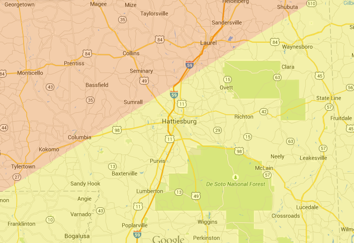
Keep in mind, weather isn’t black and white. The line on the map is fuzzy. Just because you are close to it on one side or the other, doesn’t mean your risk is immediately different.
Forecast Explainer
With southwest flow aloft and a decent surge of Gulf moisture, the atmosphere looks to remain marginally unstable (500 – 1500 J/Kg CAPE) through the day today and into this evening.
00z NAM guidance suggests a weakly capped atmosphere prevailing through early afternoon. That means that it will take a little extra juice to get things off the ground, but if storms do develop they will likely be more isolated in nature.
The main concerns given low LCL (less than 1500ft) and sufficient shear (20-30kts through 500mb) look to be heavy rain, gusty to damaging winds, hail and an isolated tornado or two can’t be ruled out.
Given the dry air above 750mb and freezing line at roughly the same area, it looks like some larger-than-normal hail (up to the size of hen eggs) may be possible, too, if a storm can establish a strong enough updraft. A decently sized “if” there, but it can’t be ruled out, either.
Helicity values aren’t overly impressive compared to historical averages for tornado days. That is why an isolated tornado cannot be ruled out, but widespread tornado development isn’t a concern.


