Hello all and happy Sunday! This forecast will look at how the extreme heat over the southeast will evolve over the work week, as well as the usual coverage on any precipitation chances.
Diving straight into the number one problem, the excessive heat, today the NWS has pulled back on the warnings, with the far southwestern portions of Mississippi under the highest risk for excessive heat indices.

I know the heat has been a real struggle over this past week, with all of the forecast area either being under a heat advisory or an excessive heat warning, but there is some good news that lies ahead. For today, our area should begin to see some cooler and drier air that starts to mix in from the north as the ridge to our northwest continues to amplify. This amplification allows for winds to turn out of the north as the flow is clockwise around a high-pressure system.

However there is one catch, it looks like most of the dry air will stay above the surface, so dew points will remain in the 70s for most of the day. A look at a skew-t diagram below shows this in action.

This quick look at a sounding or vertical structure of the atmosphere for Sunday shows the much drier mid-level air, with the humidity still present at the surface. The red line represents temperature while the green line shows dew point. The closer the lines are together, the more humid it is.
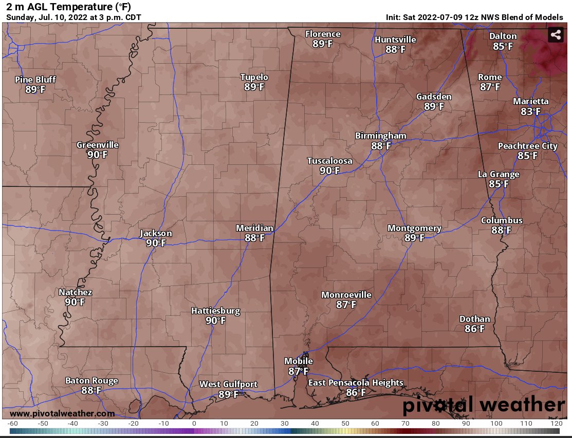
Looking at a map of the maximum temperatures across the region, it will be cooler compared to Saturday, hence the pull back on the heat warnings and advisories despite it still being humid out.

Precipitation for today should feature mainly scattered showers and thunderstorms will better chances to the south as you have a converging sea-breeze boundary.

Moving forward through the beginning of the week, Monday will feature more comfortable levels of humidity, with precipitable water values falling to around 1.5″, meaning at the surface the air should feel less oppressive and more tolerable for the day.

This allows for high temperatures in the low to mid 90s, and with that combination of slightly cooler temperatures and lower humidity, the heat indices will be near 100F. This is a much needed and welcome change from the heat indices constantly above 105F and even 110F that we had over last week! The theme of temperatures near 90 and slightly lower humidity levels will continue throughout the entire work week!


For precipitation chances, it looks like the frontal boundary that brought us some slightly cooler temperatures will linger along the gulf coast for the beginning of the work week. This will allow for some forcing in the atmosphere to assist with precipitation chances in the beginning of the week despite the more “drier” mid-level air mass.

While once again the chances aren’t 100-percent, this does allow for places particularly south of Jackson and I-20 to see better chances at precipitation through Thursday.
Once this frontal boundary eventually erodes and moves off to the west, the main driver for rain will once again be a combination of the day time heating and the southerly flow off of the Gulf. This means that the region will see the usual scattered thunderstorms and showers for the rest of the week, which always allows for a temperature decrease and a break from the summertime heat!
Day to Day Forecast
Today
Partly cloudy, with a 60-percent chance of showers and thunderstorms. Highest chances to the south of I-20. Highs in the lower-90s with heat indices near 105F. Wind southwest at 5mph.
Tonight
Partly cloudy with a 30-percent chance of showers and thunderstorms. Lows in the mid-70s with a calm wind.
Monday
Sunny with a 30-percent chance of showers and thunderstorms. Highs in the low-90s with heat indices near 100F. Wind northeast at 5mph.
Monday Night
Partly cloudy with lows in the mid-70s. Wind calm.
Tuesday
Mostly sunny with a 50-percent chance of showers and thunderstorms. Highs in the upper-80s to around 90. Wind southeast at 5-to-10mph.
Tuesday Night
Mostly cloudy with lows in the low-70s. Wind southeast at 5-to-10mph.
Wednesday
Mostly sunny with a 60-percent chance of showers and thunderstorms. Highs near 90 with wind southwest at 5-to-10mph.
Wednesday Night
Mostly cloudy with a 30-percent chance of showers and thunderstorms. Lows in the low-70s. Wind south at 5mph.
Thursday
Partly cloudy with a 40-percent chance of showers and thunderstorms. Highs in the upper-80s. Wind southwest at 5-to-10mph.
Thursday Night
Partly cloudy with lows in the low-70s. Wind calm.
Friday
Mostly sunny with a 30-percent chance of showers and thunderstorms. Highs around 90.
Friday Night
Mostly clear with lows in the low-70s.
Saturday
Mostly sunny with a 20-percent chance of showers and thunderstorms. Highs in the low-90s.
Saturday Night
Mostly clear with lows in the low-70s.


