For the next day or two, there are multiple chances for severe weather. One notable threat is a Slight Risk in New Mexico, with all hazard types possible, including a tornado threat. Discrete supercells are likely to start forming this afternoon and evening over eastern New Mexico. The map below shows the SPC’s current outlook for tornadoes this afternoon and evening, although I would not be surprised if the SPC extends the tornado risk further north a little bit in their late afternoon update. CAPE values are moderate but nonetheless sufficient for severe weather, owing to the strong shear and sufficient moisture in place.
Farther north, the SPC has another Slight Risk in place in parts of western Nebraska, southwest South Dakota, and far southeast Wyoming, with wind being the main threat. A hail risk also extends throughout all of the highlighted risk areas, with a chance for very large hail (2+ inches in diameter) in southeast New Mexico and parts of west Texas. This elongated severe threat is the result of a cold front moving eastward across the central US.
The severe risk continues Tuesday as the cold front progresses eastward. The greatest risk so far appears to be hail and wind, with some large hail possible (hatched area is a 10% or greater risk of 2+ inch diameter hail within 25 miles of a point). A tornado threat is possible, although the window of time for tornado development may be short, as initial discrete storms forming in the afternoon are expected to quickly become linear, which should result in a wind threat but a lower tornado threat. Still, tornadoes cannot be ruled out due to the favorable CAPE, shear, and dew points.
On Wednesday, another severe threat may materialize as the front continues to move eastward, but there is still a lot of uncertainty regarding factors like the position of the front, according to the SPC. Because of this, there is currently only a Marginal Risk area on the SPC outlook, but higher probabilities may be possible in future updates.
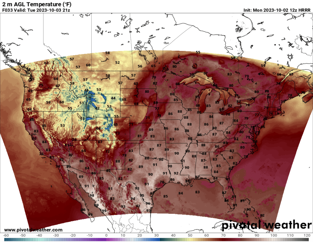
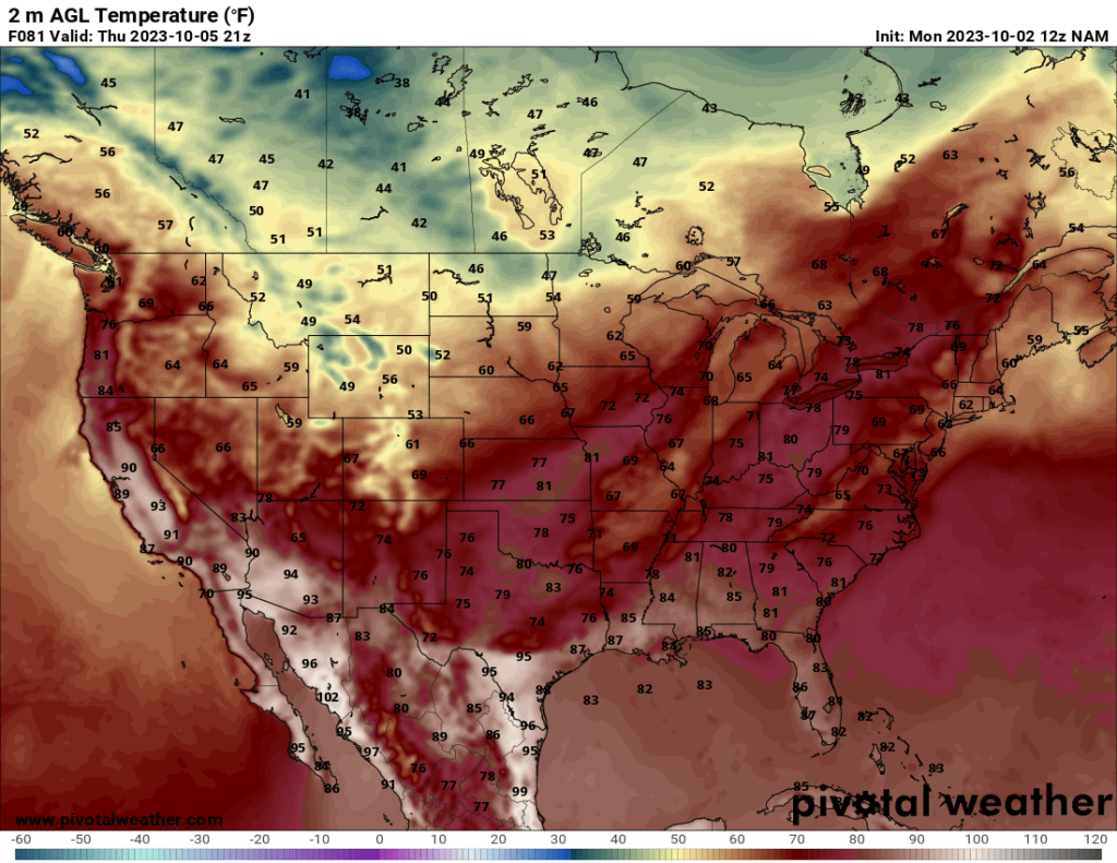
Looking to the contiguous United States at large, a trough is currently in place over much of the western US, particularly over the Rocky Mountain states, while a ridge is situated over most of the eastern half of the US. This will result in cool temperatures in the western states, with some chilly temperatures likely in some of the northern states like Montana and Wyoming, with highs in the 40s and 50s in some areas. Meanwhile, the eastern half of the US is feeling summerlike temperatures, with highs in the 80s in many places, even as far north as Michigan.
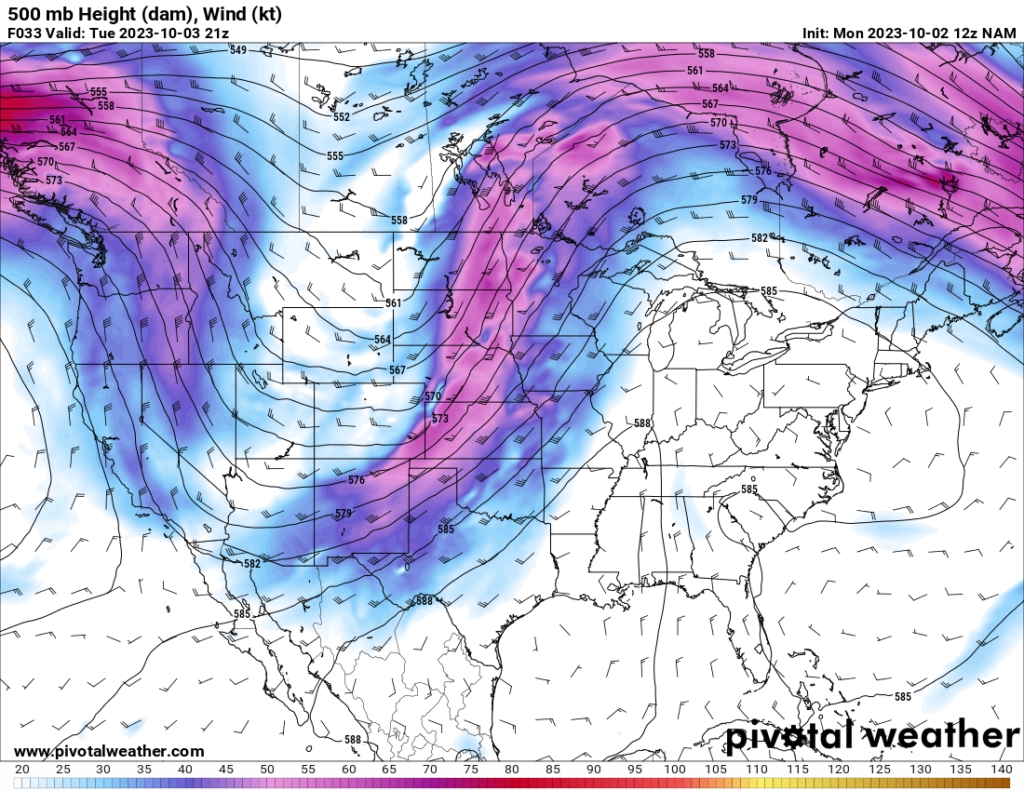
As the trough moves eastward, colder temperatures will progress eastward as well, and the eastern half of the US will start to see cooler temperatures by the end of the week. Additionally, precipitation and storms will be present ahead of the cold front, so the Midwest should see a bit of precipitation over the next few days as the front passes through that region.