The weather at the start of this week will be very messy in a lot of places, to say the least. The most concerning threat is the multi-day severe threat affecting the Southeast Monday and Tuesday.
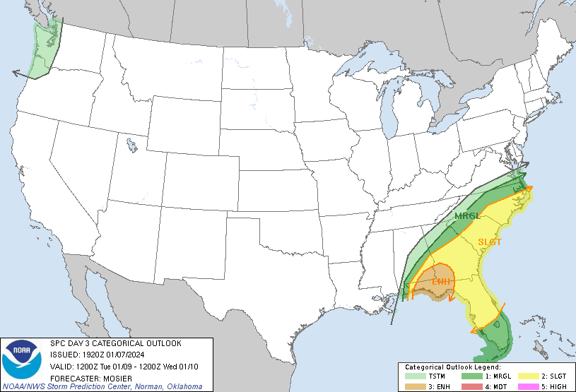
On Monday, the SPC currently has an Enhanced Risk for much of the Gulf Coast. Storms are currently expected to affect the area Monday afternoon into Monday night. All severe hazards are possible, with the main threats being tornadoes and damaging winds. Much of the extent of the severe risk depends on how much instability makes it inland, as a good chunk of instability will be offshore.
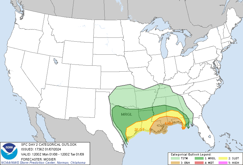
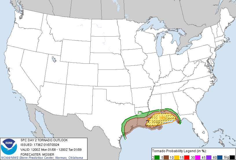
On Tuesday, the threat will continue eastward, affecting the eastern part of the Gulf Coast as well as the Atlantic Coast. Similar to Monday, damaging winds and tornadoes are the main threats. There seems to be some disagreement between the models as to what area will see the biggest threat (the HRRR has the greatest threat along the Florida Panhandle, while the NAMNEST has the greatest threat along the South Carolina coast. I wouldn’t be surprised if the SPC extends the Enhanced Risk there. A lot of uncertainty will persist until Tuesday, though, as severe risk will depend partly on where storms initiate and how much instability will come ashore. Those in the severe risk areas outlined should continue to check their forecasts as they update.
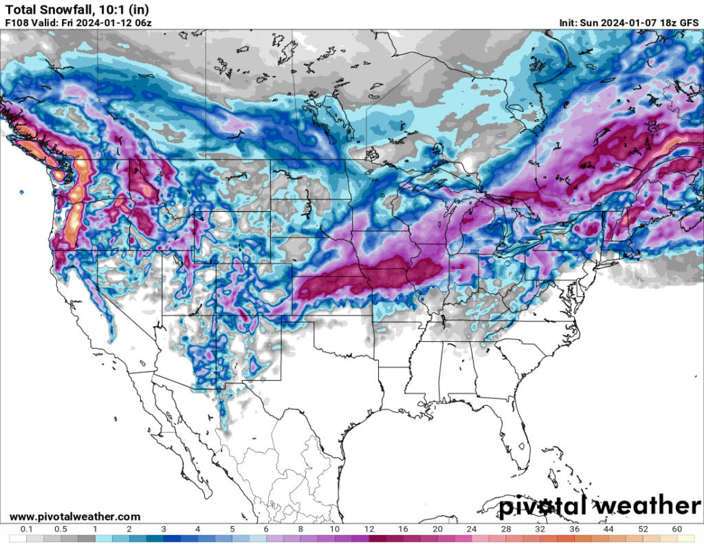
Farther north, multiple places are expected to see heavy snowfall. The central Plains will see snow Monday, the Midwest Monday night and Tuesday, and the Northeast Tuesday night and Wednesday. Some lingering snow may occur in the days after as well. Additionally, the Northwest will see a large amount of snow in the higher elevations.
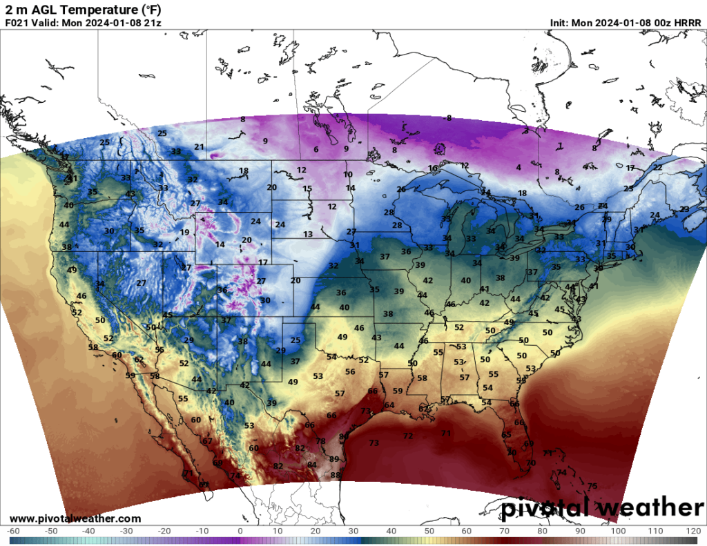
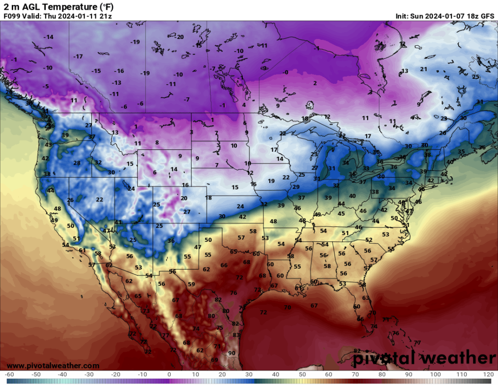
Looking at temperatures, a cold front associated with the severe weather will move across the South, but the colder temperatures will be short-lived. A much more potent cold front will make its way south across the Plains and Midwest as the week progresses. By Thursday, the northernmost parts of North Dakota and Montana may see highs hovering near zero, and lows Thursday night will likely be in the negatives.