New Data: South Mississippi severe weather threat diminishing slightly
Author: Nick Lilja
|| Published: 3/2/2019 at 11:58am
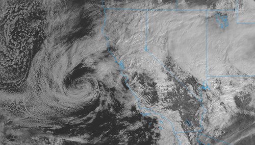
GOES 17 Satellite imagery // Courtesy: College of DuPage Meteorology
Now that the storm system has made it ashore across California, it is being sampled by weather balloons launched by the National Weather Service. That new data is being fed into the morning and mid-day models giving meteorologists a much better picture about what may – or may not – develop for Sunday.
Saturday mid-day update on Risk Levels for Sunday from the SPC // Courtesy: spc.noaa.gov
Model guidance given the new data has shifted the threat area a bit to the east and increased the threat for storms – in Alabama. It also looks like the timeline for storms have shifted a bit, too.
Quick breakdown of Sunday’s weather
Timeline for a chance for rain: 4a – 7a, then 11a – 8p
Timeline for a chance for storms: 11a – 6p
Main threats within storms: Heavy rain, frequent lightning, wind gusts up to 60mph, hail up the size of quarters
Other lower-probability threats: Wind gusts up to 70mph, Hailstones as big as golf balls, a tornado or two.
Comparing 3/2/19 00z HRW data to 3/2/19 12z HRW data, the coverage of Updraft Helicity streaks has moved east of south Mississippi
While the HRW model is only one model, it does highlight the shift in threat area that has also been shown in the long-range HRRR, NAM, NAM-3km, and other models, too.
There are still a few streaks in south Mississippi, but not as many. So the threat is lower, but certainly not anywhere close to zero.
From the Storm Prediction Center
…SUMMARY…
Severe storms with wind damage and an isolated tornado threat will be possible on Sunday from the central Gulf Coast east-northeastward into western South Carolina.
…Lower Mississippi Valley/Central Gulf Coast States/Georgia/South Carolina…
A fast moving shortwave trough will approach the Southeast on Sunday. At the surface, a low is forecast to move across northern parts of the central Gulf Coast states. A trailing cold front should be located from southern Mississippi into south-central Alabama by afternoon. Model forecasts suggest that numerous thunderstorms will develop along the front in the morning and early afternoon as the front advances southeastward. Surface winds parallel to the front combined with strong low-level convergence will be favorable for squall-line development. Additional thunderstorms should develop eastward across the moist sector. This activity should organize into a MCS and move east-southeastward across the region during the afternoon and early evening.
As the shortwave trough moves across the lower Mississippi Valley on Sunday, a 75 to 90 kt mid-level jet will move across the Tennessee Valley. The southeastern edge of this feature will enhance ascent and aid strong deep-layer shear profiles. Due to this, a wind damage threat should develop within the squall-line by midday. At low-levels, a 40 to 60 kt jet is forecast to move eastward across south-central Alabama during the afternoon. Discrete supercells that form over the warm sector near and to the southwest of the low-level jet max will have favorable shear profiles for tornadoes. The number of tornadoes that develop will be dependent upon how many discrete cells form out ahead of the cold front. If a cluster of discrete cells can become scattered across the area with stronger instability, then there could be a small cluster of tornadoes. The greatest potential for tornadoes is currently forecast from just north of Mobile east-northeastward to the east of Columbus, Georgia. An enhanced has been added along this corridor where a potential for strong tornadoes will exist. In addition to tornadoes, wind damage and isolated large hail will also be possible with supercells. A wind damage threat should also be concentrated along the squall-line to the west. The squall-line should progress eastward across the southern Gulf Coast States and into Georgia during the late afternoon and early evening.
Further to the northeast, the low-level jet is forecast to move into South Carolina by early evening. Although instability will be weaker there, a potential for supercells will still exist due the favorable shear profiles. For this reason, the slight risk area has been expanded into western South Carolina. Isolated wind damage will be possible along this part of the front.
…MAXIMUM RISK BY HAZARD…
Tornado: 10% SIG – Enhanced
Wind: 30% – Enhanced
Hail: 15% – Slight
Author of the article:
Nick Lilja
Nick is former television meteorologist with stints in Amarillo and Hattiesburg. During his time in Hattiesburg, he was also an adjunct professor at the University of Southern Mississippi. He is a graduate of both Oregon State and Syracuse University that now calls Houston home. Now that he is retired from TV, he runs this site and its app in his spare time.