NHC designates disturbance in Bay of Campeche ‘Invest90L’
Author: Nick Lilja
|| Published: 9/16/2020 at 12:13pm
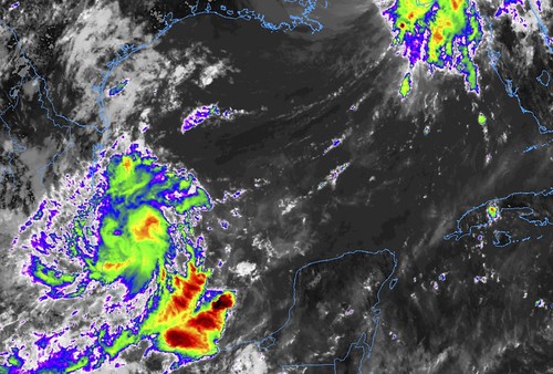
Infrared imagery from GOES 16 satellite // Courtesy: College of DuPage Meteorology
On the heels of Hurricane Sally, the National Hurricane Center is watching a different tropical disturbance in the Gulf, simultaneously. This area moved past the northern Gulf Coast last weekend and has been parked in the Bay of Campeche for the last few days.
From the NHC
Here is a look at the latest discussion from the National Hurricane Center…
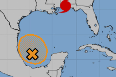
Invest 90L // Courtesy: nhc.noaa.gov
An area of low pressure over the southwestern Gulf of Mexico is producing showers and thunderstorms that have become a little better organized during the past several hours. Upper-level winds are forecast to gradually become more conducive for development, and a tropical depression could form late this week or over the weekend while the low meanders over the southern Gulf of Mexico for the next several days.
* Formation chance through 48 hours…medium…40 percent.
* Formation chance through 5 days…medium…60 percent.
Right now
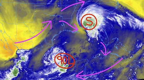
The current mid-level water vapor suggests a ridge of higher pressure aloft still exists of the region. So, should development occur, it wouldn’t be inhibited by strong shear or dry air already in place.
mid-level water vapor imagery form GOES 16 satellite // Courtesy: College of DuPage Meteorology
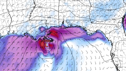
Model guidance now lifts this system back to the north in the coming days. And the GFS brings it off the coast of Louisiana by later this weekend.
GFS model showing Invest 90L close to the mouth of the Mississippi River by late Saturday night / early Sunday morning // Courtesy: Pivotal Weather
That is dependent on a lot of different things to occur, but the development of this disturbance is being shown in the latest data from the GFS, NAM and ECMWF models. Model ensembles are not quite as much on board yet, but due to there being no specific low-level center yet, that isn’t as surprising.
This system is worth watching during the next few days. For everyone from Corpus Christi to Tampa Bay.
The Bottom Line
We are still – definitely – in ‘wait and see’ mode with this one. But it is something to keep on your personal radar as we head through the weekend. And please keep up with forecasts nd don’t ‘check out’ on the weather.
Author of the article:
Nick Lilja
Nick is former television meteorologist with stints in Amarillo and Hattiesburg. During his time in Hattiesburg, he was also an adjunct professor at the University of Southern Mississippi. He is a graduate of both Oregon State and Syracuse University that now calls Houston home. Now that he is retired from TV, he runs this site and its app in his spare time.