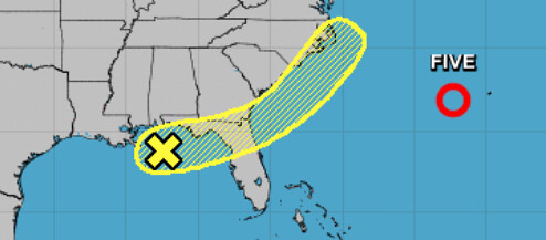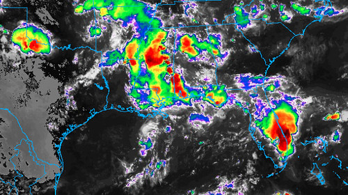
A small cluster of storms over Louisiana, Mississippi and Alabama will sag into the Gulf of Mexico during the next 24 to 48 hours. As it does so, the National Hurricane Center is watching the area for development as the cluster of storms moves to the east.

From the NHC:
Disorganized cloudiness and showers over the far northern Gulf of Mexico are associated with a nearly stationary surface trough. Some slight development of this system is possible before the trough moves onshore along the northeastern Gulf Coast on Monday. The system is then forecast to move northeastward and emerge offshore of the Carolinas on Wednesday, where environmental conditions are expected to be more conducive for development.
* Formation chance through 48 hours…low…10 percent.
* Formation chance through 5 days…low…20 percent.