Well, here we are. In May. Talking about a tropical system. Again.
This one doesn’t really pose much of a risk, truly. The NHC shows a 10-percnet chance of development during the next two to five days. And that is probably generous.

- North Central Gulf of Mexico:
An area of disorganized showers and thunderstorms is associated with a surface trough of low pressure over the north central Gulf of Mexico. Surface pressures remain high, and environmental conditions do not appear favorable for significant development before this system moves inland over the central Gulf Coast in a day or so. Regardless of development, the system could produce heavy rainfall and gusty winds over portions of the central Gulf Coast from southeastern Louisiana to the western Florida Panhandle. Additional information on the rainfall and flooding potential can be found in products issued by your local National Weather Service Forecast Office and Excessive Rainfall Outlooks issued by the Weather Prediction Center.
— Formation chance through 48 hours…low…10 percent.
— Formation chance through 5 days…low…10 percent.
This little Cluster of storms will likely drift inland before it ever has a chance to truly get its act together.
Here’s the deal…
You may be thinking, “hey, didn’t the models show a thing like this a few days ago? Is this it?”
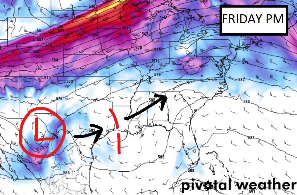
You’re right it did show something! But this isn’t it. This is actually a different little development that the models picked up on back on Thursday with a little area of low-level low-pressure zipping east from Texas to Georgia across the Gulf. If you check the forecast everyone morning, you probably remember seeing it.
Yup! That’s the one.
Except it ended up tracking barely farther south and got out over the open waters for a bit longer, and picked up some vorticity from some riff-raff rotating around the ridge to the east, and that is what prompted the NHC to jump in and say, “heads up!”
Model guidance actually has the cluster’s “center” a bit farther northwest than the NHC is showing. This is because (and many of you probably remember this from previous seasons) before there is a true center, often models try to “pick” a spot to run with, and often pick incorrectly.

Here is a look at it now:
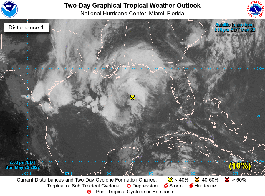
It probably looks healthier than it is. But it will be over some very, very warm water and in an area with some good ‘exhausting’ and little shear, so it may continue to look “good” even if it never develops.
It is expected to lift north-northeast and onto shore tonight and through tomorrow and eventually congeal into the next system pushing through the region.
The Bottom Line
Not much is expected with this one, but it is a good reminder that Hurricane Season is here. Time to check that Hurricane Preparedness Kit and make sure you have all of your insurance needs set and met. Probably a good time to go over things with the family, too.
And keep tabs on this one. It’ll probably give a boost to the chances for rain for later today, tomorrow and the day after and is move through the area


