The North Atlantic Hurricane Basin has been quiet over the last several days, and this pattern is expected to hold at least for the next week. Current tropical activity is confined to the Eastern Pacific Hurricane Basin where storms are forming routinely and moving westward into the Central Pacific. The beginning of August should be a different story due to a combination of decreasing dust and a shift in the Madden Julian Oscillation. This shift may bring convection back to the North Atlantic Hurricane Basin.
Current activity: where and why?
The National Hurricane Center highlights one active tropical system and one area of interest, both of which are located in the Eastern Pacific. Currently, Hurricane Estelle is barely clinging onto hurricane status while the area of interest, which is further east near Central America, has been given a 20-percent probability of tropical development.

As Hurricane Estelle pushes westward towards the hostile Central Pacific environment, it will continue to weaken and is not projected to impact the Hawaiian islands. The area of interest, highlighted in yellow, could slowly develop if it can tighten its very broad center of circulation. If it does develop, it is likely to follow a similar path to Hurricane Estelle, traveling westward and not causing any major impacts.
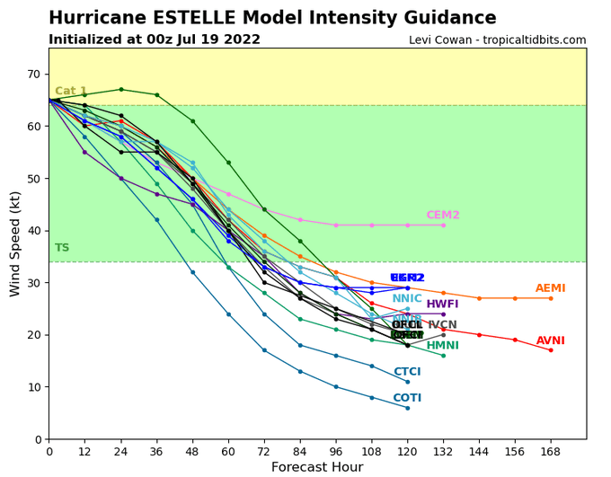
The loop of GOES-17 brightness temperatures consistently shows strong convection, using the colors gray and white, at the center of Hurricane Estelle; however, on the northwest quadrant of the storm, fringe convection is being stifled and pushed eastward. Over the last several hours, the storm’s convection in that quadrant has been restricted from growing due to an increase in shear. As the storm enters this hostile environment, the shear will tear apart the storm’s convection, weakening the storm over time. As a result, most models indicate that, within the next 3 days, the system’s sustained winds will downgrade from hurricane force (>74 mph) to tropical depression force (<37 mph).
As for the North Atlantic Hurricane Basin, the main reason for tropical inactivity is the Saharan Air Layer (SAL). With a huge amount of dust flowing off the African continent, most of the hurricane basin is filled with dust. The majority of African easterly waves coming off the west coast are falling apart due to the dust choking out any convection.

When analyzing the reach of the SAL, it is important to note that it does not need to reach the Gulf of Mexico to shut down the basin. Because the African easterly waves are not reaching the less hostile environments of the Caribbean Sea and Gulf of Mexico, the skies in these regions have stayed clear. If a wave were to reach these regions, the sea surface temperatures are above average and could support tropical development. However, this scenario is not projected to happen at least for the next week.
What does the future hold?
The tropics for the near future appear to stay quiet in the North Atlantic while the East Pacific could produce more westbound tropical systems. This pattern is projected to hold because of the Madden Julian Oscillation (MJO) which is inhibiting convection in the North Atlantic Hurricane Basin. The MJO is projected to support convection in the North Atlantic starting at the beginning of August. This shift, combined with the climatological decrease of SAL in early August, should lead to a rapid increase in tropical activity in approximately 2 weeks.


The Climate Prediction Center, like the National Hurricane Center, is forecasting an absence of tropical cyclone formation in the North Atlantic Basin through July 26th. This coincides with the GFS’ MJO forecast which indicates a region of convective inhibition (orange color) will stay over the North Atlantic until August. Once the new month begins, however, the convection-allowing region (green color) shifts into the North Atlantic which should directly correlate with an increase in tropical activity.
Expect the 2022 Atlantic Hurricane Season to kick back into gear near the beginning of August. So, as July expires, stay on alert for increased tropical cyclone activity by visiting the National Hurricane Center’s website.


