Where some places will cool down over the course of the next 7 days, others will begin to warm up and take their place. The Great Plains will finally be in line for a break from the temperatures in the back half of the week after going through days of relentless heat. Out in the western US, places in central Oregon and central Washington will start to feel the heat more and more every day, similar to what most of the central and southeastern US has dealt with for a good part of summer up to this point. Back east, more rounds of showers and thunderstorms will soak places in the Great Lakes/Ohio River region that particularly do not need to see much more moisture.
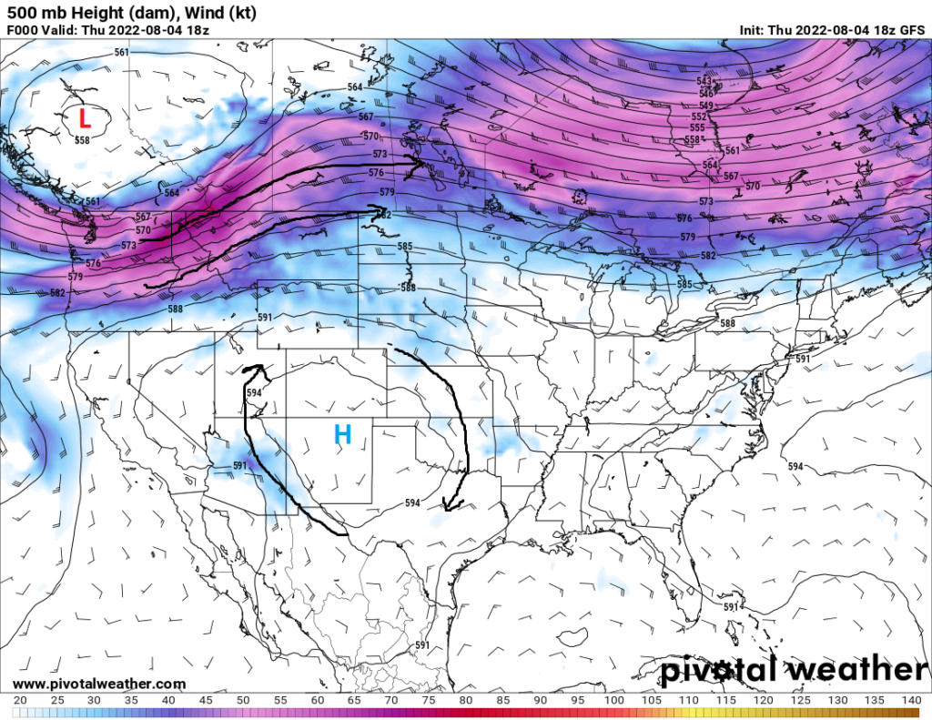
Beginning as early as Friday (today), places in the Plains will begin to notice much more comfortable temperatures. The main culprit will be a cold front originating in Canada moving its way south-southeast, which may reach as far south as the Southeast US by this time next week. Temperatures look to decrease at least 15 degrees across the front, with some places possibly seeing as much as a 25 to 30 degree temperature difference. The arrival of this front will also bring an increase in precipitation potential, something that is desperately needed for the drought-stricken region.
Speaking of precipitation, many places in the Great Lakes and Ohio River region will remain wet and soggy throughout the weekend and into next week. Now through this weekend, storms look to fire during the morning and mid-afternoon hours as a slow moving MCV (Mesoscale Convective Vortex) makes its way eastward. The slow progression of this MCV paired with an extremely moist atmosphere, with PW values approaching 2 inches or greater, does leave concern for at least localized flooding events. This has been noticed by the Weather Prediction Center, which has issued a slight risk for excessive rainfall and flash floods through today and at least a marginal risk entering the weekend.

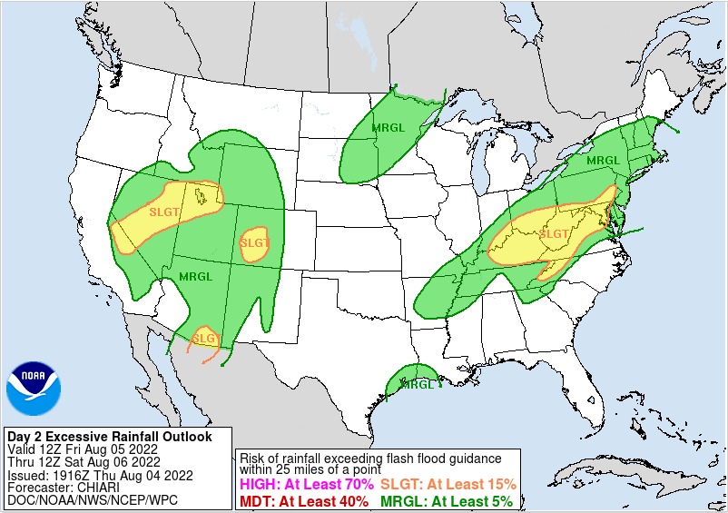
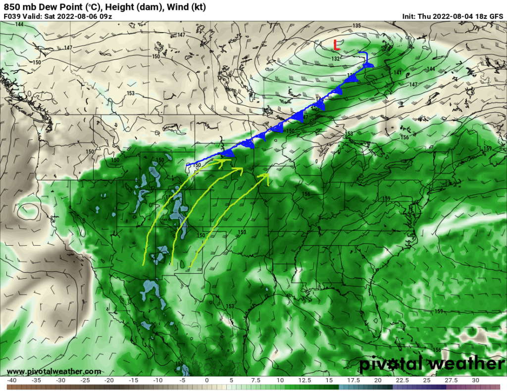
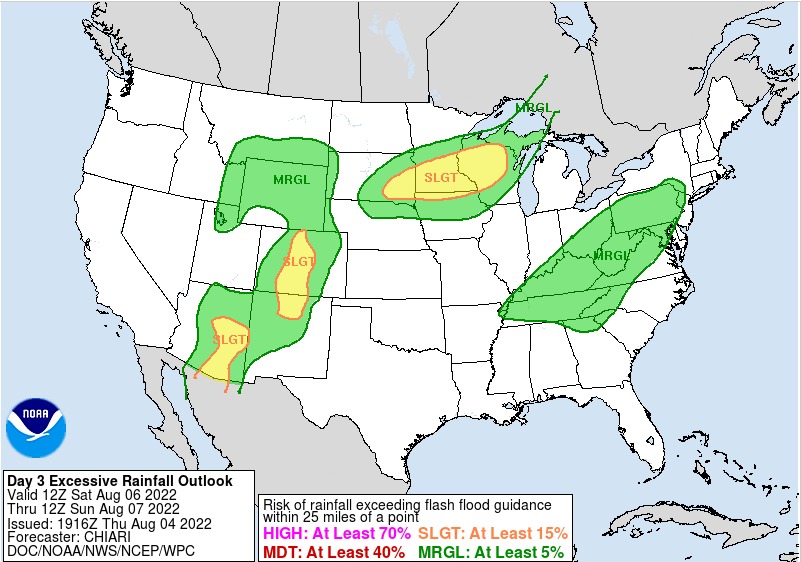
By this weekend, the aforementioned cold front that will move through the Plains will also begin to make its way through the Great Lakes and eventually the Ohio River region. Flooding will be a concern for portions of the Great Lakes region as the cold front stalls over the area this weekend. This stalled front, along with continuous monsoon moisture (yes, desert monsoon moisture making it this far north) convergence along the front and wind profiles favoring the training of thunderstorms will set the stage for the potential of significant rainfall. As the front advances southeast towards the Ohio River valley by early next week, more rain potential will follow with it. Very moist atmospheric conditions will still be present over the area and favor efficient rainfall with any storms, as such, the flood potential will once again have to be monitored.
Out in the Pacific Northwest, temperatures will begin to increase as an upper level ridge will build over the western US and allow for hot and dry conditions to settle in. The heat will especially be a concern the further east from the coast you get. Temperatures this weekend into early next week will look to rise into the mid to upper 90s, with places in north-central Oregon and south-central Washington reaching the low 100s. The heat will begin to relent as the ridge moves off to the east and a trough tries to move onshore.


