Heading into the weekend, a trough is expected to move eastward across the Plains and into the Midwest. Separately, a low pressure area in the Gulf is expected to develop Saturday and move eastward as well.
All of this will create an interesting weather setup. Showers and perhaps a few thunderstorms in the southernmost areas of precipitation will occur east of the trough moving across the Plains and Midwest, affecting the Plains on Friday and moving further east into the Midwest and Southeast after that.
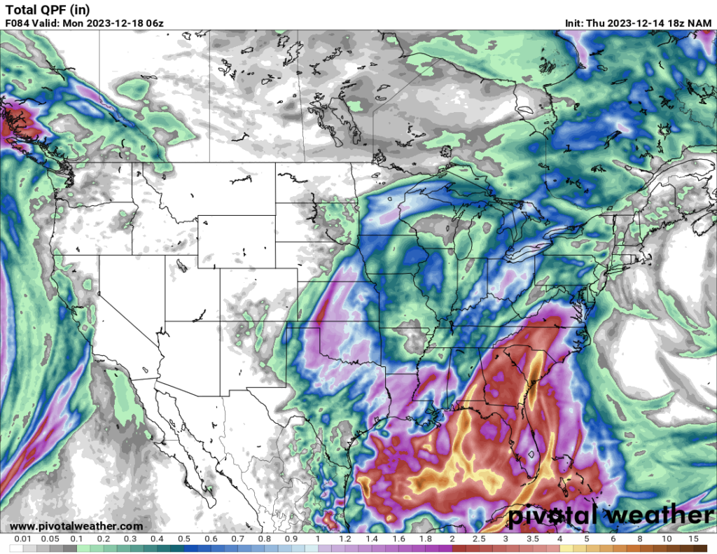
Meanwhile, showers and thunderstorms associated with the low over the Gulf will begin to affect the Southeast Saturday and Sunday, merging with the precipitation associated with the more northerly trough. This will result in a fairly large amount of precipitation over the Southeast, with the highest amounts currently forecast to affect Florida, Georgia, and the Carolinas.
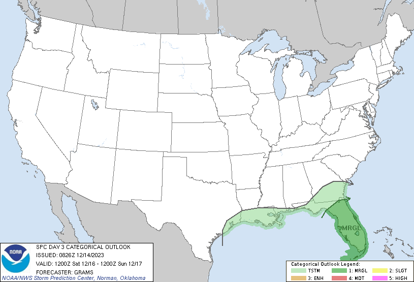
The Storm Prediction Center currently has a Marginal Risk over most of the Florida peninsula on Saturday, with the main threat being tornadoes, especially during the nocturnal hours. There is a lot of uncertainty right now with the forecast models, which is why the SPC currently has the risk at Marginal, but they do mention the possibility of increasing it to Slight in a future update. According to the SPC, the low over the Gulf is forecast to, at least initially, have warm-core (i.e. tropical) characteristics, which would provide a favorable shear profile for tornado development if the instability is sufficient. Because of the uncertainty in the models right now, I feel it is unwise to make a definitive forecast at this time. Those who live in this area should monitor their forecasts Friday and Saturday as the models hopefully become more consistent.
The SPC does note a potential tornado risk Sunday as well, with the area of interest being parts of Florida and the eastern Carolinas. However, because of the aforementioned model uncertainty, they do not have a specific risk area outlined right now, though I would expect that to change by tomorrow or Saturday. Those who live in this area should also pay attention to the SPC outlook and their local forecasts over the next few days.
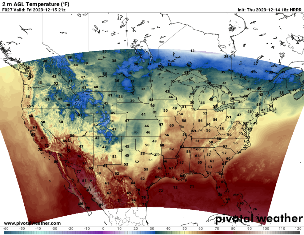
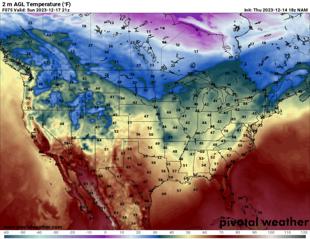
Other parts of the country should see dry weather. The maps below show the temperature estimates at 3 PM CST Friday and Sunday, with temperatures across the country being fairly normal for this time of year.