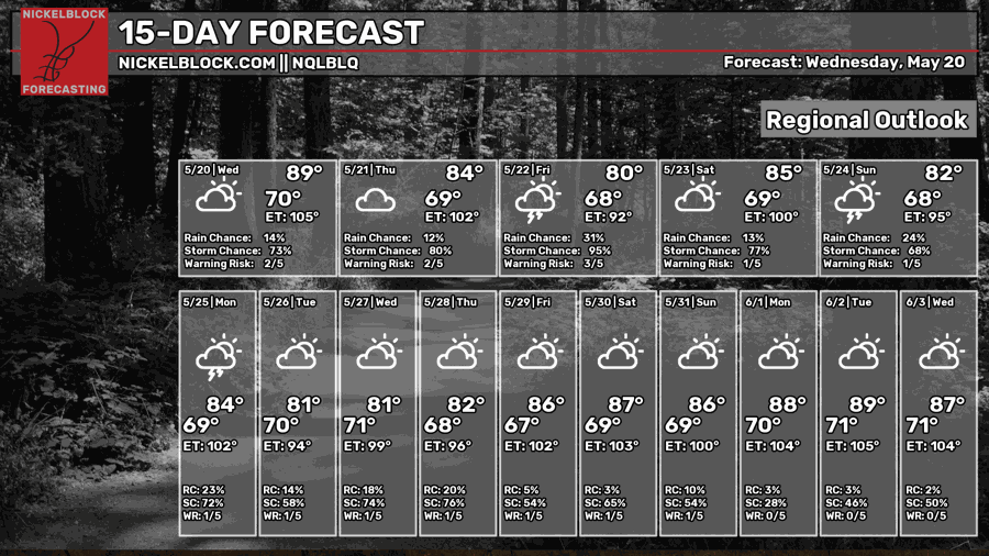
Looks like we are going to be getting rain in portions of the Southern Region till the end of the week! We have west-southwesterly prevailing winds with a lingering boundary nearby. This combo calls for a raincoat and an umbrella on deck.

Today
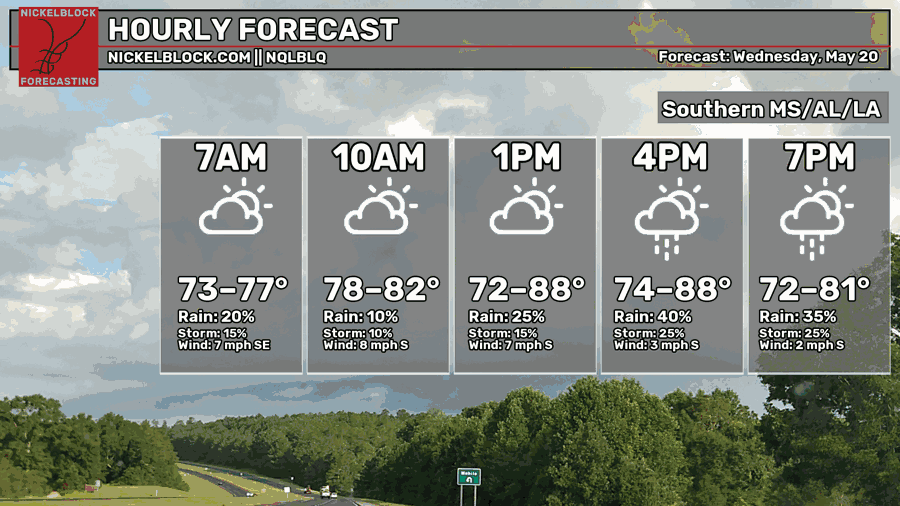
Going to be another humid, hot day in our region. Many areas are going to reach the upper 80s. Our rain chances are increasing throughout the day with scattered showers and possible thunderstorms. Luckily, it will be partly cloudy for most of the day, a small relief from the high temperatures.
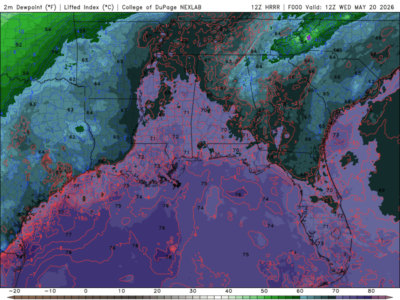
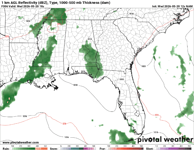
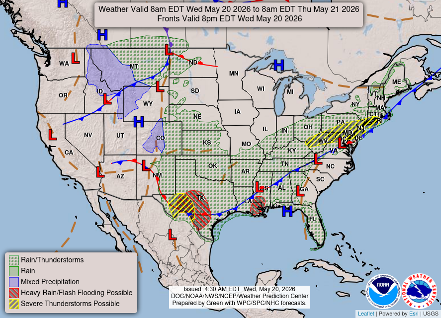
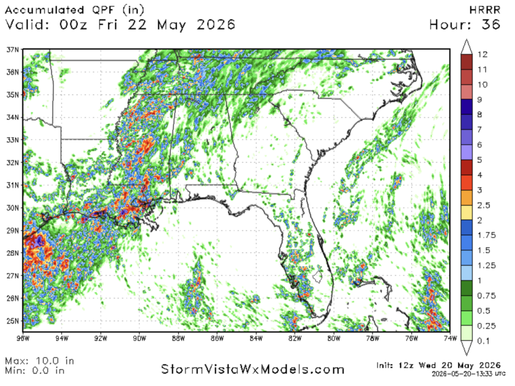
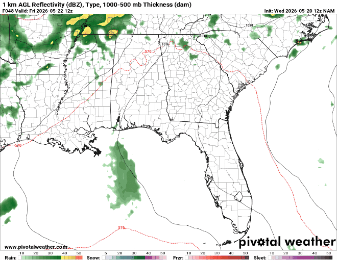
The dew points remain relatively high, so the humidity is here to stay. We can see a boundary that stretches from Central LA through the LA-MS border. What this means for us is the possibility of storms forming where this warm, humid air collides with the drier air. This rain activity will especially pick up in Lower LA around the nighttime hours. The graphic below shows these pop-ups of rain and maybe some thunderstorms through the late evening.

Tomorrow
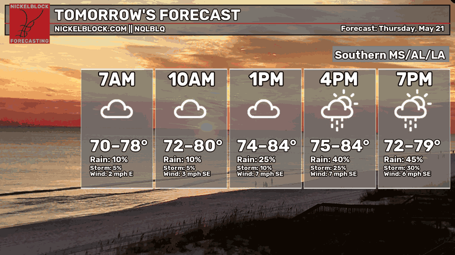
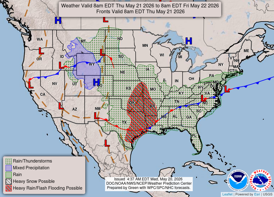
Throughout Wednesday night into Thursday morning, most of the rain will affect Lower LA and be scattered through MS. Areas that are prone to flooding should be aware that flash flooding could be possible, especially in Lower LA and Lower West MS. This is because of a low-pressure system bringing in rain and possible thunderstorms in the overnight, early morning hours. As the day progresses, rain and possible thunderstorms will continue from the early afternoon into the evening as a stationary front passes through.
While there is a possibility of flash flooding, not everyone is going to see it. Some spots could run into some trouble from the storms and rain over the next few days.

Friday
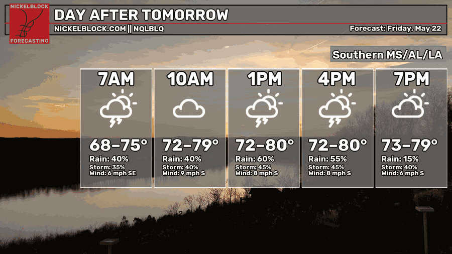
Our temperatures begin to cool down a little, with most areas reaching highs of the upper 70s and lower 80s. Rain and Thunderstorms will continue throughout the Southern region.
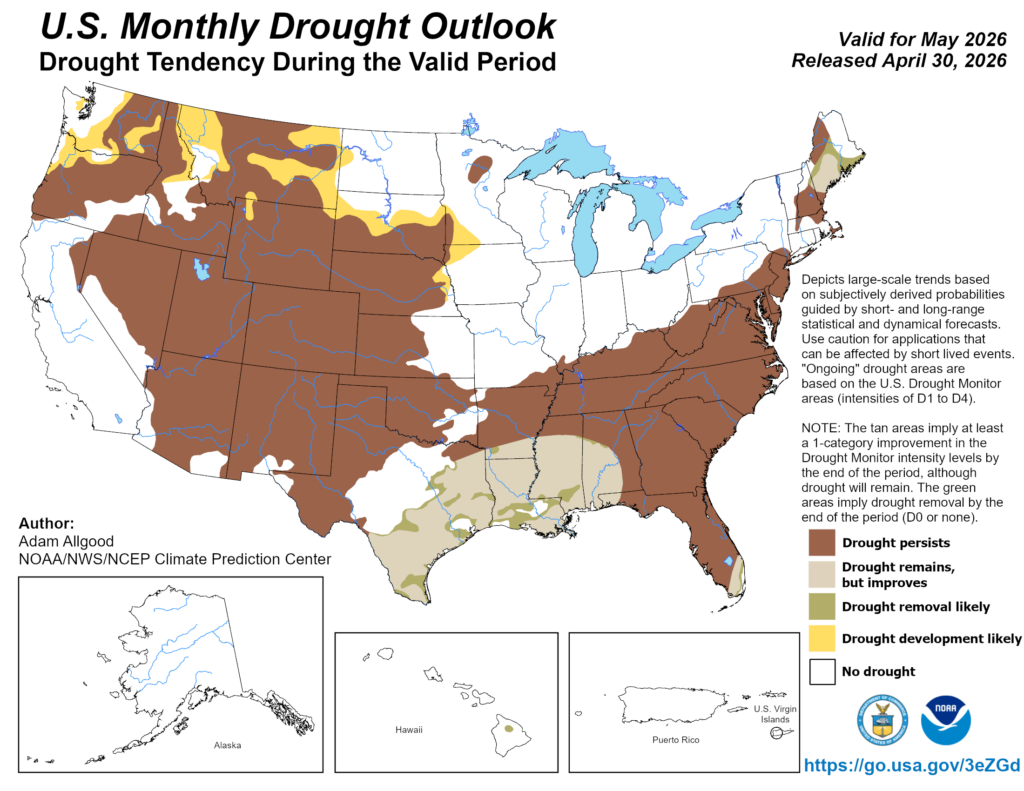
It seems that we are finally getting beneficial rain across portions of the Southern region. While we remain in drought conditions, we begin to improve from the previous month. I know rain can be annoying if you have outdoor plans, but all this rain is helpful given the drought we’ve been experiencing.

Extended Forecast
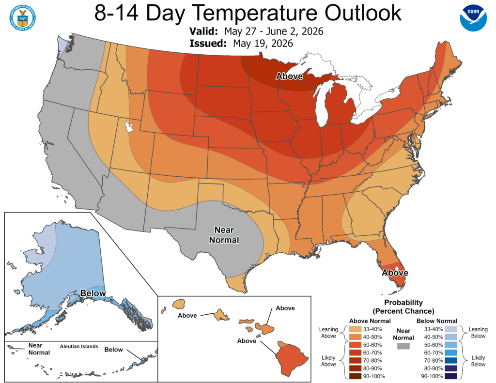
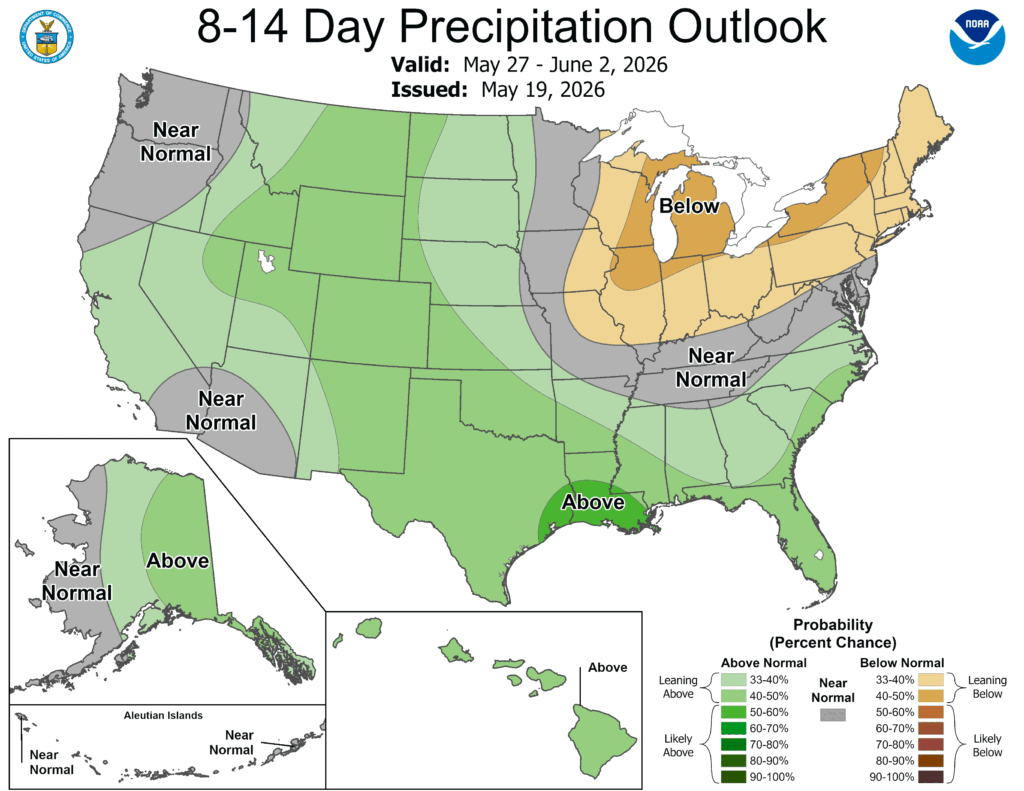
Over the next two weeks or so, the CPC is forecasting that our temperature and precipitation probabilities are leaning above normal. Boo temperatures! The reason we are seeing these above-normal temperatures with above-normal precipitation outlooks is that the overnight temperatures are not cooling down as much as they would normally.