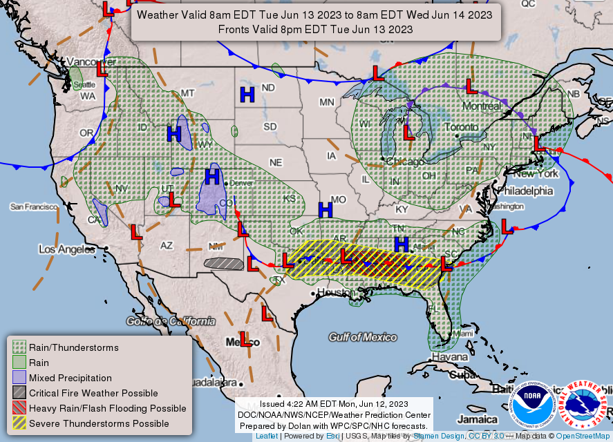
Similar to yesterday, most of our area will have the potential to see more severe thunderstorms, as a stationary front remains draped across northern Louisiana, central Mississippi, and central Alabama and will foster a severe threat over the next couple days.
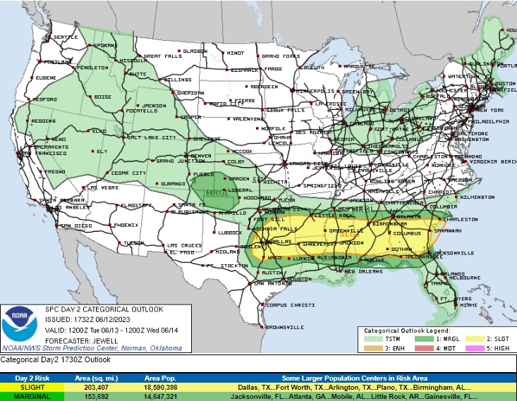
For this region the Storm Prediction Center currently has most of us under a Slight Risk (level 2/5) for severe thunderstorms today. These storms will bring mostly a large hail (up to golf balls sized) and damaging wind threat (60+ mph), although a tornado cannot be ruled out with any of these storms. Further south towards the coast, the severe threat is still evident, but not quite as high as up north. Current thinking is that storms will move in from the northwest and enter the area by around 8am before exiting around 3pm. Heading into the overnight hours, skies look to remain clear until tomorrow morning.
Extending into tomorrow, severe thunderstorms will be possible once again, but will be shifted slightly eastward compared to today. All hazards will be possible again, with large hail and damaging winds being the primary concern. Timing on these storms puts scattered development around 6am before advancing eastward and exiting the area by the evening. Following the exit of the first round of convection, a second round of storms may develop as the stationary front begins to advance southward. These storms may also pose a severe threat with the aforementioned hazards possible.
Beyond Wednesday and into the weekend, the region of high pressure down in the Gulf looks to sit idle and keep us under a northwest flow regime aloft. This, coupled with the stationary front draped across the southern US, will help continue to foster showers and thunderstorms across the area.
Temperatures throughout the rest of the week and into next week will continue to be very hot and humid, as is on par for this region this time of the year. Highs look to reach regularly in the mid to upper-90s, with heat indices clearing the century mark during this time as well. The highest of these temperatures/heat indices being in southwestern Mississippi and central to eastern Louisiana.
It will be important to be sure and take care of yourself throughout the coming days to avoid heat stress and other various heat-related illnesses. Sporadic relief may come in the form of pop-up showers and thunderstorms during the afternoons, but otherwise, take breaks from doing strenuous activities and keep yourself well hydrated.
REGIONAL DAY-TO-DAY FORECAST
Today: Mostly cloudy. Chance of scattered showers and thunderstorms in the morning before calmer conditions in the afternoon and evening. Some of these storms may be severe. High temperatures in the upper 80s to low 90s. Winds out of the southeast at 5 to 10 mph. Chance of rain 50%
Tonight: Mostly cloudy. Chance of a thunderstorm or two before midnight. Low temperatures in the low 70s. Winds out of the southwest at 5 to 10 mph. Chance of rain 30%.
Wednesday: Mostly sunny. Chance of scattered showers and thunderstorms in the morning before clearing out in the afternoon. Some of these storms may be severe. High temperatures in the upper 80s to low 90s. Heat indices may reach up to 100 degrees. Winds out of the southwest at 10 to 15 mph. Chance of rain 40%.
Wednesday night: Partly cloudy. Chance of scattered showers and thunderstorms in the evening. Some of these storms may be severe. Low temperatures in the mid to upper 70s. Winds out of the southeast at 5 to 10 mph. Chance of rain 50%.
Thursday: Partly cloudy. Showers and thunderstorms likely throughout the afternoon. High temperatures in the upper 80s to low 90s. Winds out of the east at 5 to 15 mph. Chance of rain 70%.
Thursday night: Mostly clear. Chance of showers and thunderstorms before midnight. Low temperatures in the low 70s. Winds light and variable. Chance of rain 30%.
Friday: Mostly sunny. Chance of showers and thunderstorms throughout the day. High temperatures in the mid to upper 90s. Heat indices may reach up to 105 degrees. Winds out of the southeast at 5 mph. Chance of rain 30%.
Friday night: Mostly cloudy. Chance of thunderstorms throughout the overnight hours. Low temperatures in the low to mid 70s. Winds light and variable. Chance of rain 30%.
Saturday: Mostly sunny. Chance of showers and thunderstorms throughout the day. High temperatures in the mid to upper 90s. Heat indices may reach up to 105 degrees. Winds out of the southwest at 5 to 10 mph. Chance of rain 40%.
Saturday night: Partly cloudy. Slight chance of showers and thunderstorms overnight. Low temperatures in the upper 70s. Winds out of the southwest at 5 mph. Chance of rain 20%.
Sunday: Partly cloudy. A stray shower or thunderstorm is possible. High temperatures in the upper 90s. Heat indices may reach up to 105 degrees. Winds out of the southwest at 5 to 10 mph. Chance of rain 20%.
Sunday night: Mostly clear. Low temperatures in the mid to upper 70s. Winds out of the southwest at 5 mph.


