Since the talk of the town has been about the rain coming in tomorrow and maybe even Tuesday, I figured I’d give a bit of a breakdown as to what we could expect. The SPC has been looking into tomorrow’s possible severe weather which means that we may be in for more than just a line of thunderstorms.
Monday

First of all, let’s look at the sounding for tomorrow. While the dewpoint might look a bit extreme, it’s no doubt high enough so we can reach saturation later on in the day. A low LCL and LFC also indicates low cloud development (typically cumulus for this time of year). Along with this, we also have a closed dry slot in the mid-to-upper levels that could help with some downbursts and lightning development.
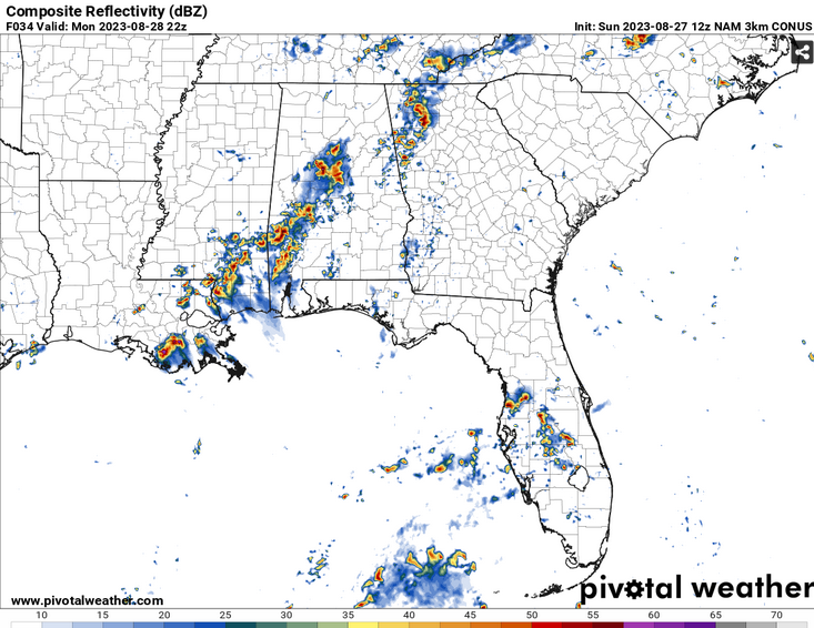
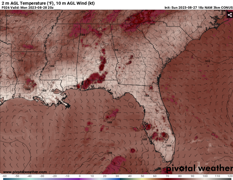
Looking at the surface tomorrow afternoon, it’s not too hard to see where the cold front is. Down in the Gulf, the winds are pulling from the south southeast bringing in moisture into the AL/FL/MS coastline. Partner this with the northern/north northwestern winds upstate, we have a pretty good sign of some storms that can spark, especially close to the coast.
With some of the parameters I mentioned earlier, after these storms start to mature, they will likely cause downbursts due to the outflow from the storm. Our main concern for tomorrow’s severe threat is high winds, which can be up to 50 mph. The timeline of these storms will begin about mid-afternoon and continue on into nighttime.

The main amount of rain we’ll likely receive is about a quarter to half an inch. Some areas may get more depending on how strong the thunderstorms are.
Tuesday

Tuesday’s Skew-T looks pretty good, but not as impressive as Monday’s. The cold front is still moving south towards the coastline at this point, however, Idalia may have a say in what we really get out of the cold front.

With the cold front moving over us and less of a southerly influence from the Gulf, we will still see a bit of rain, but not as much as Monday. Localized areas may see possibly a half inch, but most will see around a tenth to a quarter of an inch throughout most of the day. Storms will spark off around the early afternoon and continue on into the evening hours.

[wpcode id=”41179″]
Regional Day-to-Day Forecast
Tonight – A 40 percent chance of showers and thunderstorms, mainly before midnight. Partly cloudy, with a low around 75. North northwest wind around 5 mph becoming calm in the evening.
Monday – Showers and thunderstorms, mainly in the afternoon. High near 98. Heat index values as high as 107. Calm wind becoming northeast around 5 mph in the afternoon. Chance of precipitation is 80%. New rainfall amounts between a quarter and half of an inch possible.
Monday Night – Showers and thunderstorms, mainly in the evening. Low around 73. South wind around 5 mph becoming calm in the evening. Chance of precipitation is 80%. New rainfall amounts between a quarter and half of an inch possible.
Tuesday – Showers and thunderstorms likely in the afternoon. Partly sunny, with a high near 90. Heat index values as high as 101. Calm wind becoming north around 5 mph in the afternoon. Chance of precipitation is 70%. New rainfall amounts between a tenth and quarter of an inch, except higher amounts possible in thunderstorms.
Tuesday Night – Showers and thunderstorms likely, mainly in the evening. Partly cloudy, with a low around 72. North wind around 5 mph becoming calm in the evening. Chance of precipitation is 60%. New rainfall amounts of less than a tenth of an inch, except higher amounts possible in thunderstorms.
Wednesday – A 30 percent chance of showers and thunderstorms, mainly after noon. Mostly sunny, with a high near 91. Light north wind increasing to 5 to 10 mph in the morning. Winds could gust as high as 20 mph.
Wednesday Night – A 20 percent chance of showers and thunderstorms before midnight. Mostly clear, with a low around 71. North northeast wind around 5 mph becoming calm in the evening.
Thursday – A 20 percent chance of rain and thunderstorms after noon. Sunny, with a high near 93. Calm wind becoming north northeast around 5 mph.
Thursday Night – Mostly clear, with a low around 72. East southeast wind around 5 mph becoming calm in the evening.
FridayA slight chance of showers, then a chance of showers and thunderstorms after noon. Sunny, with a high near 95. Chance of precipitation is 30%.
Friday Night – Mostly clear, with a low around 74.
Saturday – A 20 percent chance of rain and thunderstorms. Sunny, with a high near 96.
Saturday Night – Mostly clear, with a low around 75.
Sunday – A 20 percent chance of showers and thunderstorms. Sunny and hot, with a high near 98.
[wpcode id=”41149″]


