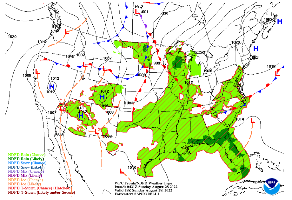
Hello everybody, there will be a low-pressure system in Northern Great Plains as it will be moving to the Midwest for heavy rainfall. Meanwhile on Sunday the monsoon moisture will continue go to the four corner states to develop any scattered thunderstorms and showers to appear throughout the day. Then for the next place that have a chance for heavy rainfall will be occurring at Florida. The cause of this will be the dirmual heating to have an increase convection to develop scattered thunderstorms at Florida.
On Sunday, there will be a warming trend starting to happen as the warm front from the Midwest and Ohio valley will start to move up north to the East coast and Northeast. This will cause for the temperature will be above normal for the next few days. Out west, there will be signs of a high-pressure ridge starting to build up again to slow down the monsoon weather activity.
SUNDAY 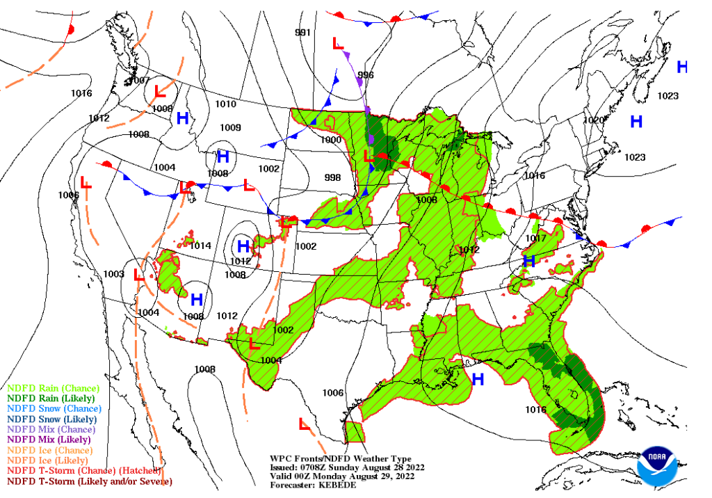
MONDAY
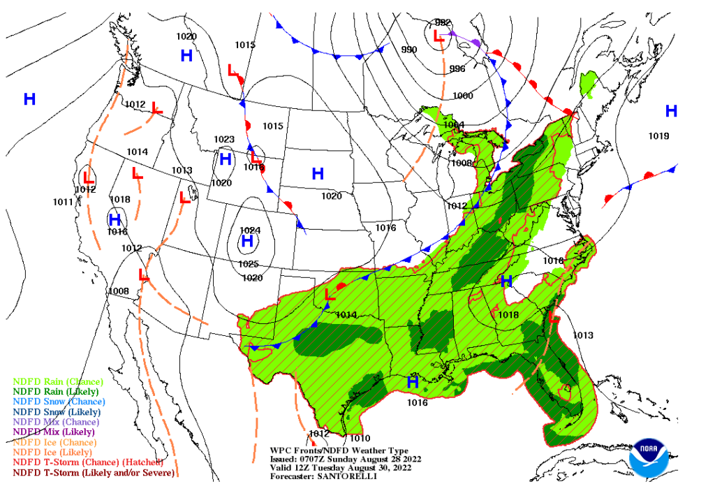
On Tuesday, there will be a cleaner picture on what going to happen as there will be more storms activity will be happening in Eastern United States. There will be a strong cold front to cool down the eastern part of the country from the warm front on Sunday and Monday.
Out west, it will be starting to get worse as there might be no precipitation will be happening on Tuesday. The multiple high-pressure systems are getting stronger and providing warmer temperatures in the west and Northern Great Plains.
CONUS short-term warming pattern and mid-week cool down
After looking at the forecasting maps, here will be the temperature anomaly will show the huge temperature swings will be happening in the United States. In the west, the temperatures will be staying above 8 F up to 15 F degrees or more above its average temperature for the rest of early next week. It will be almost a similar situation for the Northeast as it will be above 5 F up to 15 F degrees above their average temperatures on Sunday and Monday. There will be cold relief on its way from the Midwest to the Northeast to bring those temperatures back to normal for the middle of next week from the cold front. Sadly, it won’t last long for the folks in Northern Great Plains as the warm air from the west will fill up the void after the cold air leaves the area for warmer temperatures.
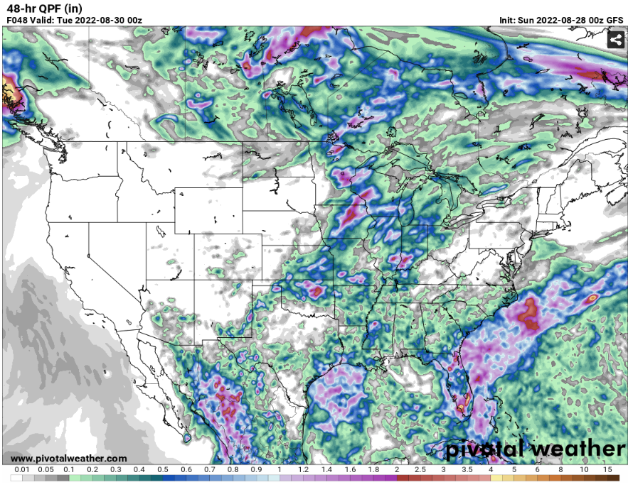
CONUS Precipitation
Now, let’s look on the which places will get some good amount of rainfall in the next few days. The Midwest and Central Great Plains will get considerable good amount of rain fall in the next 48 hours. The estimate rainfall for those places will be getting at least .02 up to 2.5 inches of rain. There will be moisture coming from the Gulf of Mexico will be help developing any thunderstorms and showers to the Southeast to provide some rain at least .2 to 1 inch of rain.
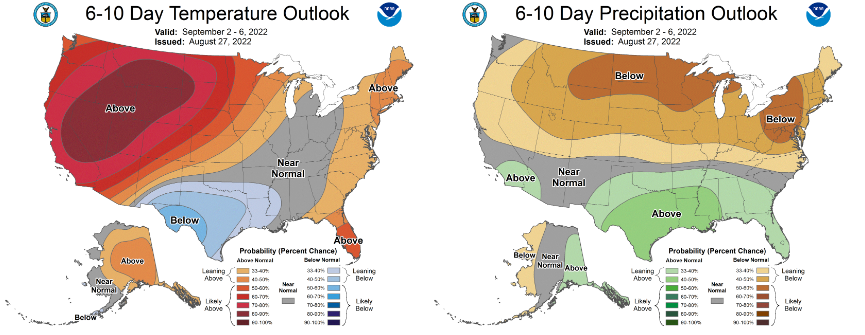
6–10-day Temperature and Precipitation Outlook
The Climate prediction center have updated the new 6-10 days temperature and precipitation outlook. It seems like in the west will be under a heat wave for a while in early September. The above precipitation outlook might be accurate with the hurricane season getting closer to its peak months.