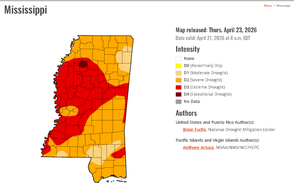
After the major dry spell we’ve had in the past several months, we’re flipping the table. Rain! Rain everywhere! Eh, well mostly. A stationary front latched onto a low pressure system in Canada will contribute to our first few rounds of rain while an influx of Gulf moisture behind the front will move more rain into our area this weekend.

Today
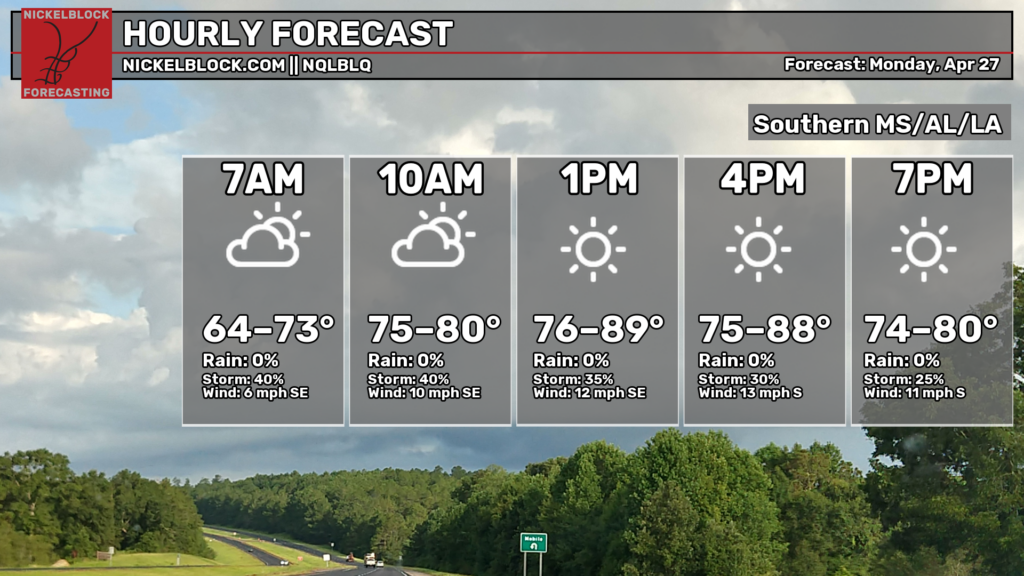
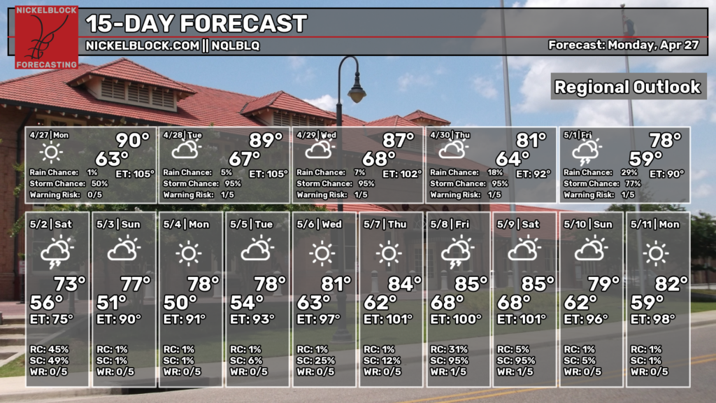
We’re starting off today with some low level clouds and fog in some areas with temperatures in the 70s. As we go on through the day, it’s going to be very warm with winds blowing out of the south contributing to the humidity. Highs will be in the upper 80s to 90 in some areas. The rain will stay to our north today. Overnight, we’ll reach the mid 60s.

Tomorrow
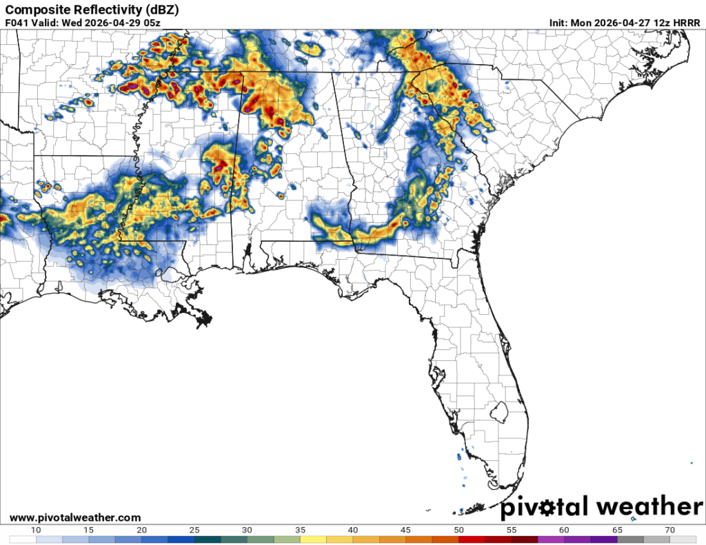
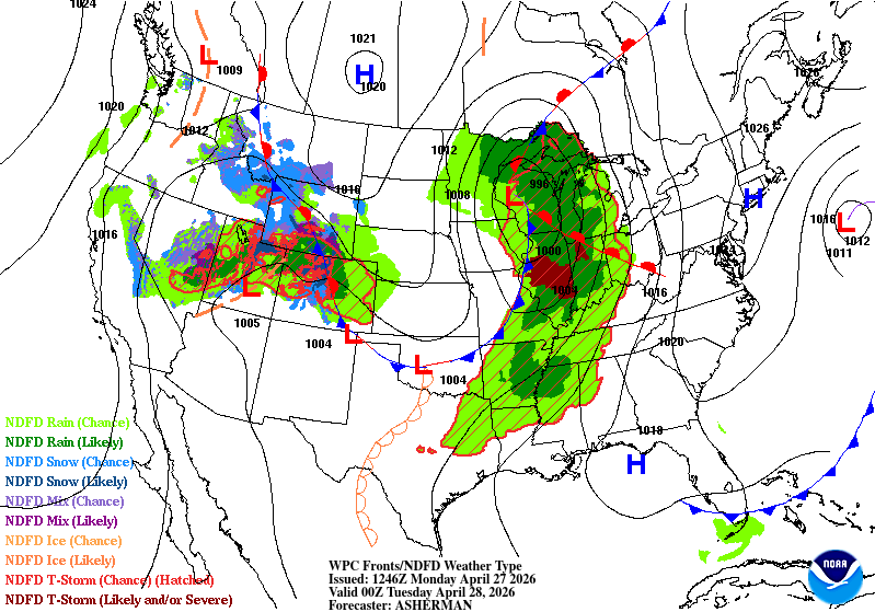
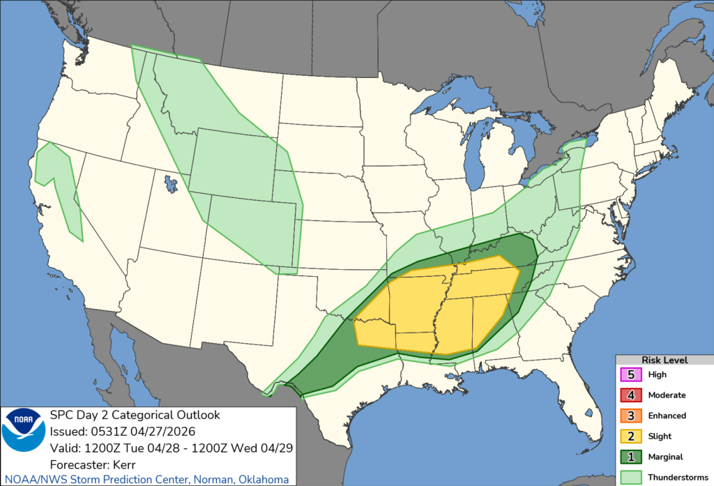
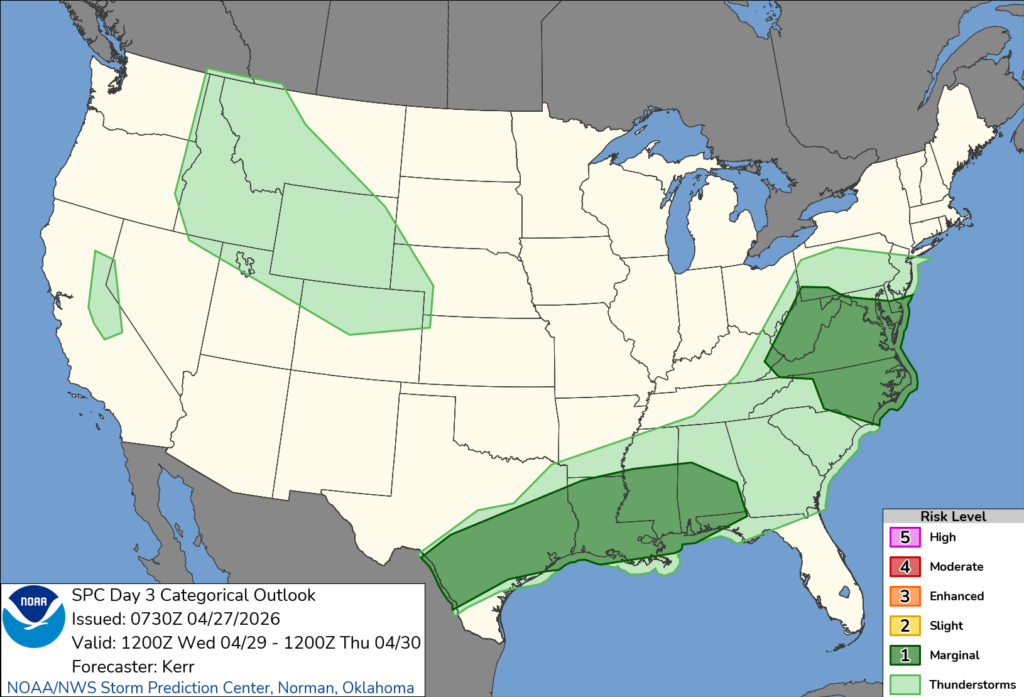
By tomorrow, two rounds of thunderstorms are possible across much of the South. Our first round will be in the afternoon with most of the storms in the northern part of the Pine Belt and along I-20. Our second round will move in before midnight with a cluster of scattered thunderstorms. The SPC has placed a slight risk (2/5) for much of the Mississippi River Delta along with its northern neighbors, so expect a few severe storms during the day. Most of the risk will be to our north, however a few strong cells may spawn in our area. So far, our largest risk looks to be high winds and hail. A 2% tornado risk is also in the cards but will be conditional.
Otherwise it’s going to be another warm day with a high in the upper 80s. Patchy fog is possible in the morning and clouds will move in by midday. Overnight, the low will fall into the upper 60s with winds out of the South.
Wednesday
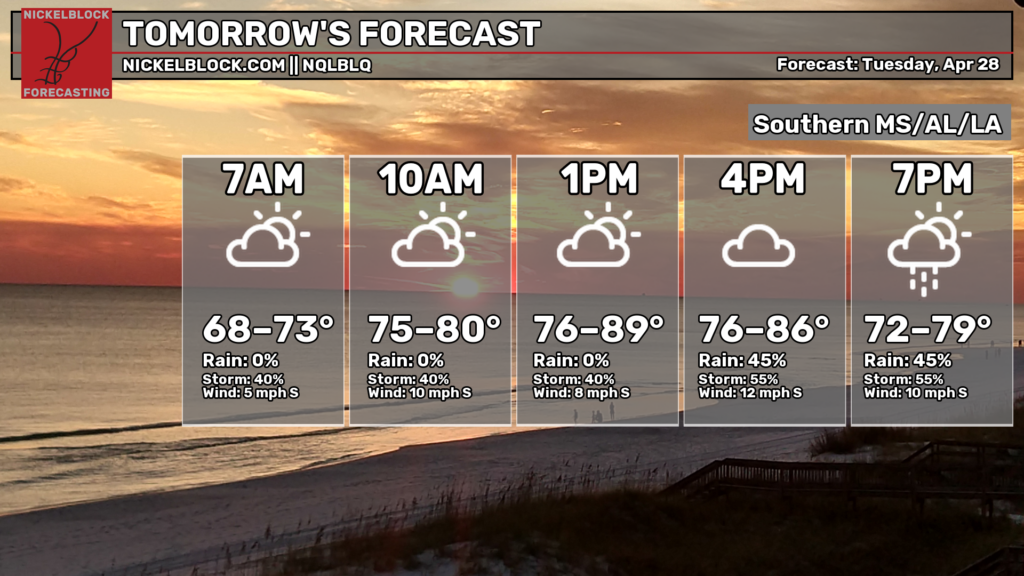
Hump Day! Another warm and humid one with rain and thunderstorms possible again. These will pick up during the afternoon and remain until the early evening before another round moves in overnight. The SPC has placed a marginal risk (1/5) for much of the coastal South, and we’ll have similar risks to Tuesday. Highs will be in the upper 80s with winds out of the southwest. Overnight, temperatures will fall into the low 70s.
Thursday and Friday
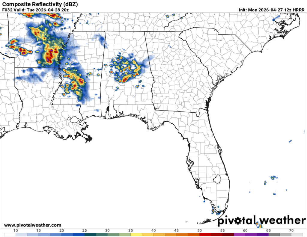
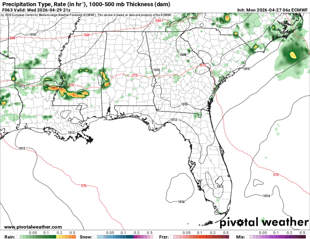
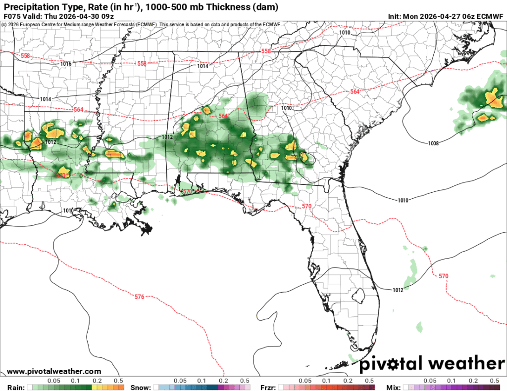
Over the next few days, the weather pattern will shift due to the frontal passage on Thursday. As the front hugs the coast, the moisture and high dewpoints will remain in the Gulf and still bring in enough moisture to rain us out on the weekend. Expect some coastal showers and thunderstorms to develop as they pull in from the southwest and move east towards the AL/LA/MS coast.
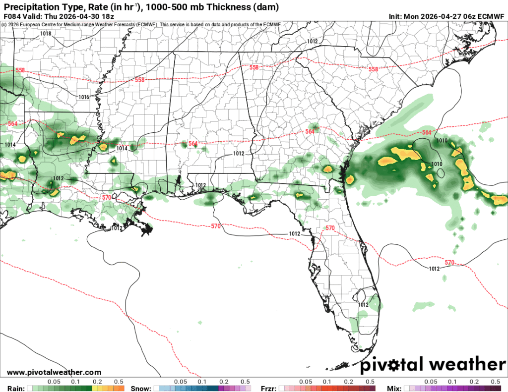
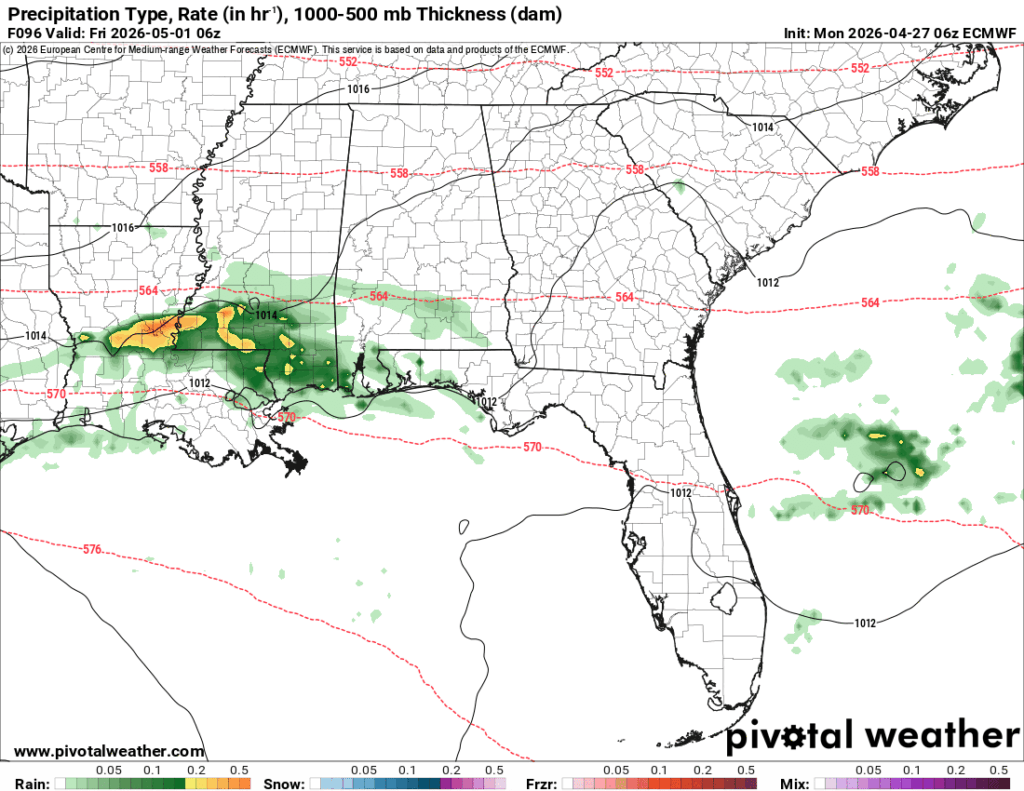
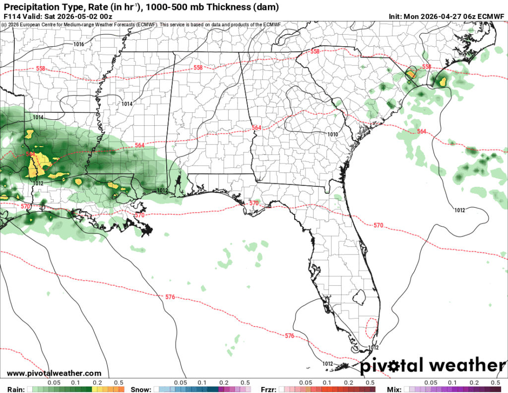
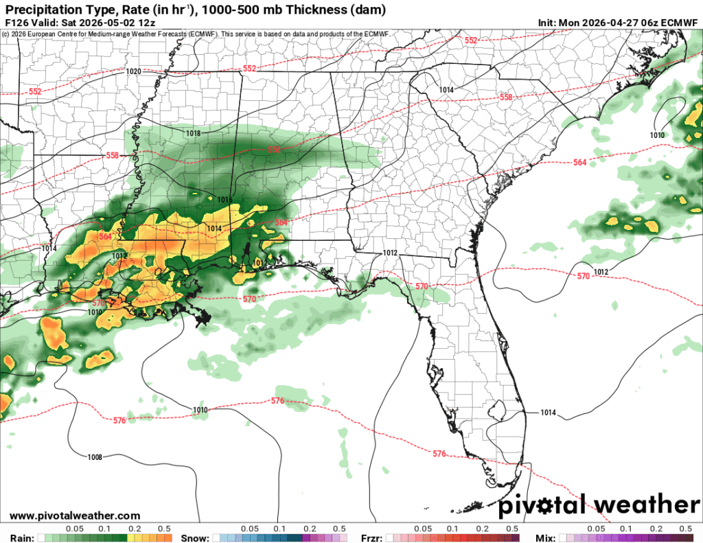
Precipitation rate from the ECMWF model on Thursday-Saturday //Courtesy: Pivotal Weather
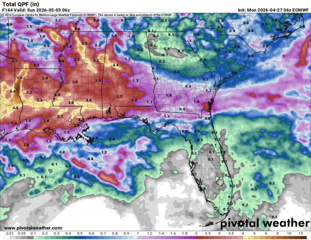
The good news is that our overall totals for the next several days will exceed 3 inches of rain, so we’re getting out of this drought slowly but surely! Some other good news is that the temperatures begin to drop starting Thursday! The bad news, well, it might rain out your plans on Saturday.


‘So, Ya Wanted Rain?’ …. NO, we did not. Who/what gave you ‘that’ idea? Too much, too fast.