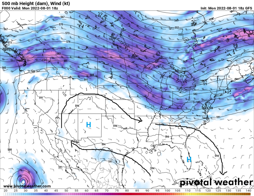
In what is the norm for this part of the country at this time of year, days of sunshine with intermittent rounds of showers and thunderstorms will pave the way for us for the coming days. High pressure will remain steadfast aloft in the upper levels, which will help to keep the current pattern of weather around by blocking any sort of pattern change or system from coming through. That’s not to say we will be completely devoid of all weather hazards, as these repeated rounds of rain may start to cause flooding concerns due to the already saturated ground.
Temperatures will remain very seasonal throughout the coming days. Daily high temperatures will mostly remain in the upper 80s to low 90s in the day and upper 70s at night. Heat indices may reach the century mark during the day but should remain below the temperature warranted for a Heat Advisory.
Rainfall will make a constant appearance each day throughout much of the coast. Very deep moisture will continue to sit over us and help provide the water needed to fuel these storms. PW values ranging from 1.75 inches to 2.25 inches will help to ensure some of these storms are very efficient rainfall producers, which could in turn cause a localized flood threat due to the level of soil saturation already present. Strong wind gusts and frequent lightning will also pose a risk to those who see these storms during the day.
Below is one model run of the total amount of rainfall we could possibly see over the next week. The higher values in yellow indicate the possibility of 4 inches or greater.

Day to Day Forecast
Tuesday
Mostly cloudy skies, with showers and thunderstorms likely. High temperatures in the upper 80s to low 90s. Heat indices may reach up to 100°F. Low temperatures in the upper 70s. Chance of rain 90%.
Wednesday
Partly cloudy skies, with showers and thunderstorms likely. High temperatures in the upper 80s to low 90s. Heat indices may reach up to 100°F. Low temperatures in the upper 70s to low 80s. Chance of rain 80%.
Thursday
Mostly cloudy skies, with showers and thunderstorms likely. High temperatures in the mid 80s to low 90s. Low temperatures in the upper 70s to low 80s. Chance of rain 80%.
Friday
Partly cloudy skies, with a chance of showers and thunderstorms. High temperatures in the upper 80s to low 90s. Low temperatures in the upper 70s to low 80s. Chance of rain 40%.
Saturday
Partly cloudy skies, with a chance of showers and thunderstorms. High temperatures in the upper 80s to low 90s. Low temperatures in the upper 70s to low 80s. Chance of rain 50%.
Sunday
Mostly cloudy skies, with a chance of showers and thunderstorms. High temperatures in the upper 80s to low 90s. Low temperatures in the upper 70s to low 80s. Chance of rain 40%.
Monday
Partly cloudy skies, with a chance of showers and thunderstorms. High temperatures in the upper 80s to low 90s. Low temperatures in the upper 70s to low 80s. Chance of rain 60%.


