There may be a slightly better shot for rain today than originally anticipated. And it may be even higher than I have inthe forecast below. The overall pattern should support some stronger storms, too, with brief heavy downpours, localized (and very brief) flash flooding, frequent lightning, and even some small hail.
Tomorrow, things should go back to ‘typical’ in terms of the storm potential.
That said, both days will also feature a Heat Index up over 105. So if you have to be working outside, or you know someone without easy access to Air Conditioning, please make sure they are getting plenty of water and they take plenty of breaks from any physical activity.
In the Tropics
Down in the Tropics, Fred is now a thing. The TRopical Storm formed overnight and will be crossing Haiti during the day today. It will bring the island some heavy rain and gusty wind. So far, it isn’t as well organized, so that will limit the potential threat to Haiti.
As if continues to move to the wester-=northwest, it will eventually become a concern for Florida. And it is forecast to move into the Gulf of Mexico.
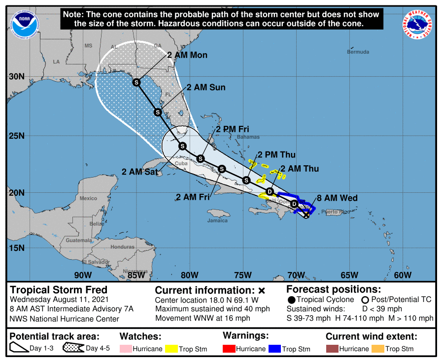
The current tack takes it up the west coast of Florida.
Though, many folks in south Mississippi may be thinking, “I’ve heard that before” And speaking of ‘that’ on this day in weather history, the wave that would eventually become Hurricane Katrina was identified as Invest 96L. Brian McNoldy had a few great tweets talking about it.
The difference between today and 2005, has been well-documented on this site, so while it may send a chill up your spine to see/hear things like the forecast above, please know that the forecasts themselves have improved dramatically in 16 years.
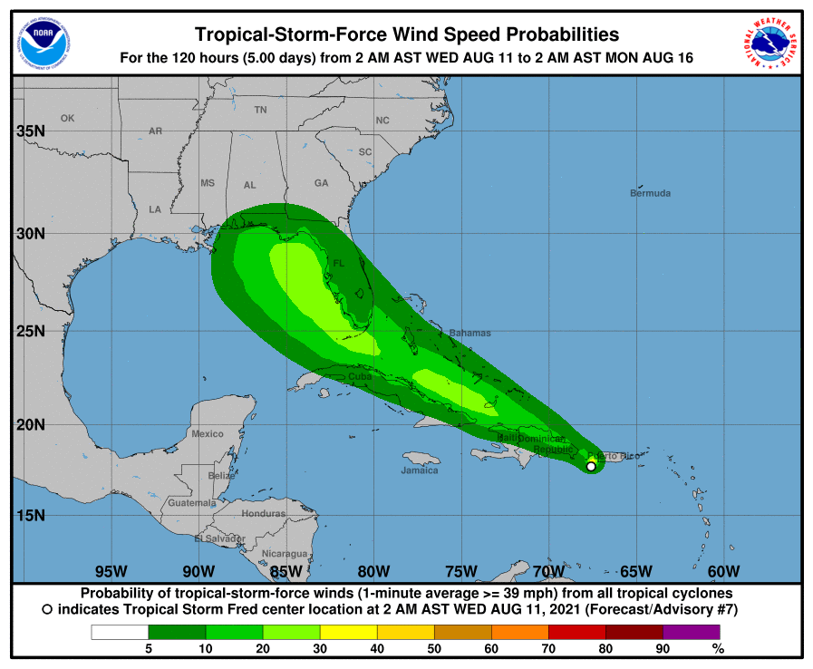
Speaking of the forecast guidance, here is a look at it, thanks to Levi over at Tropical Tidbits.


There is a bit of a sag to the west and southwest in the guidance during the last 24 hours, as well as a bump to the overall potential strength of the system. That said, if it continues on the southerly track, it will drag across Haiti, the Dominican Republic, and Cuba. And that will really, really limit the organization of the system.
But that will also allow it extra time in the Gulf to eat up all the warm bath water. And there is a healthy amount of it, if the storm pushes far enough to the west.

But the chances that it pushes THAT far to the west are very, very, very low. Not zero, sadly, but pretty low.
It will really depend on how the two competing areas of high pressure dance around. One is near Bermuda (the Bermuda high) and the other is out over West Texas.

Fred is most likely going to ride between the ridges in the area that is the path of least resistance. If one dances to the west or east a bit more, it will impact the eventual track. That is why there is a forecast “cone” and not a forecast “line” as there is a bit of wiggle room to the forecast that far out in the future.
Day-to-Day Forecast
Today
Partly cloudy with a chance for afternoon storms. Highs in the lower 90s. The chance of rain 50-percent. Heat Index values will top out around 105.
Tonight
Partly cloudy. Lows in the lower 70s.
Thursday
There may be a bit of fog in the morning. Then, partly cloudy by afternoon with a chance for a few storms. Highs in the lower 90s. The chance for rain will be about 40-percent. Heat Index values will peak around 106.
Thursday Night
Partly cloudy. Lows in the lower 70s.
Friday
Partly cloudy with a 40-percent chance for afternoon storms. Highs in the lower 90s. Heat Index values around 105.
Friday Night
Partly cloudy. Lows in the lower 70s.
Saturday
Passing clouds with some showers and storms possible. Highs in the mid 90s. The chance of rain 30-percent.
Saturday Night
Partly cloudy. Lows in the lower 70s.
Sunday
Passing clouds. Highs in the lower 90s. The chance of rain 30-percent.
Sunday Night
Partly cloudy. Lows in the lower 70s.
Monday
Mostly cloudy by afternoon with showers and storms possible. Highs in the lower 90s. The chance of rain 50-percent.
Monday Night
Partly cloudy. Lows in the lower 70s.
Tuesday
Mostly sunny with a few storms possible. Highs in the lower 90s. The chance of rain 30-percent.


