The threat for severe weather and flooding remains for south Mississippi on Thursday and into Friday morning. As an area of low pressure moves northwest through Texas, Oklahoma and Kansas, it will push two rounds of rain through parts of the Gulf coast. The first round will slow to a halt and fall apart across parts of Mississippi. The second will pick up in Louisiana and push all the way through the Gulf Coast and toward Georgia.
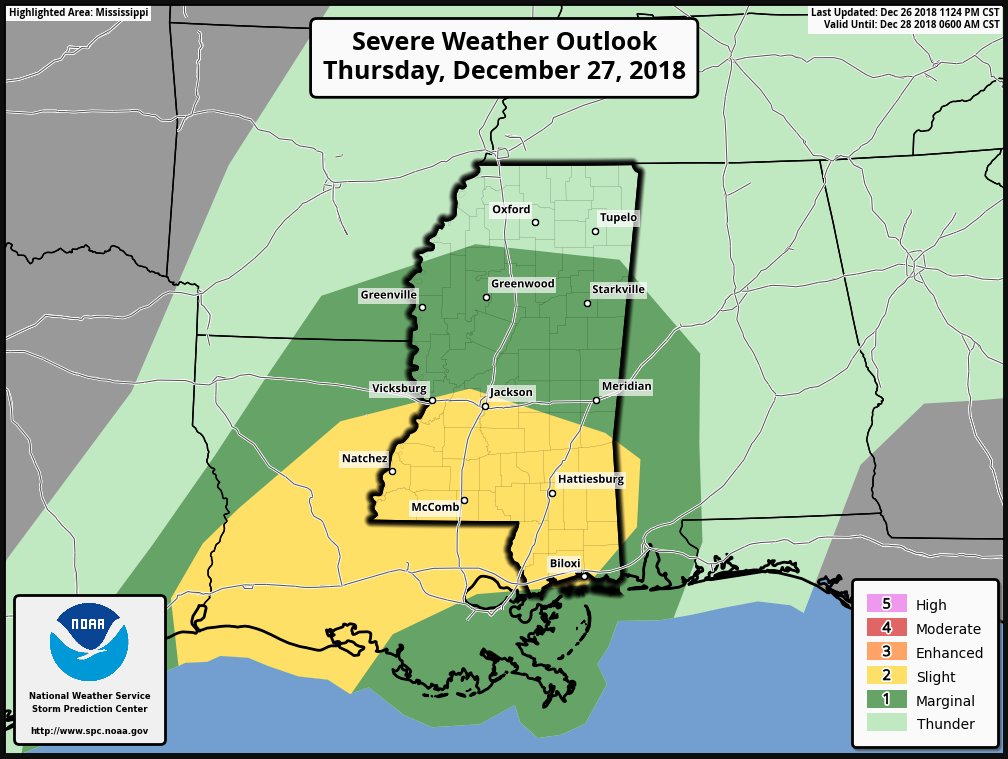
The Storm Prediction Center has south Mississippi under a Slight Risk. And it only features a 2% tornado risk. That means that you are twice as likely to see a tornado on Thursday across south Mississippi than any other day.
Timeline
For south Mississippi rain will be off-and-on overnight Wednesday and into Thursday and through Thursday morning. The rain will be generally light to moderate. And nothing severe is expected during this time.
The onset of severe weather for south Mississippi will be between 1pm and 3pm on Thursday. The threat for severe weahter will linger through 11pm that night. And then pick back up again after 4am on Friday morning.
Here is a quick peek at the severe weather threats for tomorrow. We are most concerned about flooding, but can’t rule out some damaging wind and a tornado or two. pic.twitter.com/35vtkh5dr8
— Nick Lilja (@NickLilja) December 26, 2018
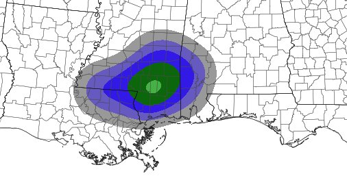
This graph from Wednesday afternoon still holds true after looking at the late-night computer model data. The Karrie Meter is holding at a 3.50.

Threats
The biggest concern is for heavy rain and localized flooding. Also, look out for frequent lightning, wind gusts in excess of 50mph and the possibility for a few brief tornadoes.
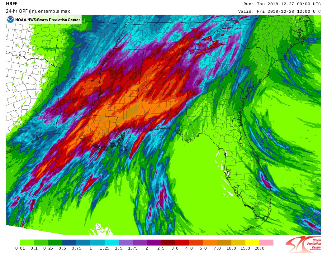
The 00z data from the HREF Ensembles shows a bulls eye over Lamar, Forrest and Perry counties for the strongest Updraft Helicity. Recall that UH is a measure of how much spin an updraft in a thunderstorm has. This is a good indicator for where the potential for the strongest storms will be. And, in some cases, where the formation of tornadoes may be most likely.
In this case, with the tornado threat being on the lower end, I’m not rady to say, “this is where the tornado ill be!” but it does mean that while watching the radar for rotating supercells, it will be prudent to watch storms in this area a bit closer.
The biggest concern, though, really, is rain. The area is forecast to pick up between 2″ and 4″ of rain. With some spots receiving as much as 6″ of rain.
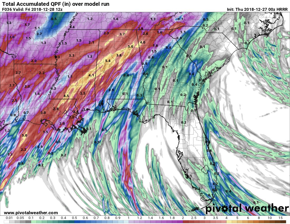
Earlier tonight, the WSI RPM model was showing up to 9″ of rain possible for parts of south Mississippi. As I said on television tonight, I think that is a bit much. However, it wouldn’t surprise me to see somewhere in south Mississippi pick up more than 6″ of rain.
The HREF Ensembles came back with equally as astounding numbers:
That is a 7″ to 10″ slice across parts of south Mississippi between Poplarville and Leakesville.
Some cool stuff
Something really fascinating is happening in the atmosphere. Unfortunately, it is causing for some extra uncertainty in the forecast for South Mississippi.
That is the area of low pressure moving through the southern plains that will push a cold front through south Mississippi. But the explosion of storms that you see in the middle of that water vapor loop is just a cold pool of air up between 10,000 and 20,000 feet that got shoved out over west Texas. As it was kicked out, the warm moist air underneath it surged up and blossomed into storms.
Totally awesome.
That explosion of storms started to slide east. And it will continue to slide east until it gets to south Mississippi. That is when it will slow to a halt – somewhere between Louisiana and Alabama. Exactly where is still a bit of an unknown. But where ever it ends up will likely be the area that receives the most rainfall tomorrow evening and into the overnight hours.
Because coming in behind that decaying line of storms will be the actual cold front with another developing line of storms. And more rain. That will swing through south Mississippi between 2am Friday morning and 7am Friday morning.
Once that passes through Mississippi, the threat for severe weather will end.


