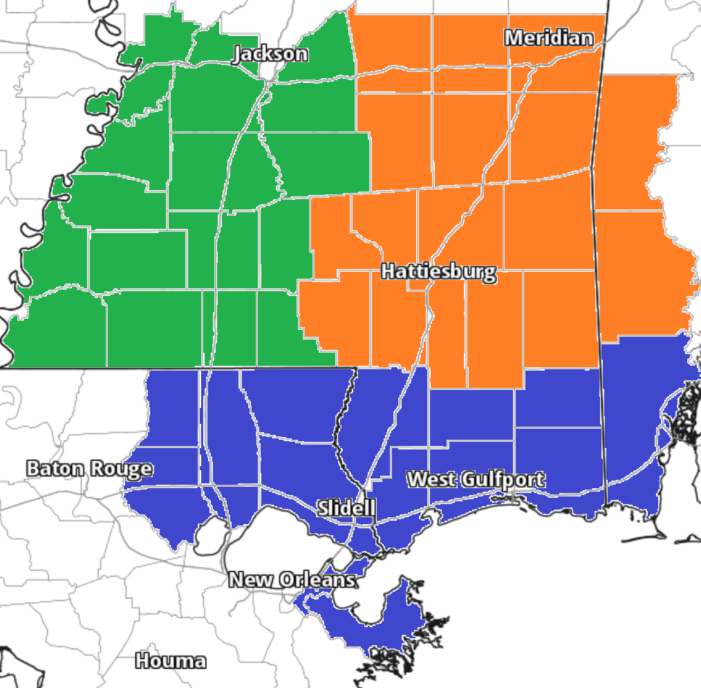
This page is your one-stop shop for forecasts for southeast Mississippi and Southwest Alabama. Forecasts are produced by our team of interns. This page will be updated with a new forecast, nearly, every day. the counties covered with these forecasts are highlighted in orange on the map below.
If you live in the area and want easy access to these forecasts, don’t forget to bookmark the page. And you can even add it to the home screen of your phone! (for more info on how to do that, click here)!
Latest Forecasts
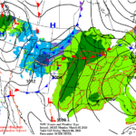
- New Changes to SPC Severe Weather Outlooks – 3/5/26
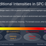 Hey everyone! As we head into severe weather season, I wanted to update you all on the new severe outlooks from the SPC, which include cleaner graphics and some changes to how storm intensity is shown within the outlooks. Before you read on, just note that the graphics I’m sharing below are not current or…
Read more of New Changes to SPC Severe Weather Outlooks – 3/5/26
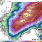
- Severe Thunderstorm Potential on Saturday: Southern MS/AL/LA Local Weather Forecast – 3/5/26
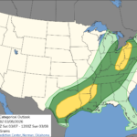 Severe Outlooks Ahead It seems like each time there’s a severe weather event, it occurs on the weekend. Don’t feel left out, the same thing happens in Jersey, it only snows on the weekend! Just in time for the new SPC graphics, there’s a good chance of severe thunderstorms tomorrow in the areas in Tornado…
 - Warm Mid-Week Followed by Soggy Weekend – Weekend Forecast for South MS/LA/AL 3/4/26
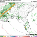 The good news is that the air quality has improved over the past couple of days! There still are some that may be affected by the current conditions, though. The next few days are going to be much warmer than average, and southerly winds will contribute to the incoming moisture flow for the rounds of…
Read more of Warm Mid-Week Followed by Soggy Weekend – Weekend Forecast for South MS/LA/AL 3/4/26
- Increased Rain Chances and Keeping Temps in the 80s: Southern MS/AL/LA Local Weather Forecast – 3/3/26
 Overall Setup Over the next week, there will be increased rain chances and certainly more clouds around. An active pattern is taking shape in the southern Plains and Midwest, and though we will not see as much rain as our neighbors, we will see some of the action. Severe weather looks to be an issue…
 - Warm Week Ahead with Air Quality Problems for Some – Week Ahead Forecast for South MS/LA/AL 3/2/26
 It’s gonna be a warm start to March! We’re going to be in the low 80s for the next few days before some rain chances come in closer to the weekend. Low temperatures will also increase as southerly winds will dominate and increase the inflow of Gulf moisture and close the diurnal temperature range. Air…
National Weather Service Products
Interactive Radar
Regional Forecast Maps
Storm Prediction Center Outlooks


National Hurricane Center Outlook


