Things are just starting to pick up for the region.
Latest from the SPC is that they are monitoring just west of our area (including perhaps some of our western counties – for a potential Watch. It looks like they would be leaning toward a Severe Thunderstorm Watch, but a Tornado Watch would also be possible.
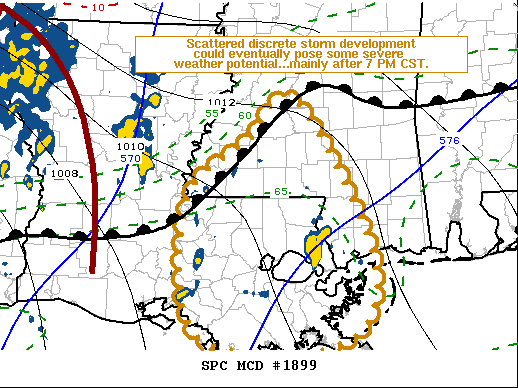
Here is a look at the discussion from the SPC:
Probability of Watch Issuance…40 percent
SUMMARY…
Increasing discrete thunderstorm development is underway across the region. This could eventually pose increasing potential to produce a tornado and/or damaging wind gusts, but it is not yet clear that a severe weather watch will be needed, at least prior to around 6-7 PM CST.
DISCUSSION…
To the south of a strengthening warm frontal zone, surface dew points have increased into mid 60s to near 70F across much of southeastern Louisiana, and currently as far north as the McComb MS vicinity. This has contributed to modest boundary-layer destabilization, with CAPE now generally on the order of 500+ J/kg.
Supported by large-scale ascent associated with lower/mid tropospheric warm advection, beneath increasingly difluent mid/upper flow, this has contributed to increasing discrete storm development. Some of the stronger cells have exhibited rotation, aided by strong deep-layer shear beneath 50+ kt southwesterly 500 mb flow. However, southerly low-level flow, though gradually strengthening, remains rather modest in strength.
More substantive intensification, including to 40+ kt around the 850 mb level, is not forecast to develop/shift across the lower Mississippi Valley until closer to the 01-03Z time frame. Once this commences, residual boundary-layer instability, coupled with enlarging clockwise-curved low-level hodographs, could pose at least some increase in potential for supercell structures capable of producing tornadoes.
However, until then, though perhaps not completely out of the question, this potential seems likely to remain relatively low.
SPC.NOAA.GOV
A few showers and storms have started to bubble up to the southwest and are lifting through the region.
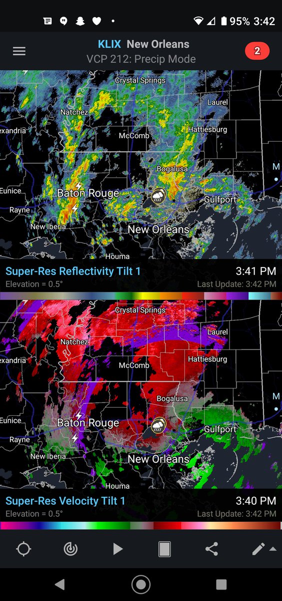
At this point there are a few little spots where broad rotation is present within some of the showers and storms, but nothing terribly organized. Given the environment, this is expected. There is a lot of shear in the atmosphere right now, so even a lot of the regular rain showers are going to show very broad rotation.
But so far, that is it, just some showers and regular storms. We will continue to monitor things and if a Watch is issued, let you know ASAP.


