Showers and storms are still in the forecast as we head through the overnight hours tonight and into tomorrow morning. The Storm Prediction Center still has sections of the region in a Marginal Risk for severe weather, given the potential for some of the storms to produce some wind gusts exceeding 60mph.

As of now, it looks like the potential for severe weather will be limited given that the boundary between the higher dewpoints and warmer temperatures will outrun the convection by tomorrow morning. Because this isn’t a ‘real deal’ cold front, it means that a cold pool diving toward the southeast doesn’t automatically mean storms developing along the leading edge.
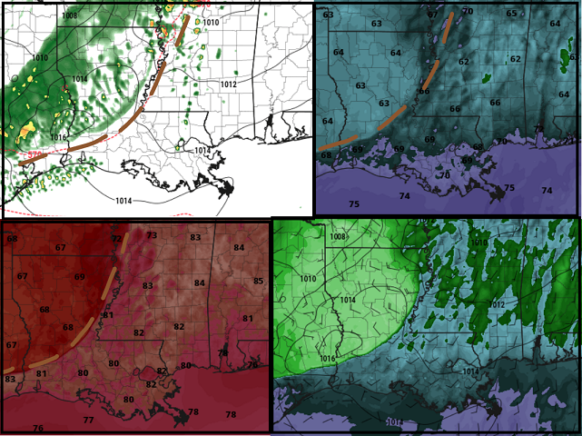
That lack of storms along the leading edge of the boundary should limit the chance for storms to be severe.
Beyond tomorrow, as we move into next week, things will be getting rather toasty across parts of the Southern MS/AL/LA region. As high pressure builds over the region, it will push temperatures into the 90s.

The area of low pressure off the east coast will slowly drift back toward Florida and Georgia. There is still some question about where it goes from there. The farther west it drifts, the more is would help to cool down temps across the area as we head toward next weekend.
Day to Day Forecast
Today
Some fog this morning. Then mostly sunny. Highs in the upper 80s.
Tonight
Mostly cloudy with some storms possible after midnight. Lows in the upper 60s. Chance of rain 30-percent.
Friday
Mostly cloudy with some passing storms in the morning. Then turning mostly sunny in the afternoon with another round of a you-can’t-quite-rule-it-out chance for rain. Highs in the upper 80s. Chance for rain in the morning is around 60-percent. Chance for rain in the afternoon is around 20-percent.
Friday Night
Mostly clear. Lows in the mid 60s.
Saturday
Sunny. Highs around 90.
Saturday Night
Mostly clear. Lows in the mid 60s.
Sunday
Sunny. Highs in the mid 90s.
Sunday Night
Mostly clear. Lows in the upper 60s.
Monday
Sunny. Highs in the mid 90s.
Monday Night
Partly cloudy. Lows around 70.
Tuesday
Sunny. Highs in the mid 90s.
Tuesday Night
Mostly clear. Lows in the upper 60s.
Wednesday
Sunny. Highs in the mid 90s.


