For the first time in – roughly – six months, South Mississippi is looking at a chance for organized severe weather. As a cold front moves through the Gulf Coast region, it will spark showers and storms – with enough background help from the atmosphere to support the potential for severe storms.

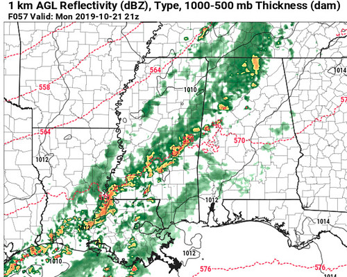
From the SPC
Severe thunderstorms are possible Monday across portions of the lower Mississippi Valley, into portions of the lower Ohio Valley, posing a risk for damaging wind gusts and perhaps a few tornadoes.

Rather amplified large-scale troughing over the interior U.S. may take on more of a negative tilt while progressing across the Mississippi Valley during this period. Smaller-scale embedded perturbations / developments remain more unclear due to sizable spread within model output, but it does appear that there may be substantive further deepening of the primary associated lower/mid-tropospheric cyclone. The center of this feature is expected to migrate from the mid Missouri Valley into the Upper Midwest Monday through Monday night, with an occluding surface front surging east of the Mississippi Valley toward the Appalachians.
Lapse rates within much of the moistening portion of the warm sector of the cyclone are generally forecast to remain weak, which may limit CAPE to around 500-1000 J/kg within a pre-frontal plume across the lower Mississippi Valley into the lower Ohio Valley.
South to southwesterly lower/mid tropospheric flow may include 50-70 kt at 850 mb, and 70-90+ kt at 500 mb, but there may be a tendency for the strongest deep-layer mean wind fields to shift north of the destabilizing warm sector early in the period.
Still, there appears potential for the environment to become conducive to the development of a combination of one or more broken lines of storms and discrete supercells, particularly during the day Monday across Louisiana, Mississippi, and adjacent portions of southeast Arkansas and western Alabama, into portions of middle Tennessee, which probably will be accompanied by a risk for damaging winds and a few tornadoes.
Model Data
The model guidance is coming into better agreement – sort of – with respect to the threat for severe weather on Monday for South Mississippi. So far there has been a split between the Euro and GFS, with the Euro showing the higher threat (between the two, at least) for heavier rain and stronger storms.
The GFS came around today with data supporting a slightly higher risk for severe weather. There is also data available from the NAM, the NAM-3km, and the SREF models, now, too. However, while the NAM and NAM-3km support the chance for storms and severe weather, the SREF shows limited instability and lower deep-leyer shear in the vicinity, which would limit storm organization and the overall threat for severe weather.
So, where does that leave us? How do we cut through the riff-raff? Let’s take a look…

Starting with the 700mb Vertical Velocity map for the area on Monday afternoon. This is from the GFS computer weather model and the red blobs show plenty of vertical motion in the atmosphere Monday. With the front nearby, this isn’t surprising. However, notice how bloby it is. Generally, if we are looking for a sharp front there is more of a “line” of red rather than scattered blobs.
Like this:

The above map is from the NAM model, rather than the GFS model (the first vertical velocity image above). The NAM model is more on-board, as you can imagine, with storms. This is highlighted by the blobs of so-red-that-it-is-now-blue shading.
That data shows support for a line of thunderstorms. So we go and look to see if the hi-res NAM shows any storms, and…
There you go, a line of storms around 3pm entering South Mississippi. but is there a chance for severe weather?

The raw data shows a marginal risk for severe storms, but some key ingredients are missing from each set of data for a true threat for severe weather.

The Skew-T and sounding data from the NAM-3km (shown above) is the most “robust” data supporting severe weather, but even that is missing an impressive low-level wind field within the Effective Inflow Layer and doesn’t have an impressive hodograph.
The analogs

Analogs are a great way to figure out what is in the realm of possibility for weather. Looking back in time, there have been multiple situations that have looked like Monday in the past.
Interesting note: The Top 5 most analogous events (days where the atmosphere looked a lot like Monday is forecast to look) didn’t really produce much severe weather for South Mississippi.
When you corral the Top 15 most analogous events, though, there is evidence that some severe weather is possible. Looking back in time at those 15 similar situations, a tornado occurred one out of every three events. That is a 33-percent chance of a tornado. Not encouraging odds for those who want zero tornadoes.
The Bottom Line
Given the available data, there will be a chance for storms in South Mississippi on Monday between 3p and 10p. There is a chance a few of the storms may be severe. The main concern is for heavy rain, frequent lightning, gusty wind (up to 60pmh), small hail and the potential for a tornado or two. Widespread flooding doesn’t look likely, though some localized flash flooding may be possible.
This doesn’t look to be a severe weather outbreak, but a few storms may be strong and a couple more may be severe. Also, please keep in mind, a storm doesn’t need to be severe to cause damage. Every thunderstorm can be dangerous. So when storms are nearby, head inside.


