Recent radar shows storms tracking across our area with pockets of heavy rain, frequent lightning, gusty winds, and perhaps small hail. Fueled by high surface temperatures, elevated dew points, and southwesterly flow aloft, this wet pattern is here to stay… so you may be hearing the f-word quite often- that is, flooding.
Be sure to keep phone alerts on and drive safe this Memorial Day weekend!

TODAY
Earlier this morning, the National Weather Service confirmed an EF0 tornado just southwest of Jackson shown below.
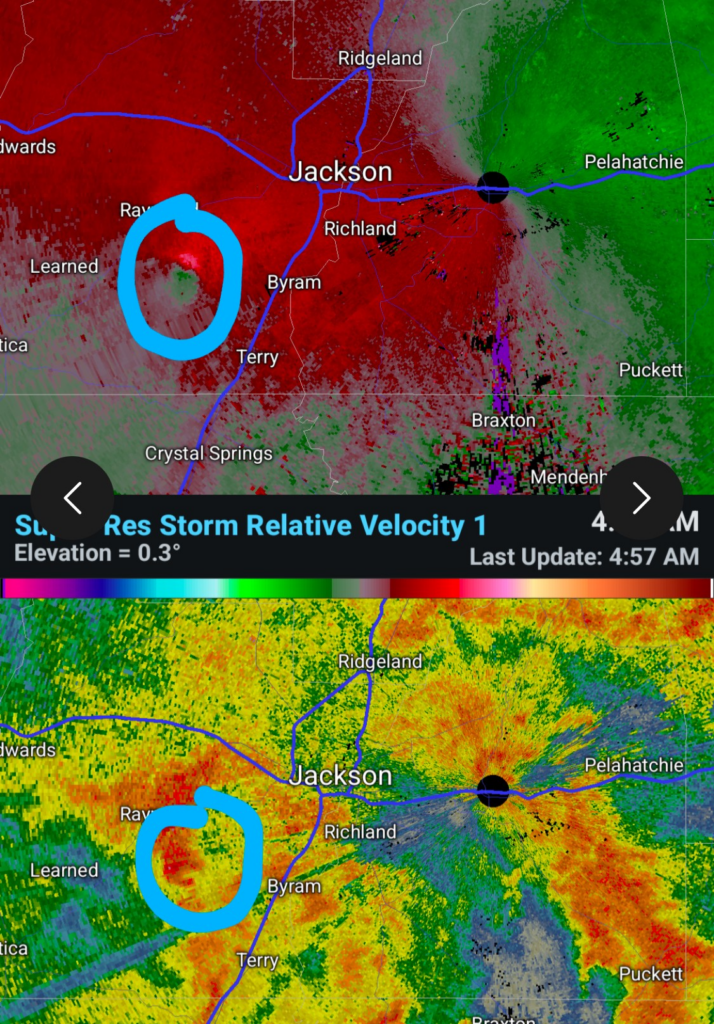
The tornado was on the ground for about 5 minutes but managed to travel 2 miles. IT was about 2 football fields wide and caused some tree damaged.
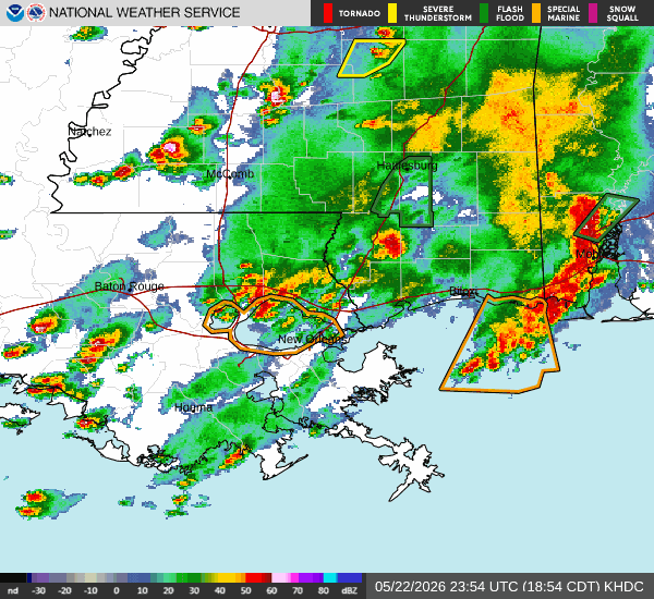
Currently, there is a flash flooding risk over southeastern Louisiana and Mississippi.
- Flood warnings and advisories are in place for Pearl River, Stone, and Perry counties. Water over a few roads in the city of Picayune will cause traffic problems, give yourself extra time when traveling!
TONIGHT/TOMORROW
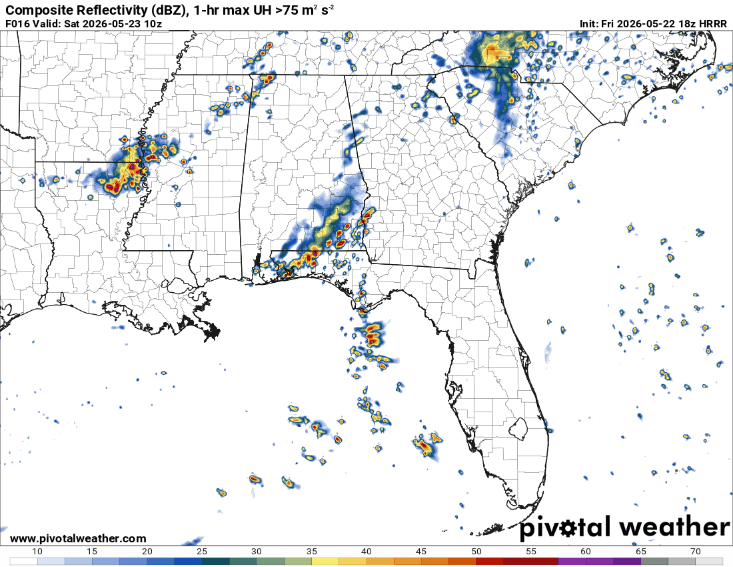
We will see a brief, much needed, break from rain tonight. Mostly clear skies overnight, so enjoy it before storms return tomorrow afternoon. Thunderstorms will once again be capable of producing heavy rain, with the greatest impacts likely felt in New Orleans and Baton Rouge.
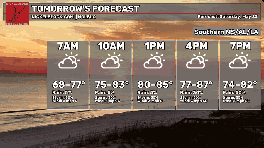
Highs tomorrow will reach the upper 80s, however that humidity will make it feel about 7 degrees warmer than what’s shown below.

DAY AFTER TOMORROW
Sunday, short-range models show early morning storms traversing through New Orleans and moving into Hattiesburg by noon, followed by evening thunderstorms.
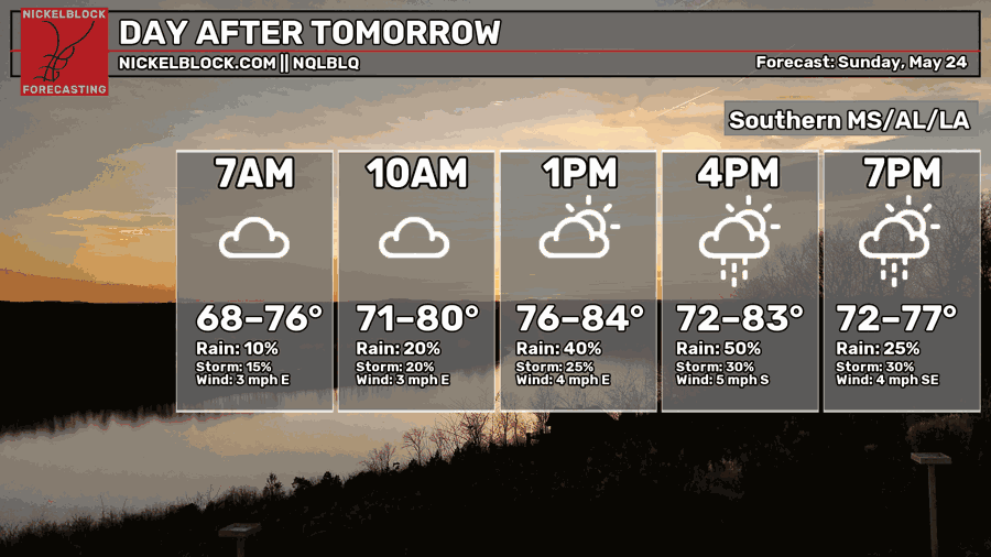
Bringing with it a slight risk of flash flooding Sunday for areas such as Baton Rouge, Woodville, and McComb. Rainfall totals this weekend could approach 4 inches near Baton Rouge, while much of Mississippi may see 2–4 inches of rain. Soils are already saturated in these areas, which makes them much more sensitive to flooding!

EXTENDED OUTLOOK
Daily chances for showers and thunderstorms continue through all of next week, as shown in the Euro quantitative precipitation forecast below (in red!)
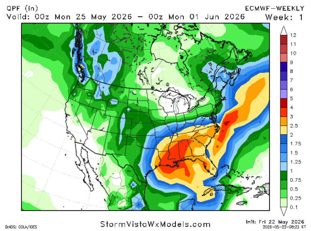
This wet pattern is here to stay for another week, but you’ll be happy to hear there is a light at the end of the tunnel, with drier weather expected to return starting March 31st.
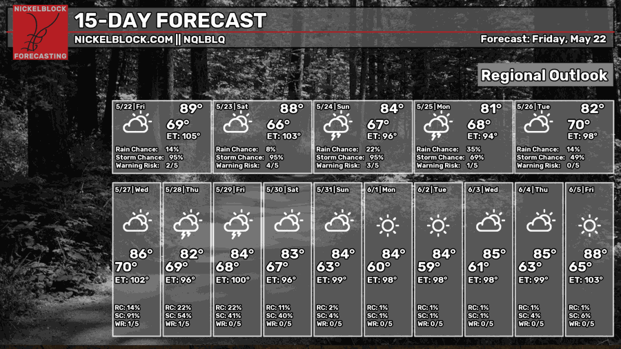
DAY-BY-DAY FORECAST
Today: Moderate chance of showers and thunderstorms mainly before midnight. Highs in the upper 80s. Southwest winds 5 mph.
Tonight: Mostly clear. Lows in the upper 60s. Southwest winds 5 to 10 mph. Low chance of rain.
Saturday: High chance of showers and thunderstorms in the afternoon and evening hours. Highs in upper 80s, humid. Calm wind becoming southeast around 5 mph in the afternoon..
Saturday Night: Low chance of overnight storms otherwise mostly cloudy. Lows in the mid 60s.Southeast wind around 5 mph becoming calm in the evening.
Sunday: 95% of storms/heavy showers all day. Watch roadways for flooding. Highs in the lower 80s. South wind around 5 mph.
Sunday Night: High chances of shower and thunderstorms. Lows in the 60s.
Monday: Higher chance for storms/showers in the morning, followed by a chance for storms in the evening. Highs hovering around 80. South wind 5 to 10 mph.
Monday Night: Slight chance of thunderstorms otherwise partly cloudy. Lows in the upper 60s.
Tuesday: Showers and possibly a thunderstorm. High near 80s. South wind 5 to 10 mph.
Tuesday Night: A slight chance of showers and thunderstorms. Mostly cloudy, with a low around 70
Wednesday: Showers and possibly a thunderstorm. Partly sunny, with a high near 86, will feel like 102. South wind 5 to 10 mph..
Next Thursday: Showers and possibly a thunderstorm. Mostly cloudy, with a highs near 82.
Next Thursday night: A chance of showers and thunderstorms. Mostly cloudy, with a low around 74.
Next Friday: Showers and thunderstorms likely. Partly sunny, with a high near 84, experienced temperature of 100. Calm wind becoming southwest around 5 mph in the afternoon.
Next Friday Night: Cloudy and humid with a chance for showers early overnight. Lows in the upper 60s.
Next Saturday: Alternating breaks between times of clouds and sun with chances of showers in the morning. Highs in lower 80s. Wind blowing from the north at 10mph.
Next Saturday Night: Mostly clear (finally). Lows in the upper 60s.


