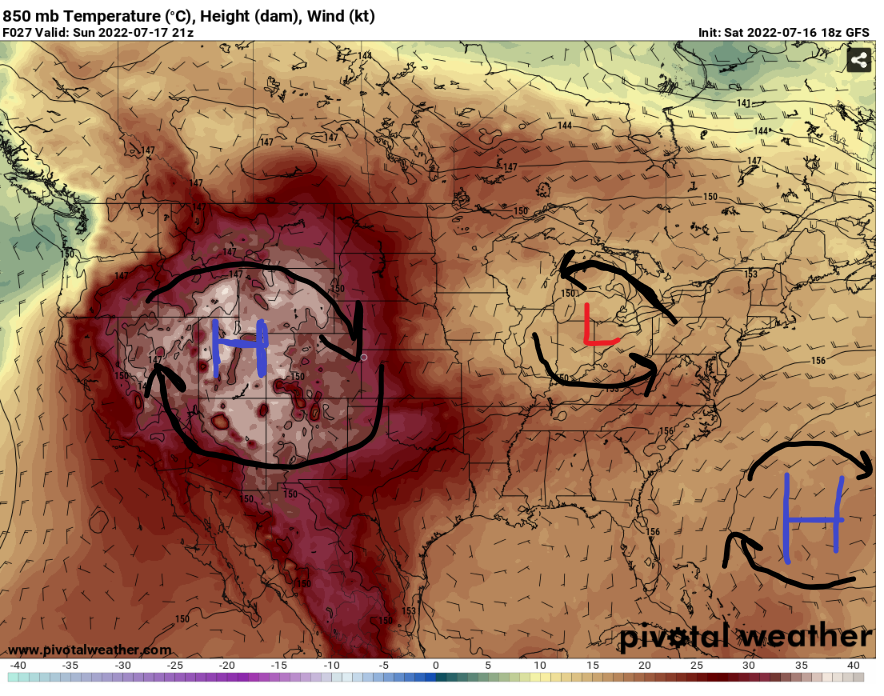
Hello everybody, the overall CONUS forecast will be heavy rainfall and thunderstorms will occur in the Midwest. The low-pressure system will be moving northeast to provide more rain relief for those areas. Then the High-pressure ridge still remain near the four corners of United States that will provide above average temperature in July. There will be another high pressure in the Atlantic Ocean that will slowly coming to the Southeast and East coast. In the next few days, it will play a role to bring warmer temperatures in the east coast and affecting the weather pattern.
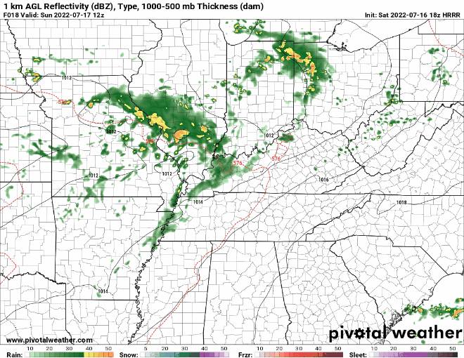
Severe weather in the Midwest
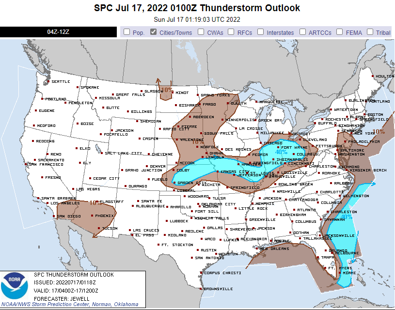
For today, there will be a 40% chance for thunderstorms to appear in central plains to the Midwest. There are few reasons for storms happening in the mid-west because there will be low 70s dew points and a low-level system in the Midwest. There will be a warm/cold front boundry near the Midwest will be the reason for the storms happening in the Midwest. It will bring in multiple rounds of storms and heavy rainfall for the Midwest. In the next few days, the rainstorms will be starting to move to the Northeast for moderate rainfall.
High plains and West Heat Wave
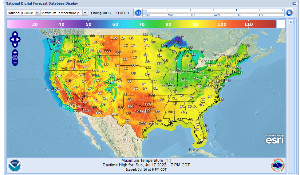
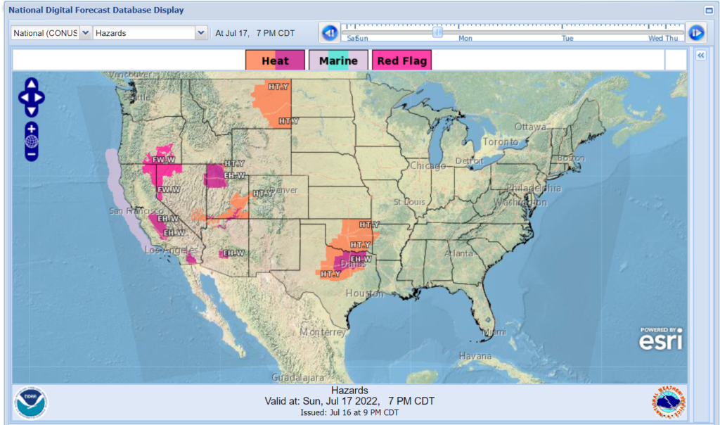
The high-pressure system in the west will continuing bring in warmer air from Mexico into western United States. From Northern Montana to Texas will continue to have upper 90s to low 100s degrees weather as the high-pressure system brings in warmer and drier air throughout western and Great plains. Be watchful, for the heat Index values as it will go up to 105 to 110 degrees in some places in United States. Don’t forget, that these states that has been under this heat dome for the past few days. There will be some states will be vulnerable for any fire weather as there going to be dry vegetation and high-speed winds near Northwestern Nevada and Northeast California. There will be multiple states will be under heat advisories in orange as the temperatures and heat index getting closer to the 105+ degrees weather. The States under dark pink will be under excessive heat warnings as the temperatures has exceed 105+ degrees. There will be no sign yet on knowing on when the high-pressure system will be letting go its grip on Western United States for next week.
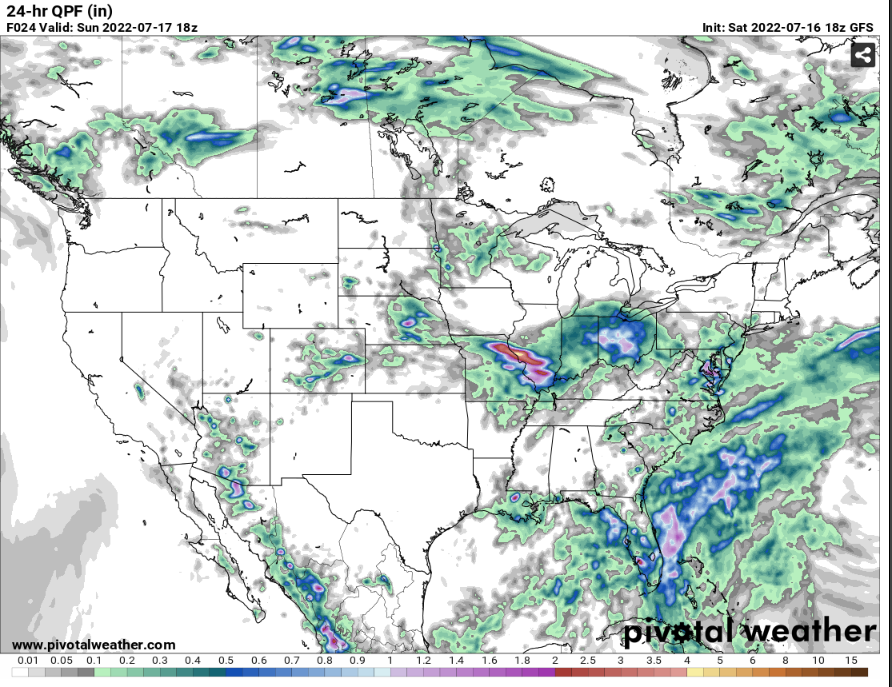
United States Rainfall
So far, the western United States will receive less rainfall for today. There will be some isolated showers will pop up in the southern and central Arizona as the humid air from Gulf of California and a dry line boundry will be the driving factors for these storms. The estimate rainfall in Arizona will be less than half of inch of rain. Meanwhile in the Midwest, it will receive more rainfall as a warm/cold front boundry and high dew points in the Midwest will be the main driving factors of producing thunderstorms for heavy rainfall. The estimate rainfall throughout the Midwest will have .5 up to 5 inches of rain.