Hello everybody, the overall forecast for the weather across the nation that there are chance of rain and thunderstorms for the east coast, Midwest, northeast and Southeast from the national wide cold front. The Northern and northern-western states will remain dry and sunny with the high pressure in the central of United States for this weekend. The monsoon rain still continues in the southwest states.
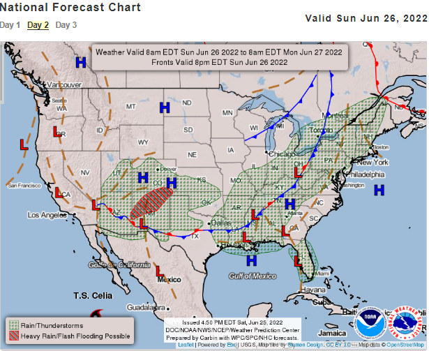
Nation-Wide Cold Front
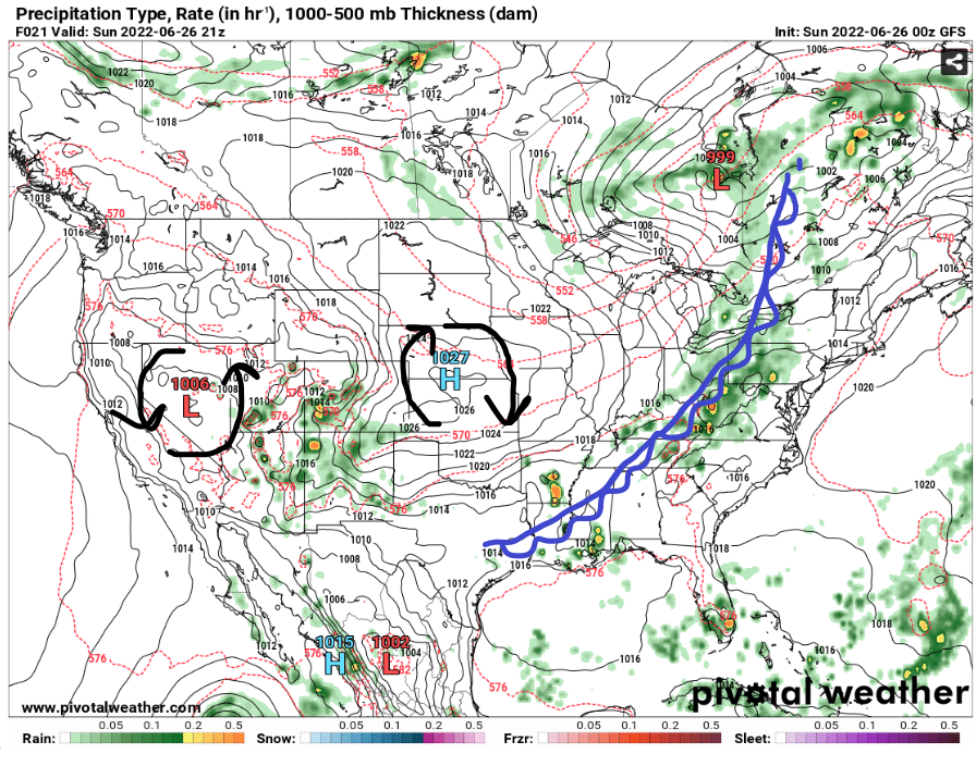
With the high pressure stays in the central plains and will push the cold front down to the southeast and east coast. With the moisture in the southeast, it will provide much need fuel to produce thunderstorms in the east coast and the southeast. For some states, this will bring some good relief from the hot summer temperatures in the past few days.
Increasing Four Corners States Flood Threat
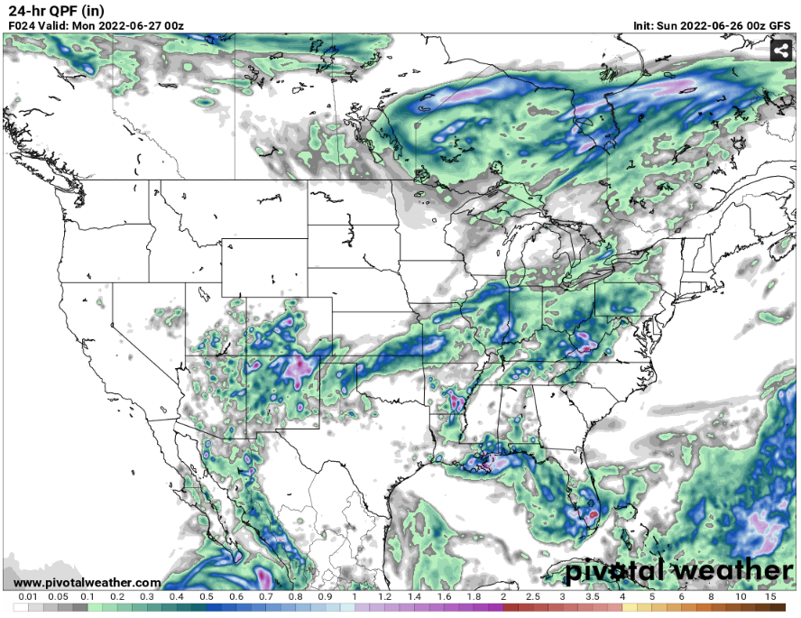
From yesterday COUNS report from Gabriel Taylor, he provided the excessive rainfall outlook for this weekend that they’re going to be a slight risk for flooding in New Mexico, Arizona and Colorado. There will be heavy rainfall from thunderstorms that will be happening in the afternoon and evening. From Quantitative precipitation 24 hours, there is an estimate rainfall of .5 inches to 2 inches of rain in the northeast of New Mexico and some parts of Colorado for today.


